Solar Grand Solar Minimum part deux

Cardinal

Chickministrator
_______________
While this is not being attributed to climate change, I'll bet a lot of these insect infestations are the result of it.


The Evergreen State has had quite a 2020 so far.


First, it had the early cases of the coronavirus.

Then, it was the "murder hornet."

Now, Washington is facing a new enemy: the Asian gypsy moth.

The issue of the new flying bug is so worrisome that the governor issued an emergency proclamation this week, saying there is an "imminent danger of an infestation."

What's the problem?
Washington Gov. Jay Inslee (D) declared a state of emergency Tuesday over the "imminent danger of an infestation" of the Asian gypsy moth.

The plant-eating pests threaten crops statewide and could have a major impact on the agriculture-heavy state.

The U.S. Department of Agriculture stated that the bugs can cause massive damage.

"If they would become established here, they could cause serious, widespread damage to our country's landscape and natural resources," the USDA said. "Each female moth can lay hundreds of eggs that, in turn, yield hundreds of voracious caterpillars that may feed on more than 500 tree and shrub species."


"Large (Asian gypsy moth) infestations can completely defoliate trees," the agency said. "This defoliation can severely weaken trees and shrubs, making them more susceptible to disease. Repeated defoliation can lead to the death of large sections of forests, orchards and landscaping."


img.jpg


Photo by Suzanne Kreiter/The Boston Globe via Getty Images


Inslee ordered the state to apply aerial insecticide spray to stop any potential infestation.

It's vital to stop the gypsy moths now, since, as the USDA noted, the moths have the ability to fly long distances — meaning they could spread across the nation in no time.
 

TxGal

Day by day

Snow and record cold headed for Northeast

May 8, 2020 by Robert

An “out of season Arctic blast” will make for a chilly & blustery Mother’s Day Weekend for much of the eastern U.S. where dozens of record low temperatures may be tied or broken, warns the National Weather Service.

Temperatures will approach record cold readings on Saturday morning from the Great Lakes to the Northeast, including major cities such as Philadelphia, New York City and Boston.

Dozens of states from the Plains to the Northeast are already under freeze watches and warnings this morning.

Measurable snowfall possible in the Northeast & Great Lakes

In addition to the winter-like temperatures, parts of the Great Lakes, Appalachians, and Northeast will witness wintry precipitation Friday evening and into Saturday.

Snow could fall heavily at times with several inches of accumulating snowfall possible in the northern and central Appalachians.

Just when you thought it was safe to believe that winter was finally behind us, well, guess again, WGME reports.

The National Weather Service office in Gray, Maine, predicts a widespread 1 to 4 inches of snow across most of northern Maine overnight Friday into Saturday, with larger amounts of snowfall possible for the highest elevations and at the Canadian border.

Nighttime lows get to the low 30s (Fahrenheit) Friday night and again Saturday night. High temperatures Saturday will likely only get to the 40-degree range outside of the mountains — very cold for early May, WGME reports.

One more snowstorm is on the way this weekend

WPC's Short Range Public Discussion

Snow and record cold headed for Northeast this weekend

Thanks to Argiris Diamantis and Ryan for these links
 

TxGal

Day by day

Frigid Friday (and Sat.) On The Way

Guest Blogger / 17 hours ago May 7, 2020


Guest post by Paul Dorian,
image-7.png

Quite an amazing outbreak of significantly colder-than-normal air will encompass much of the northeastern quadrant of the US by the early part of the weekend. Map courtesy NOAA, tropicaltidbits.com

***A remarkable cold air outbreak on the way for Friday night and Saturday…powerful winds to 50 mph or so will accompany the cold blast…rain-changing-to-snow scenario for interior sections of the Mid-Atlantic/Northeast US…warmer pattern finally on the horizon***

Overview


A remarkable cold air outbreak is coming to the northeastern quadrant of the nation for Friday night and Saturday and it will be accompanied by a rain-changing-to-snow event for many interior sections of the Mid-Atlantic/Northeast US. This cold blast is likely to result in some of the coldest daily temperatures ever recorded both at the surface and in the upper atmosphere and, in some cases, monthly temperature records may be set. In addition, some spots might see their latest measurable snowfall in the Friday night/Saturday time period. Some interesting notes…in Philadelphia, there has not been a temperature in the 30’s on May 9th or later in more than fifty years (1966) and it could happen on both Saturday (9th) and Sunday (10th) mornings. In Buffalo, the predicted temperature of -40°C this weekend at the 500 millibar level would shatter the previous record of -35.7°C for the entire month of May. In Baltimore, there has not been a measurable snowfall in the month of May since 1872 and the latest on record there is May 9th (1923).


image-8.png

An extremely anomalous upper-level low will move on top of the Mid-Atlantic/Northeast US by the early part of the weekend representing the core location of a remarkably cold air mass for this time of year. Map courtesy NOAA, tropicaltidbits.com

In addition to the cold and potential snow, winds will become an important factor as well on Saturday with gusts past 50 mph on the table in the Mid-Atlantic/Northeast US and this will raise the chance for scattered power outages. Looking ahead, the overall weather pattern that has resulted in multiple cold air outbreaks from Canada into the central and eastern US during the past several weeks is likely to finally break down during the third week of May, but we’ll have to endure some pain before we get to those expected warmer-than-normal conditions.

image-9.png

06Z EPS total snowfall forecast map for the upcoming event with quite an impressive display for this time of year. (Note- this computer forecast model map of total snowfall is based on a 10:1 ratio of snow-to-liquid and it is likely to end up being a higher ratio than that during this upcoming event which would mean less snow than depicted here). Map courtesy Weather Bell Analytics, ECMWF

Details

Generally speaking, there are two requirements for significantly colder-than-normal weather this time of year in the Mid-Atlantic region and they include thick cloud cover and low-level easterly winds which bring the still quite cold ocean air into the area from the western Atlantic. Indeed, temperatures peaked on Wednesday at 52 degrees for highs in Lancaster, PA which was the lowest high temperature ever recorded there and in State College, PA, the high of 43 degrees was the lowest in the month of May since 1989. These two examples were pretty representative of the chill experienced throughout the rest of the Mid-Atlantic region on Wednesday. The chill of mid-week will ease considerably on Thursday with the return of sunshine and a change of the low-level flow of air from east-to-west and high temperatures will be in the low-to-middle 60’s in many spots. The weather will become quite a bit more active later Friday as a strong cold front advances this way from the Upper Midwest and low pressure begin to develop over the Tennessee Valley.

image-10.png

Low pressure will intensify rapidly on Friday night and Saturday and become a powerful storm by the time it reaches the Gulf of Maine. The pressure gradient will tighten markedly on Saturday between this low and high pressure over the middle of the country resulting in wind gusts to 50 mph or so in the Mid-Atlantic/Northeast US. Map courtesy NOAA, tropicaltidbits.com

This low pressure system will push along the southeastward-advancing cold frontal boundary zone on Friday and rain is likely return to the Mid-Atlantic region during the afternoon and evening hours. As colder air wraps into the system on Friday night, the rain is likely to change to snow in a good part of the Mid-Atlantic/Northeast US; especially, across interior higher elevation locations of upstate PA, NY and New England where accumulations are possible. In fact, there can be a changeover from rain-to-snow showers later Friday night all the way into the suburban locations just to the north and west of Route I-95 in the DC-to-Philly-to-NYC corridor. This low pressure system will intensify dramatically by the time it reaches the Gulf of Maine on and a deepening pressure gradient will result in powerful winds to go along with the unusual cold. In fact, the low pressure reading expected for this storm on Saturday could rival the lowest ever recorded in Maine during the month of May. Winds on Saturday can gust to 50 mph or so in the Mid-Atlantic region/Northeast US raising the chance for scattered power outages.

By the late morning and mid-day hours on Saturday, an extremely anomalous upper-level low will slide over the Northeast US and the quite amazingly cold air aloft will create a very unstable environment. As a result, while the low pressure and frontal-induced precipitation may have ended, a re-development of snow showers is quite possible during the late morning and mid-day hours on Saturday in the unstable atmosphere and this could take place all the way into the I-95 corridor. Mother’s Day (Sunday) will get off to a very cold start for this time of year and it’ll stay quite a bit colder-than-normal; however, the afternoon will be much more bearable when compared to Saturday as the winds should be far less noticeable and there should be some sunshine although it might fade behind increasing clouds ahead of the next system.

image-11.png

Cold air outbreaks have dominated the scene for several weeks in the central and eastern US, but there is light at the end of the tunnel. It looks like the third week of May will bring about a transition in the overall weather pattern to one that features warmer-than-normal weather for much of the central and eastern US – and the Atlantic Basin tropical season will not be too far behind. Map courtesy NOAA, tropicaltidbits.com

Looking ahead, the overall weather pattern that has resulted in cold air outbreaks from Canada into the central and eastern US during the past several weeks looks like it may finally break down during the third week of May. It should remain generally colder-than-normal for much of next week in the Mid-Atlantic/Northeast US, but then a transition to warmer weather looks likely once we get past the middle of the month. The temperature at Philadelphia has not reached the 80 degree mark yet this year and the latest that that has happened for the first time in a given year was May 20th in 1984 – something of interest to monitor in coming days. Once we transition to a warmer weather pattern during the second half of the month, the Atlantic Basin tropical season may not be too far behind as, often times, the tropical season begins rather early when there is a chilly spring in the central and eastern US.

Meteorologist Paul Dorian

Perspecta, Inc.

perspectaweather.com


TxGal

Day by day

Extreme Mother's Day Weekend: Record Cold into the South, Snow in the Northeast, Potential New England Bomb Cyclone
By weather.com meteorologists
4 hours ago
weather.com


Cold and Snowy Weekend for the Northeast


Cold and Snowy Weekend for the Northeast
Mother Nature may be looking at the wrong calendar – it's going to feel much more like winter than May for Mother's Day weekend from the Great Lakes to the Northeast and South.
At a Glance
  • An extreme weather pattern is setting up for Mother's Day weekend.
  • Dozens of daily records will fall in the Great Lakes, East and South.
  • A frost is possible as far south as parts of the Carolinas and Southeast this weekend.
  • Some wet snow is likely Friday night and Saturday in the interior Northeast.
  • This could include rare May lake-effect snow in some of the Great Lakes snowbelts.
  • Low pressure could undergo bombogenesis along the New England coast.
  • May pressure records could be set along the New England coast and in northern Canada.
An extreme weather pattern is setting up for Mother's Day weekend that will shatter dozens of temperature records, wring out strange May snow in the interior Northeast and possibly set May pressure records both in parts of New England and northern Canada.

Happening Now

Rain will continue to spread into the mid-Atlantic and Northeast into Friday evening with snow expected in parts of northwestern Pennsylvania and upstate New York.

Light snow began to fall midday Friday in Buffalo, Rochester and Erie.

image


Forecast: Snow and Wind

As the frontal system moves through the Ohio Valley and Northeast on Friday, the air will be just cold enough to produce some wet snow in parts of the interior by Friday afternoon into Friday night.

On Saturday, snow, possibly heavy, is expected to continue in parts of northern New England, particularly in Maine, as the intense potential bomb cyclone wraps moisture into sufficiently cold air.

(MORE: May Snowstorms: How Unusual Are They?)

The best chance of accumulating snow will be over the higher terrain, but even lower elevations down to valley floors could have a bit of wet snow.

The heaviest snow accumulations are expected in the high country of northern New England, where over 6 inches of wet, heavy snow is possible. The National Weather Service has issued a winter weather advisory for northern Maine for Saturday where slippery roads are likely.

northern Maine for Saturday where slippery roads are likely.

image


As the storm intensifies, strong winds on Saturday, potentially lasting into Sunday morning, combined with the weight of wet snow, could trigger power outages and lead to some tree damage, particularly in northern New England.

Sustained winds will be over 20 mph at times with gusts 30 to 50 mph possible in the Northeast Saturday. The wind combined with below-average temperatures will make it feel even colder.

image


As if that wasn't strange enough for the second weekend of May, some lake-effect snowbands may set up for a time on Saturday downwind of the eastern Great Lakes. Lake-effect snow is quite rare this time of year for two reasons.

First, as we progress deeper into spring, the sun is higher in the sky, so temperatures typically warm up too much to generate much snow, particularly during the day.

Second, the Great Lakes are usually relatively cold from the past winter, and therefore, it's more difficult to generate enough of a temperature difference between the lake and the air above it that would manufacture lake snowbands.

In addition, some thundersnow is possible with intense snow squalls on Saturday, the NWS office in Binghamton, New York, noted in a Wednesday forecast discussion. These could lead to abrupt reductions in visibility that could make driving dangerous.

Forecast: Record Cold

On Friday, the stronger cold front will sweep across the Midwest and East, making it feel more like late March than early May. High temperatures will be 10 to 25 degrees below average Friday into Mother's Day weekend.

Highs will only be in the 40s in most areas from the upper Midwest to the Great Lakes and interior Northeast on Friday. Much of the Northeast will stay in the 40s on Saturday. Some locations in the northern Great Lakes and in the higher elevations of the interior Northeast might not get out of the 30s.

Numerous daily record cold high temperatures are possible in the Midwest, South and East into early next week.

week.

image


Forecast Highs Compared to Average
Low temperatures will be downright cold for Mother's Day weekend, even in parts of the South.
(MORE: The 10 Things We Won't Forget About Winter 2019-20)
Lows in the 30s will plunge into parts of the Carolinas and Tennessee Valley, including Nashville, Tennessee, where the average low this time of year is in the mid-50s.
Early-morning temperatures in the 20s are expected in the Great Lakes, Ohio Valley and parts of the interior Northeast.

image


Forecast Morning Lows
This late-season cold air might harm any sensitive spring vegetation where a frost or freeze occurs.
The National Weather Service has issued freeze warnings and frost advisories from Nebraska and southeastern South Dakota into much of the Midwest, parts of the mid-Atlantic and as far south as northern Georgia.
(MORE: When the Season's Last Freeze Typically Occurs)

image


Frost and Freeze Alerts
(Issued by the National Weather Service)
This weekend cold will threaten scores of daily record lows for May 9 and 10 in the Midwest, South and East. The graphic below shows Saturday morning's forecast lows compared to the record to beat that day for a few selected cities.
Temperatures could also approach some all-time May record lows in a few spots this weekend, including Detroit (25 degrees), Lexington, Kentucky (26 degrees), Pittsburgh (26 degrees), Indianapolis (28 degrees), Knoxville, Tennessee (32 degrees), and Nashville (34 degrees).

image


Potential Daily Record Lows Saturday

(Shown is the forecast low for Saturday morning in comparison to the daily record low for May 9.)

Extreme Pattern

This weather pattern would grab the attention of meteorologists in the middle of winter, much less the second weekend of May.

Basically, the jet stream will resemble a white-knuckle ride on a roller coaster.

Blocking high pressure near Greenland and another "omega block" of high pressure bulging northward from the West Coast of the U.S. to the Arctic Ocean northeast of Alaska will work together to force the jet stream to take a sharp southward plunge over the Great Lakes and Northeast.

0507-Extreme-May-Pattern.jpg


There are several parts of this pattern that could be record-setting.

The Weather Channel meteorologist Jim Cantore noted temperatures in the mid-levels of the atmosphere – for meteorologists, the 500-millibar level – could reach minus 40 degrees (Celsius and Fahrenheit) over the Great Lakes this weekend, a first anywhere in the U.S. in May, according to data from NOAA's Storm Prediction Center dating to the mid-20th century.

Secondly, intensifying low pressure in the Northeast may become a bomb cyclone – a drop in the storm's central pressure by at least 24 millibars in 24 hours or less – by the time it moves into the Gulf of Maine on Saturday. The storm could be strong enough to set all-time May pressure records along the Maine coast, according to data compiled by David Roth, a meteorologist at NOAA's Weather Prediction Center.

bombo-fcst-7may20.gif


Model forecast pressure from Friday evening through Saturday afternoon, showing the intensification of what could become a bomb cyclone near coastal New England, New Brunswick and Nova Scotia.

If that wasn't enough, Roth noted the strength of high pressure over the Canadian Arctic could set May high-pressure records there.
 

TxGal

Day by day
There's a new Adapt 2030 podcast out this evening.
"Is This a Planned Food Blockade of Protein Sources?"
rt = 9:17

Thanks, Martinhouse!!

As Martinhouse said, ADAPT 2030 has a new podcast out:

View: https://www.youtube.com/watch?v=EwXTRPUSXVE


Is This A Planned Food Blockade of Protein Sources (973)
6,898 views
•May 8, 2020

Run time is 9:17

As we saw with the Allied Blockade of Greece beginning in 1941, bread prices rose by 89X and staples slowly disappeared across the country. We are beginning to see the same in the N. America as beef is at all time highs, unenviable or rationed. Don't kid yourself, limit one is rationing. Blistering cold Arctic fronts slamming the E.U and N. America the same week after crops have already emerged. Time for a pioneering lifestyle.
 

TxGal

Day by day
The Oppenheimer Ranch Project has a new podcast out:

View: https://www.youtube.com/watch?v=JYs9Id_szSI


Freeze Warning: Northeast Braces For Record Cold & Snow in May - GMO Mosquitoes - Comet Swan Fizzles
3,405 views
•Premiered 8 hours ago

Run time is 17:18

Freeze warning: Northeast braces for record cold and accumulating snow https://bit.ly/2znhCRX
Twin Cities may see first measurable Mother's Day snow since 1946 https://bit.ly/2YOguRJ
FROST TO HIT THE CORN BELT FRIDAY NIGHT, FORECASTER SAYS https://bit.ly/3biO3ya
Residents worried as Florida wildfire chars 2,000 acres https://cnn.it/3ci54JT
Mother's Day storm may bring a month's worth of rain to one corner of the US https://bit.ly/2LcVNqP
Hurricane season is expected to be worse than normal https://nbcnews.to/2Aaeglv
Latest snow on record possible for some of the North Carolina High Country https://bit.ly/3fzO5Vt
Warm In The West But Cold Everywhere Else https://www.weather.gov/
GFS Model Northeast Snowfall https://bit.ly/2WDToLd
GFS Model Total Snowfall US https://bit.ly/2A6Z20A
Worldwide Volcano News https://www.volcanodiscovery.com/volc...
In 1110, The Moon Vanished From The Sky. We Might Finally Know What Caused It https://bit.ly/2Lf28Cc
Did you hear the ‘boom’ Wednesday evening? It was a meteor explosion https://bit.ly/3dv7Ag6
Swarms of genetically modified mosquitoes could soon be descending on Florida https://bit.ly/3cj008i
Earth’s Magnetic North Pole Is Shifting Dramatically From A Powerful Tug Of War https://bit.ly/2SPhh19
Comet SWAN 2020: 'Volatile' comet releases a huge outburst https://bit.ly/3cjJTat
Comet Swan Light Curve https://bit.ly/3cj6HqO
Comet SWAN (C/2020 F8) Info https://theskylive.com/c2020f8-info
 

TxGal

Day by day

Record cold, snow overtakes northeastern US

By Alex Sosnowski, AccuWeather senior meteorologist
Updated may. 9, 2020 4:55 AM

Americans across a large portion of the Northeast are in the midst of an unusually late-season blast of Arctic air courtesy of the polar vortex. Adding to the frigid conditions will be accumulating snowfall, another rarity for some places across the region this time of year.

Freeze watches and warnings along with frost advisories are in effect until Saturday morning for many places across parts of the Midwest, down into the Southeast and into the Northeast. Cities from Atlanta to Detroit to New York to Boston will be colder than parts of Alaska this weekend. Pittsburgh, Detroit, Washington, D.C., and Buffalo will challenge low-temperature records.

Meanwhile, Fairbanks, Alaska, will approach 80 degrees Fahrenheit on Mother’s Day, which is about 20 degrees above normal. Farther south in The Last Frontier, it will be cooler in Anchorage over the weekend, but with temperatures in the low 60s, highs will still be about 4-5 degrees above average -- and higher than some places in the Northeast.

1589032092892.png
The AccuWeather severe weather map shows a wide stretch of the nation was under freeze warnings or watches and frost advisories early Saturday morning. (AccuWeather)

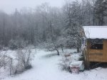
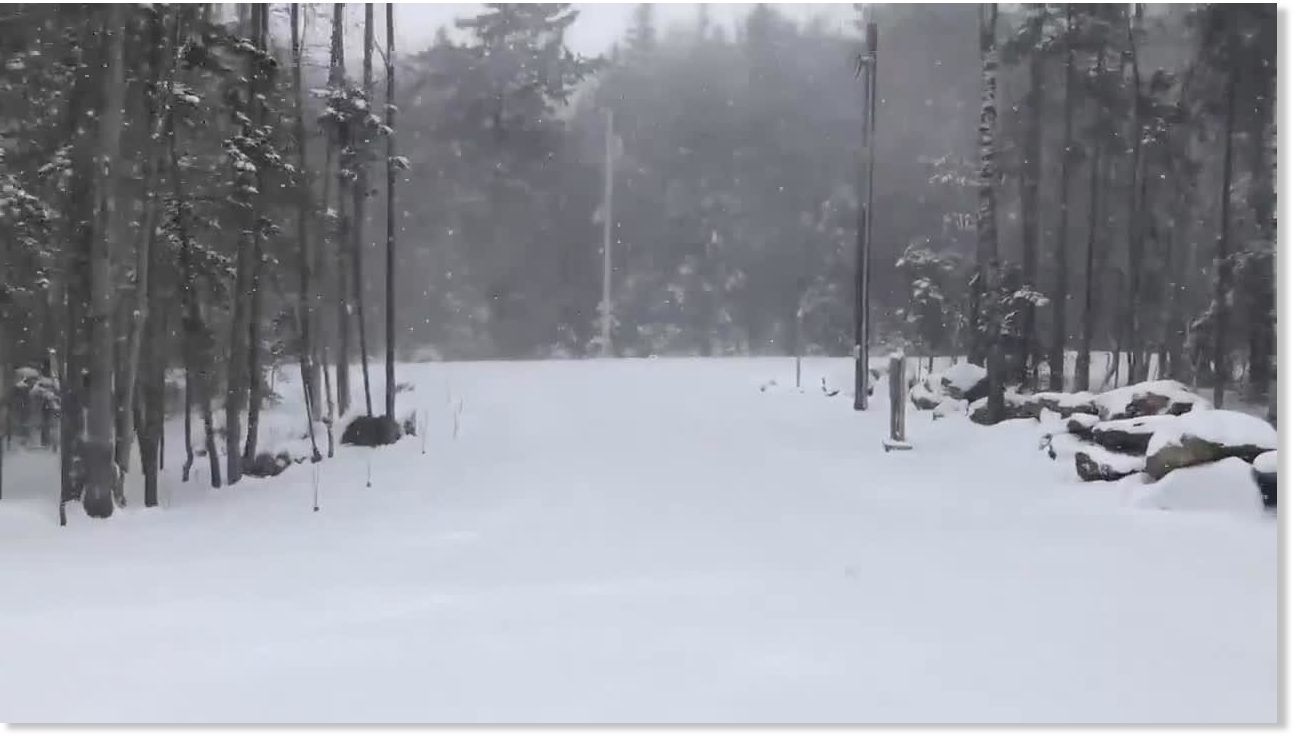
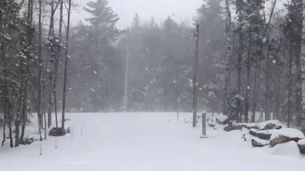
Not only will the frosty weather be more conducive to social distancing across the region than last week's pattern was, accumulating snowfall will stretch across a swath as far south as West Virginia and extend through interior portions of the Northeast up into New England, where some places could pick up a foot of snow or more.

"A lobe of the polar vortex will spin southward and loop around the Great Lakes and northeastern United States into next week before shifting farther northwest over Canada toward the middle of May," Paul Pastelok, AccuWeather's top long-range forecaster, explained.
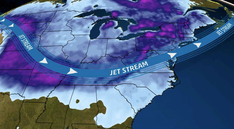
1589032153860.png

As the jet stream plunges across the eastern U.S., allowing the unusually cold weather to press southward, it is bulging northward in the West. An oppressive heat wave is affecting L.A., Phoenix and Las Vegas as warmth builds across the Pacific Northwest and up toward Alaska.

"What a pattern across the United States! Look at that big jet stream across the eastern U.S. Meanwhile, in the West, it’s totally opposite, polar opposite, where we’re looking at record warmth ... It will be warmer in Alaska than it will be in Atlanta, Georgia. That’s something," AccuWeather Chief On-Air Meteorologist Bernie Rayno said.

Way too cold for May in the East

Even though strong May sunshine will work to negate some of the chill by day, where thick clouds linger and rain or snow falls, daytime temperatures can hover in the 30s to lower 40s F, which is about 20-30 degrees below normal in the Midwest and Northeast.

However, despite the warm May sun shining, some locations can still rival record low maximum temperatures as the air coming in is from the Arctic. Washington, D.C., will challenge a record low maximum temperature of 52 on Saturday -- a mark that has stood since 1877. The 143-year-old record at stake in the nation's capital is a testament to the magnitude of the frigid air coming into the region.

CLICK HERE FOR THE FREE ACCUWEATHER APP

"Other places where low maximum temperature records could be set on Saturday include Hartford, Connecticut, Boston and Mount Pocono, Pennsylvania, to name a few," AccuWeather Meteorologist Jesse Ferrell said. The old low maximum temperature records are 45 in 1972, 45 in 1966 and 41 in 1947, respectively.

Where the wind is active and during cloudy intervals, AccuWeather RealFeel® Temperatures can hover 10-20 degrees below the actual temperature during the daytime. It may feel like the temperature is in the 20s and 30s at times even during the midday hours.

Actual nighttime temperatures dipped into the 20s and lower 30s and challenged record low levels for the date in portions of the Great Lakes, Ohio and Tennessee valleys and the central and northern Appalachians on Saturday. Cities from La Crosse, Wisconsin; to Fort Wayne, Indiana; to Cincinnati and Baltimore all surpassed previous record lows early Saturday morning.

AccuWeather meteorologists recommend covering your warm weather plants or bring potted plants indoors at night until the pattern eases up later next week.

1589032236527.png

"If a hard freeze or heavy frost occurs in portions of the Ohio Valley, central Appalachians and mid-Atlantic region, where buds have broken out, significant damage could occur to fruit trees, vineyards and berry farms," said AccuWeather Senior Meteorologist Randy Adkins.

The surge in temperatures this past weekend may have been just enough to bring some vegetation out of dormancy across the northern tier. In a few extreme cases, temperatures could dip as low as the upper teens in the coldest spots across the northern locations this weekend.

Agricultural interests may need to implement every means possible, such as wind machines, smudge posts and sprinkler systems, to raise the temperature a few degrees around crops.

"Old-timers in the region typically don't plant their tomatoes, peppers and other warm-season plants until around Memorial Day weekend to reduce the chance of frost or freeze damage," said AccuWeather Senior Meteorologist Dave Dombek, adding that this is sound advice for this year in particular.

Farther south, record lows, short of frosty levels, in the 40s and 50s will be challenged on one or more nights from central Texas to the Carolina coast.

Not just one round of snow

Perhaps the wildest part of the weather pattern will be the rounds of snow coming for some locations. Even though snow has fallen and accumulated in May in the past, those events are generally very small in areal coverage and are usually a "one and done" type of phenomenon.

1589032503044.png
This graphic shows the latest calendar day snowfall on record, which may not include multi-day snowstorm totals.

Some snow will continue to fall and accumulate from a storm through Saturday from the mountains of West Virginia to most of Maine and into New Brunswick. Anywhere from a few snowflakes mixed with rain to steady snow and a slushy accumulation on grassy areas can occur in the valleys and lower elevations in this corridor.

1589032595323.png
The exact track of the storm and where the heaviest band of precipitation occurs will be critical factors for total accumulation amounts. It must snow at quite a heavy rate to accumulate this late in the season.

However, at elevations above 1,500 feet, a few inches of snow could pile up on grassy areas and roads over the ridges could become slushy and slippery for a time.

Even heavier snow totals, along with a higher risk for power outages and travel disruptions are anticipated in northern New England. In New Brunswick, there can be an AccuWeather Local StormMax™️ of 14 inches.

New York City recorded a trace of snow at its climate station in Central Park less than two hours into Saturday morning. This trace of snow ties the record for latest recorded snowfall in the city, last set in 1977.

AccuWeather meteorologists are monitoring another storm with its sights set on the Upper Midwest on Sunday and the Northeast on Monday.

Lake-effect snow in May?

Following the storm-related snow to end this week, another unusual event will occur -- lake-effect snow spanning Friday night to Saturday. Usually during May, the water is too cold and the air not cold enough for lake-effect snowfall.

lake-effect.jpg

In this case, only 0.2 of a percent of the Great Lakes is covered by ice and the air is going to be cold enough to trigger bursts of snow.

"In the middle of winter, lake-effect snow often organizes into bands of heavy snow. When lake-effect snow occurs in spring, the stronger sun disrupts the organization of persistent bands, and causes more of a 'cellular' effect, similar to pop up thunderstorms in the summer," explained AccuWeather Meteorologist Jake Sojda.

"Still, while the persistent lake-effect bands that bury communities in the winter aren't expected, very heavy bursts of snow and gusty winds can quickly reduce visibility and bring a quick coating on some grassy areas," Sojda added.

Where heavier bursts of lake-effect snow squalls are a bit more persistent an inch or two can accumulate on grassy surfaces, mainly in the higher terrain from portions of Michigan to northeastern Ohio, northwestern Pennsylvania and western New York state into Saturday morning.
 

alpha

Veteran Member
I couldn't understand why there was such a lull in posting on the 'old' thread. I should have read the small print I guess... anyway, I found you all again!
 

TxGal

Day by day
I couldn't understand why there was such a lull in posting on the 'old' thread. I should have read the small print I guess... anyway, I found you all again!
It was an interesting set of circumstances! Really glad you came back to the thread :-)
 

TxGal

Day by day
Central Park Ties its Latest Snowfall EVER + Hundreds more All-Time Cold Records Tumble ACROSS North America

May 9020 Cap Allon


According to official NWS observations, snow was measured in Central Park early Saturday morning, tying the all-time record for the latest May snowfall set back in 1977 (solar minimum of cycle 20):

View: https://twitter.com/NWSNewYorkNY/status/1258996203271802882


CBS meteorologist Jeff Berardelli confirmed the event: “In New York City at Central Park this morning, it tied for the latest snowfall we’ve ever seen.”

A “significant” accumulation left Upstate New York looking like a winter wonderland, in the middle of spring — welcome NYC, to the next Grand Solar Minimum.

View: https://twitter.com/NycStormChaser/status/1259067791778492418

A violently buckling jet stream –associated with the historically low solar activity we’re experiencing– has once again diverted brutal Arctic air to the lower-latitudes, sinking it anomalously-far south.

The MSM often refers to this phenomenon as the “polar vortex”, and its latest play is to blame a warming Arctic. However, for decades prior to the inception of the global warming scam, scientists were confidently linking an increase in both the intensity and regularity of these events to sharp reductions in the Sun’s output.

“It is very strange because typically the polar vortex may visit a few times during the wintertime,” said Berardelli. “It almost never comes down here in May. As a result, we have dozens and dozens of records being shattered in the eastern part of the country.”

More like hundreds of records Berardelli — this is an incredibly rare event:


usa.movieday.gif

Freeze watches are in place from the Midwest to the Northeast, and many more records will likely be shattered next week, with temperatures plummeting again Tuesday morning.

“This cold front is forecast to reinforce the abnormally cold air-mass in the eastern U.S. to kick-off the upcoming week,” reads the National Weather Service website. And over the weekend, “well below average temperatures with widespread record lows are likely across the Eastern, Central and Southern U.S.” with “freeze watches and warnings along with frost advisories are in effect,” across the eastern two-thirds of the U.S., it said…


gfs_T2ma_namer_fh-36-102-1.gif


…more worrying news for growers up and down the continent.

The COLD TIMES are returning, the lower latitudes are REFREEZING; in line with historically low solar activity, cloud-nucleating Cosmic Rays, and a meridional jet stream flow.

The MSM needs to wake to these facts and warn the population of what’s really coming. There is no such threat as a CO2-induced heating apocalypse, the opposite is actually closer to the truth — the COLD TIMES are returning, and the crop loss, civil unrest and famines these periods bring are all-but upon us.

Prepare accordinglylearn the facts, relocate if need be, and grow your own.
 
Last edited:

Grouchy Granny

Deceased
Which is why, after last year's experience with snow in late May (Colorado) I'm not planting until at least the end of May.

Also need to get on with the hooping of the garden beds.
 

TxGal

Day by day

‘Nerve-Racking and Very Unusual’: Snow in May Worries Growers
The coronavirus pandemic was already making life on the farm unpredictable, and then came an Arctic blast.


merlin_172347459_bbaecfca-8b25-4d14-900b-b1c8f7ad732b-superJumbo.jpg

Maurice LeFranc, the owner of Touche-a-Tout Gardens in Pleasant Mount, Pa., covered young trees in his apple orchard to protect them from the cold weather on Saturday.Credit...Michelle V. Agins/The New York Times

By Maria Cramer
May 9, 2020Updated 3:44 p.m. ET

Across New York and New England, farmers and growers watched with worry on Saturday morning as a late season blast of Arctic air and even snow descended on fragile fruits and vegetables that had just begun to poke through.

Workers at Westwind Orchard in Accord, N.Y., about 70 miles south of Albany, on Friday night sprayed water, molasses and kelp mineral on budding apple blossoms to help protect them against the cold.

By 5 a.m. on Saturday, growers were on the phone with each other to learn what kind of damage the unseasonable weather had unleashed.

“What we’re experiencing is nerve-racking and very unusual,” said Mike Biltonen, a pomologist who runs Know Your Roots, a small apple orchard and consulting company in Hector, N.Y., in the Finger Lakes region, about 20 miles west of Ithaca.

In New Hampshire, Massachusetts and Maine, people woke up on Saturday to find snow falling. The temperature in Worcester, Mass., fell to 30 degrees, breaking the previous record of 31 set on May 9, 1934, according to the National Weather Service.

At Bigelow Nurseries in Northborough, Mass., workers stayed hours after closing on Friday, pulling in annuals like begonias and petunias. They then covered the hydrangeas and Japanese maple trees, which had just started growing, with garden cloth to keep the blooms from dying.

“We had to scramble,” said Nick Steiman, a wholesale representative at the nursery. “Nothing got lost. It’s definitely going to slow down new growth but we didn’t have any fatalities.”

In parts of Massachusetts, forecasters warned of wind gusts of up 50 miles an hour through Saturday evening. The Weather Service warned of low temperatures through Sunday morning.

“Gusty winds could blow around unsecured objects,” the National Weather Service said. “Tree limbs could be blown down and a few power outages may result. Freeze conditions will kill crops and other sensitive vegetation.”

It was not the kind of forecast that farmers needed to hear as they continue to worry about how the coronavirus pandemic might affect their industry and the critical months in the summer and fall, when tourists come for the pick-your-own season or to drink cider on the sprawling acres.

Fabio Chizzola, the owner of Westwind Orchard, where tourists come for cider, pizza and Italian food, said he had managed to keep the business going during the pandemic by offering takeout.

He said he was lucky to not have had to lay off any workers, but the slog of isolating at home, then driving to the farm to work has become tiring.

“It’s been tough,” Mr. Chizzola said. “We’ve been quarantining and then you work, work, work, and then you go home and then work, work, work.”

John Wightman, owner of Wightman Fruit Farm in Kerhonkson, N.Y., says his apple trees are planted well above sea level and are closer to the warm air. Still, he said, he doesn’t know yet how the low temperatures will affect his apple trees.

(I hope I got the entire article before it wanted me to log in or sign up......)
 

TxGal

Day by day
If anyone needs a chuckle, read the comments on Twitter's SNOWING (some are just priceless!)


TxGal

Day by day

Polar vortex brings snowfall, wintry conditions to New England - up to 9 inches of snow recorded in Vermont
Yahoo! News
Sun, 10 May 2020 10:30 UTC

1589121465090.png

A polar vortex brought rare winter weather conditions to the Northeast of the US on May 9, with freezing temperatures and snow reported across parts of New England, including Vermont.

Up to 9 inches of snow was recorded in parts of Vermont with freeze or frost advisories reported in 20 states across the Midwest and Northeast.

Video filmed by Mitch @VermonsterWx shows several inches of "light and fluffy" snow accumulation near Readsboro, Vermont.

View: https://youtu.be/xOmeyRAR0dY
 

TxGal

Day by day
The Oppenheimer Ranch Project has a new podcast out:

View: https://www.youtube.com/watch?v=57SWCka7pfU&feature=youtu.be


Meridional Flow & the Breakdown of the Jet Stream Destroys Record Lows & Snows - GSM is the Cause
4,380 views
•Premiered 8 hours ago

Run time is 14:52

Records shattered as latest snow and cold on record grip New York City https://7ny.tv/3dAxtuX
Polar vortex whips millions of Americans with strong winds, record lows and even snow https://cnn.it/2WIopxy
Snow in Central Park! In May! The Central Park Automated Surface Observing System (ASOS) recorded snow. This ties the record latest snow set on this day in 197 https://bit.ly/2LhphDO
N.J. just got some snow ... in May. Has this ever happened before? https://bit.ly/2SOOSZ0
SNOWFALL ANALYSIS FROM THE LAST 48 https://www.weather.gov/crh/snowfall
Warm Temps In The West.; Well Below Normal for the Eastern U.S. https://www.weather.gov/
GFS Model US total snow https://bit.ly/2YQpAhc
Polar vortex brings record-breaking snowstorms to northeast https://bit.ly/2WD02Bg
What is the Polar Vortex? https://www.weather.gov/safety/cold-p...
NullSchool https://bit.ly/2WFGsEC
Zonal vs Meridional http://bit.ly/2AQEWop
Worldwide Volcano News https://www.volcanodiscovery.com/volc...
The Science Guild’s Mask Is Falling Off https://bit.ly/3ci5Y9m
Three top U.S. health chiefs enter self-quarantines https://politi.co/2YQrrlN
 

TxGal

Day by day
(A number of graphics simply would not copy over for me in this article. Please go to the link to see them)


Thousands without power in Maine as polar vortex freezes big chunk of US
By Travis Fedschun | Fox News


Thousands of people were without power in Maine after a punishing spring storm brought snow and high winds Saturday to New England.

The frigid cold, caused by a polar vortex that blasted in from the north, set a number of records across the region, forecasters said.

The National Weather Service said unusually chilly conditions are expected to linger Sunday across the Central Plains, Midwest, Mid-Atlantic and Northeast ,with freeze warnings and frost advisories in effect.

"We have another really cold morning across parts of the Northeast," Fox News chief meteorologist Rick Reichmuth said on "Fox & Friends Weekend." "It is going to get better. In fact, temps today are going to be back up into the 60s for a lot of people, so that snow that we had yesterday will be gone, but we do have one more chilly morning to get through with this."

RECORD SNOWFALL IN NORTHEAST SEES FIRST MAY SNOW IN CENTRAL PARK SINCE 1977

The polar vortex is a batch of cold air that stays trapped in the Arctic all winter, but a couple of times during the season, it can wander south and bring bone-chilling cold and snow to Canada and parts of the U.S.

A low-pressure system off the coast of southern New England on Friday helped pull the cold air down from the north, lan Dunham, a meteorologist with the NWS in Norton, Mass., told The Associated Press.

In this photo provided by Robert Beretta, snow accumulates on the grass and vehicles in Monroe, N.Y., Saturday, May 9, 2020.

In this photo provided by Robert Beretta, snow accumulates on the grass and vehicles in Monroe, N.Y., Saturday, May 9, 2020. (Robert Beretta via AP)

Much of the Northeast saw rare May winter weather conditions, with freezing temperatures, snow and high winds from late Friday through Saturday.

View: https://twitter.com/NWSBoston/status/1259270641833832448


Strong winds in Maine left almost 11,000 customers without power Saturday night across a dozen counties. Gusts were reported up to 50 mph.

View: https://twitter.com/NWSGray/status/1259271204080246785


“This is the kind of day when outage numbers will fluctuate,” Central Maine Power spokeswoman Catharine Hartnett told the Portland Press-Herald. “The wind is responsible, but it is not so persistently gusty that we can’t make repairs as outages occur today."

Utility crews were working to make repairs as quickly as possible.

POLAR VORTEX TO BRING 100-DEGREE DIFFERENCE ACROSS THE US

Higher elevations in northern New York and New England saw snowfall accumulations of up to 10 inches, as traces of snow were reported from coastal Maine to as far south as New York City, where the flakes tied a record set in 1977 for latest snow of the season in Central Park.

Up to 10.5 inches of snow was reported in higher-elevation communities, such as Sugar Hill, New Hampshire, which got 10.5 inches, and Carrabassett Valley in Maine, which had 9 inches..

Snow squalls were reported in Vermont, where Radek Przygodzki posted a video to Twitter from Lyndonville with the caption: “A decent snow squall moved through this evening. Unreal pattern for May.”

View: https://twitter.com/RadektheWxman/status/1259299923889135617


The NWS in Burlington said Saturday was only the 15th time on record that snow has fallen in the region in May.

Forecasters said dozens of daily low-temperature records were broken or tied on Saturday morning.

View: https://twitter.com/NWSEastern/status/1259170455925260290


Binghamton, N.Y., broke the record for the coldest temperature in all of May, while State College, Pa., tied its May low-temperature record, according to the NWS.

Freeze watches and warnings remained in effect for much of the Northeast on Sunday morning.

Temperatures were below freezing Sunday morning in parts of New Jersey and New York, and a freeze warning was issued for parts of Pennsylvania.

"Get ready for another chilly morning," Reichmuth said Sunday.

Forecasters from the NWS Weather Prediction Center said that while temperatures will warm during the day on Sunday, the eastern and central regions of the U.S. are facing more record-breaking cold Tuesday morning.

The wintry weather came two days after Vermont began to lift restrictions on tennis, golf, and other outdoor activities that had been imposed to help control the coronavirus outbreak.

Gov. Phil Scott tweeted sympathy to Vermonters frustrated by the weather following weeks of being inside their homes.

View: https://twitter.com/GovPhilScott/status/1259123656116051969


“I know snow on May 9th isn’t a welcome sight for many Vermonters, just as we’re cautiously allowing outdoor recreation to get going again,” he wrote. “But this is just a snapshot in time. Just like better weather is ahead, better days will come, as well. We will get through this, together.”

The Associated Press contributed to this report.
 

Seeker22

Has No Life - Lives on TB
I want to purchase a set of snowshoes. Can anyone recommend a good brand? I am not joking because of all the snow news. I had this on my prep list for several years. Thanks.
 

TxGal

Day by day

Record cold, but headline calls it ‘very unusual’

May 10, 2020 by Robert

Breaks record set in 1934, and it’s merely “very unusual”?

“Nerve-Racking and Very Unusual’: Snow in May Worries Growers”,” reads the headline. in the New York Times.

“Unseasonable weather,” the article calls it.

Finally, if you bother to read through to paragraph five, comes the admission that the temperature in Worcester, Mass., had fallen to 30F (-1.1C), ” breaking the previous record of 31 set on May 9, 1934, according to the National Weather Service.

Across New York and New England, farmers and growers watched with worry on Saturday morning as a late season blast of Arctic air and even snow descended on fragile fruits and vegetables that had just begun to poke through.

In New Hampshire, Massachusetts and Maine, people woke up on Saturday to find snow falling. The temperature in Worcester, Mass., fell to 30 degrees, breaking the previous record of 31 set on May 9, 1934, according to the National Weather Service.

It was also snowing in Connecticut. Here’s a photo that a reader near Hartford, Alane Powell, sent to me:

Hartford-snow-9-may-2020.jpg


As I’ve been saying for years; we’ll be fighting in the streets for food long before we’re covered by ice. Especially since this follows heavy crop damage in April, when temperatures dipped to 23F in parts of New York State, killing pear trees and damaging peaches, sweet cherries and apricots.

Doesn’t anyone understand that this is how ice ages begin?

‘Nerve-Racking and Very Unusual’: Snow in May Worries Growers
 

TxGal

Day by day
Adapt 2030 has a new podcast out:

View: https://www.youtube.com/watch?v=fI-q-abbyac


Will Record May Cold in Europe and N. America Wipe Out Crops (974)
2,667 views
•May 10, 2020

Run time is 6:40

Record cold records broken by the thousands between N. America, Australia and Europe over the first weeks and a half on May 2020. Wheat planting is 22% compared to 49% the average in USA. So the question to be asked with the warm spring and now epic May freeze in multiple continents, how do you think this will affect agriculture in 2020?
 

TxGal

Day by day

More crop damage on the way

May 10, 2020 by Robert

FREEZE WATCH IN EFFECT FROM MONDAY EVENING THROUGH TUESDAY MORNING…

* WHAT…Sub-freezing temperatures possible in the mid to upper 20s inland, and lower 30s near the lakeshores.

* WHERE…All of western and north central New York.

* IMPACTS…Frost and freeze conditions could kill crops, other sensitive vegetation and possibly damage unprotected outdoor plumbing.

National Weather Service Buffalo NY – May 10 2020
Including the counties of Niagara-Orleans-Monroe-Wayne-Northern Cayuga-Oswego-Jefferson-Lewis-Northern Erie-Genesee-Wyoming-Livingston-Ontario-Chautauqua-Cattaraugus-Allegany-Southern Erie

-Including the cities of Niagara Falls, Medina, Rochester, Newark, Fair Haven, Oswego, Watertown, Lowville, Buffalo, Batavia, Warsaw, Geneseo, Canandaigua, Jamestown, Olean, Wellsville, Orchard Park, and Springville

National Weather Service Watch Warning Advisory Summary

Thanks to Kenneth Lund for this link
 

TxGal

Day by day

Brace for record cold from the Plains all the way to the Eastern Seaboard

May 10, 2020 by Robert

Also, another round of snow.

Record low minimum and maximum temperatures should be set from the Plains all the way to the Eastern Seaboard both Monday and Tuesday, according to the National Weather Service.

Freeze Warnings are currently located across parts of the Midwest, with Freeze Watches across the Appalachians into parts of the Northeast.

Much of the central and eastern U.S. will continue to be dominated by colder than average temperatures.

Higher elevations in the Cascades and Sierra Nevada and then into the Northern Rockies could see some light snow with this. The Northern High Plains could also see a couple of rounds of light snow on the cold side of a front draped across the Intermountain West over the next couple of days,

Another round of light mixed precipitation or snow is also possible for the Central Appalachians and across parts of the interior Northeast behind the low.

WPC's Short Range Public Discussion
 

TxGal

Day by day
Latest EVER Snowfall In New York City Central Park

May 10, 2020 by Robert

Polar Vortex blasts northeastern US.

Several states in New England hit by cold, wind and unexpected snow in the midst of May.

More than 100 record low temperatures for May could potentially be broken this weekend.

New York received snow in Central Park and in the upstate region on Saturday.

New Hampshire’s record for latest snowfall was May 13, 1914 and Saturday could see six inches of snow.

Vermont received as much as nine inches of snow in Shaftsbury.

Part of New Hampshire will be 100 degrees colder than California.

Polar Vortex blasts the northeastern US as snow falls in Central Park

Thanks to Greg C for this link
 

TxGal

Day by day

1589205143139.png

May Snow Hits the UK, just as Met Office and others) Forecast 1,500 mile “Cool Blob” lasting all Summer

May 11, 2020 Cap Allon

Parts of Scotland woke to May snowfall this morning (Monday, May 11) as a mass of brutal Arctic air rides anomalously-far south on the back of a meridional (wavy) jet stream flow.

Looking at the forecasts, the Highlands can expect even heavier flurries through Tuesday and Wednesday with temperatures dipping below 0C (32F). While southern England will see lows of around 2C (35.6F) overnight Monday, with the windchill making it feel 0C (32F) — protect those young shoots.

1589205230091.png
GFS Temp Anomaly: May 11 – May 17 [tropicaltidbits.com]


Monday’s polar blast has arrived with the news that six global organisations, including king warm-mongers the Met Office, have combined to create a weather model for June through August, 2020 (well they’ve gotta spend all that funding on something, right, and the world is just screaming-out for MORE MODELS).
The six forecasters’ combined map shows a 1500 mile-wide “cool blob” covering the Atlantic and much of Europe. They’ve predicted an overall UK summer temperature of 14.7C, which would be the coldest summer since 2015’s 13.9C. However, that prediction –as with most-other things coming out of the UK Met Office– is likely on the warm side and something far-closer to 2015’s reading is probably on the cards — time will of course tell.

Furthermore, the UK experienced a relatively mild month of April this year, and usually after a warm April –such as in 2011 and 2007– the subsequent summer goes on to suffer very low maximum temperatures.

But what if it isn’t the Sun, the jet streams, and the clouds that are the drivers of Earth’s climate, what if it was those pesky CO2 emissions all-along… ha:

View: https://twitter.com/TonyGosling/status/1259647976244490245


The “cool blob” is returning, the lower latitudes are refreezing, in line with historically low solar activity, cloud-nucleating Cosmic Rays, and a meridional jet stream flow.

NASA has said this upcoming solar cycle (25) will be “the weakest of the past 200 years,” and the agency has correlated previous solar shutdowns to prolonged periods of global cooling here.


Prepare accordinglylearn the facts, relocate if need be, and grow your own.
 

TxGal

Day by day
The Oppenheimer Ranch Project has a new podcast out:

View: https://www.youtube.com/watch?v=f4erA1Ii_Z8&feature=youtu.be


Record Cold Mother's Day For Most Of The US - Record Snow - Magnetic Excursion - We Will Survive
2,849 views
•Premiered 8 hours ago

Run time is 16:13

Epic Mother’s Day Cold Snap Leads to Records, Snow https://bit.ly/2SSTBsy
Record cold Mother's Day in Wisconsin https://bit.ly/35PAmpg
Record cold temperatures broken https://bit.ly/3bmr7xK
More daily record lows possible today as Eastern US suffers cold blast https://abcn.ws/2Lk2Qy6
Record cold in forecast for Kansas City Monday, rainy weather this week https://bit.ly/2LhAQLp
Record cold brings the lowest May temperatures ever recorded in Fort Wayne https://bit.ly/2xRSSRp
CNY wakes up to record cold and SNOW in MAY https://bit.ly/2Le6Ujc
SNOWFALL ANALYSIS FROM THE LAST 48 HOURS https://www.weather.gov/crh/snowfall
Critical Fire Weather in the Southwest; Below Normal Temperatures Continue in the East https://www.weather.gov/
GFS Model Total Snowfall US https://bit.ly/2SPB8NG
Frost advisory issued for southern Ontario with ‘record cold’ expected, possible snow https://bit.ly/3fBfvKT
Are We Seeing a New Ocean Starting to Form in Africa? https://bit.ly/3fIS6az
Worldwide Volcano News http://bit.ly/2v9JJhO
Austrian ski resort covers glacier after coronavirus cuts season https://reut.rs/2WIiit8
Stone Tools Show How Humans Survived a Supervolcano Eruption 74,000 Years Ago https://bit.ly/2Lkmbz7
Japanese probe's asteroid Ryugu encounter hints at space rock's dynamic history https://bit.ly/3fzSuI5
Japanese asteroid probe discovers an incredible secret https://bit.ly/2zn6y7f
 

Melodi

Disaster Cat
It didn't get as cold as expected last night but it may freeze in parts of Ireland tonight, at least it isn't snowing..
 

Martinhouse

Deceased
A new Ice Age Farmer podcast just up.

Food Supply Collapse: Ice Age Farmer with Spiro Skouras.

rt - 27:38
 
Last edited:

TxGal

Day by day
Adapt 2030 has a new podcast out:

View: https://www.youtube.com/watch?v=C5JFPjN4jJw


Why Are Five Continents Below Normal Temperature in May (975)
5,344 views
•May 11, 2020

Run time is 8:56

May has been record breaking in both hemispheres for temperature and snow records. This is a deep dive into the crop destroying freezes that are finally in main stream media because the records are so vast and all encompassing on five continents.
 

TxGal

Day by day

Scotland – Coldest May in 20 years

May 11, 2020 by Robert

Millions of flowers are set to be killed by the out-of-season frost.

Temperatures to fall to -5C, which will be colder than 1C lows in Helsinki, Finland.

The Met Office warned of snow flurries, ice and frost.

Snow in eastern Scotland – even to lower levels – was forecast by The Weather Outlook.

Scots to face coldest May in over 20 years with temperatures due to fall to -5C

Thanks to Andrew for this link
 

TxGal

Day by day

May snowfall in Turkey

May 11, 2020 by Robert

10 May 2020 – “Very rare” May snowfall surprises residents of Ardahan.

Flaky snowfall imbued the center of the city with white.

Trees that were prepared to bloom in May were covered by so much snow that branches of some trees were broken.

Turkey News: Snow surprise in May. 09.05.2020
The snow falling in Erzurum in May turned the Palandöken Ski Center to white. The snow reached 5 cm at an elevation of 1890 meters and exceeded 10 cm in high sections. Municipal teams carried out snow removal in the hotels area.

Due to the coronavirus epidemic, the hotels and businesses in the Ski Center were closed, and Palandoken had silence.

Mayıs ayında kar sürprizi
https://i2.cnnturk.com/i/cnnturk/75/650×325/5eb67935c8c37311ec47bff2.jpg
Snowfall Affects Negatively in May in Erzurum
View: https://www.youtube.com/watch?v=-WITrjfyWho


The snow formed a layer on the vehicles. Citizens also opened their umbrellas.
Citizens were surprised by the snow in May and took pictures with their mobile phones.
Erzurum'a mayıs ayında kar yağdı

Ardahan'da mayıs ayında kar yağışı
https://i4.hurimg.com/i/hurriyet/75/750×422/5eb7aac5c03c0e0f98370ced.jpg

Thanks to Argiris Diamantis for these links
 

TxGal

Day by day
The Grand Solar Minimum (GSM) News has a new podcast out (Publius, part is about the lack of sunspots):

View: https://www.youtube.com/watch?v=q1_9JaxgNuE


100 Days Without Sunspots so far in 2020 / More Record Cold on the Way / Possible Tropical System?
546 views
•Streamed live 116 minutes ago

Run time is 29:31

No synopsis provided except as suggested by the title
 

TxGal

Day by day
For anyone who may have lost bedding plants due to frost/freeze/snow - or those who couldn't find any due to greater demand at their garden centers - the Lowe's at Bryan/College Station, TX was getting in a huge shipment this morning while I was there!

They still had fruit trees in stock, a good selection actually. But this morning's delivery was a ton of vegetable plants that looked great! I was really, really surprised.

If anyone needs any vegetable/other plants for their gardens, it's probably worth a call to the local garden centers to see if they're getting in more plants.
 

Martinhouse

Deceased
TxGal, thanks for this! I've been wondering if I dare a quick early trip to town in case the virus has an upsurge with more places opening back up.

If I do dare to go, it will be very soon and I can add Lowe's to my short list. I've figured out what I should have like it could be my last shopping trip ever. And life still wouldn't be much different for me because of how I've isolated myself every flu season for a good many years already.
 

ktrapper

Veteran Member
I want to purchase a set of snowshoes. Can anyone recommend a good brand? I am not joking because of all the snow news. I had this on my prep list for several years. Thanks.
Go with the military issue ones. They are made of magnesium with lightweight wire rope for webbing. They very rugged and can be had cheap. You can scrape shaving off of them for fire starting just like a magnesium fire starter.
 

TxGal

Day by day
TxGal, thanks for this! I've been wondering if I dare a quick early trip to town in case the virus has an upsurge with more places opening back up.

If I do dare to go, it will be very soon and I can add Lowe's to my short list. I've figured out what I should have like it could be my last shopping trip ever. And life still wouldn't be much different for me because of how I've isolated myself every flu season for a good many years already.

Martinhouse, you're welcome! I'd call first, I'm not sure what's going on in anyone else's area, but this is truly odd for them to get another shipment in now. Our planting season was quite a while ago. I also swung by the WalMart garden center nearby, but it wasn't going to open the outside doors for a few hrs. In other words, I'd have to go into the store to access the garden center. Uh, no, not a chance! BCS is STILL having new cases between 5-10 or so every day...they're calling it community spread, and not due to increased testing.

Except for the employees in the Garden Center at Lowe's, only a handful of us shoppers were masked. I hardly go anywhere, DH doesn't go to any stores, and I'm masked and have hand sanitizer in my car. We don't really need much, if anything....I'm just topping off here and there. I do want more hardware cloth to expand the chicken housing, but I haven't seen the larger rolls and the smaller ones have jumped in price. I'll need to order the larger rolls....maybe later :-)
 
Top