
You are using an out of date browser. It may not display this or other websites correctly.
You should upgrade or use an alternative browser.
You should upgrade or use an alternative browser.
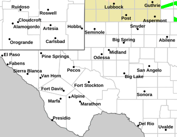
WEATHER Severe Weather the Week of April 29th, 2024
- Thread starter packyderms_wife
- Start date
packyderms_wife
Neither here nor there.
packyderms_wife
Neither here nor there.
South Texas

packyderms_wife
Neither here nor there.
Tornado Warning
TXC371-042230-
/O.NEW.KMAF.TO.W.0004.240504T2139Z-240504T2230Z/
BULLETIN - EAS ACTIVATION REQUESTED
Tornado Warning
National Weather Service Midland/Odessa TX
439 PM CDT Sat May 4 2024
The National Weather Service in Midland has issued a
* Tornado Warning for...
Central Pecos County in southwestern Texas...
* Until 530 PM CDT.
* At 439 PM CDT, a severe thunderstorm capable of producing a tornado
was located 18 miles southeast of Fort Stockton, moving east at 10
mph.
HAZARD...Tornado and hail up to two inches in diameter.
SOURCE...Radar indicated rotation.
IMPACT...Flying debris will be dangerous to those caught without
shelter. Mobile homes will be damaged or destroyed.
Damage to roofs, windows, and vehicles will occur. Tree
damage is likely.
* This tornadic thunderstorm will remain over mainly rural areas of
central Pecos County.
PRECAUTIONARY/PREPAREDNESS ACTIONS...
TAKE COVER NOW! Move to a basement or an interior room on the lowest
floor of a sturdy building. Avoid windows. If you are outdoors, in a
mobile home, or in a vehicle, move to the closest substantial shelter
and protect yourself from flying debris.
&&
LAT...LON 3060 10284 3081 10274 3076 10240 3041 10260
TIME...MOT...LOC 2139Z 289DEG 8KT 3067 10273
TORNADO...RADAR INDICATED
MAX HAIL SIZE...2.00 IN
$$
93
packyderms_wife
Neither here nor there.
Tornado Warning
TXC329-461-042345-
/O.NEW.KMAF.TO.W.0006.240504T2302Z-240504T2345Z/
BULLETIN - EAS ACTIVATION REQUESTED
Tornado Warning
National Weather Service Midland/Odessa TX
602 PM CDT Sat May 4 2024
The National Weather Service in Midland has issued a
* Tornado Warning for...
Southeastern Midland County in western Texas...
Northern Upton County in western Texas...
* Until 645 PM CDT.
* At 602 PM CDT, a severe thunderstorm capable of producing a tornado
was located 20 miles northeast of Crane, moving east at 20 mph.
HAZARD...Tornado.
SOURCE...Radar indicated rotation.
IMPACT...Flying debris will be dangerous to those caught without
shelter. Mobile homes will be damaged or destroyed.
Damage to roofs, windows, and vehicles will occur. Tree
damage is likely.
* This tornadic thunderstorm will remain over mainly rural areas of
southeastern Midland and northern Upton Counties, including the
following locations... Midkiff.
PRECAUTIONARY/PREPAREDNESS ACTIONS...
TAKE COVER NOW! Move to a basement or an interior room on the lowest
floor of a sturdy building. Avoid windows. If you are outdoors, in a
mobile home, or in a vehicle, move to the closest substantial shelter
and protect yourself from flying debris.
&&
LAT...LON 3157 10224 3169 10224 3178 10178 3151 10178
TIME...MOT...LOC 2302Z 267DEG 19KT 3164 10216
TORNADO...RADAR INDICATED
MAX HAIL SIZE...<.75 IN
$$
16