
Melodi
Disaster Cat
'An eruption could occur at any time from 8 hours to 72 hours from now'
Olivia Petter
@oliviapetter1
The Independent Travel
There have been over 500 earthquakes in Iceland in the last four days, leading experts to believe that a volcanic eruption could be imminent.
A series of 40 small earthquakes occurred just North East of Mount Fagradalsfjall two days ago, with the final one felt in Reykjavik, measuring at almost 4 on the Richter scale.
"It's quite normal for Reykjanes, there have been a series of quakes there in the past few years,” the Met Office commented.
rexfeatures-7473815a.jpg
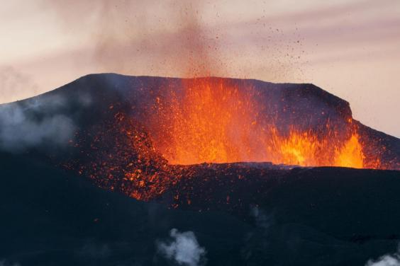
Eruption of the Fimmvoerduhals Volcano, between Myrdalsjoekull and Eyjafjallajoekull, Highland, Iceland 2010 (Rex Features)
According to a post on volcano enthusiast site Volcanocafé, eruptions occur in Iceland every three to seven years.
The ash cloud caused by Mount Eyjafjallajökull's eruption that caused enormous disruption to air travel across Europe for three months took place in 2010 - seven years ago.
“We have never seen a large powerful intrusion at a Mid Oceanic Ridge at such a well instrumented place,” Carl Rehnberg wrote on Volcanocafé.
“We now know that the initial swarm rapidly transformed from tectonic earthquakes, via volcano-tectonic, to earthquakes consistent with moving magma in a surprisingly short timeframe. As such this is turning into a potential eruption, or a state of volcanic unrest.”
Normally, this kind of data would lead experts to believe that an eruption could be days or even weeks away.
istock-155375562.jpg
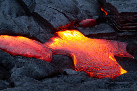
(iStock)
But at this unusually high rate of magma ascent - five kilometres in four hours - Rehnberg believes that a major eruption could be just hours away.
If, however, the “current unrest” stops, there will be no eruption, he claims.
But, he explains, “At the intensity and force of the current seismic unrest, it is likely that an eruption will occur if the seismic crisis is prolonged.”
He speculates that there is currently a 50 per cent chance of an eruption, but that number is increasing by the hour.
The final call, however, will be made by the Icelandic Met Office, who are currently not concerned about a major volcanic eruption, citing the recent seismic activity as "normal for an active region".
"Earthquake swarms like the one presently taking place around the hill Fagradalsfjall are not unknown," Icelandic tour guide Gunnar Birgisson told The Independent, "The last swarm of this magnitude happened in July 2004. During that swarm we had an earthquake of magnitude 4.7, and the largest quake this time around has been 4.0.
"At the moment the seismic activity at Fagradalsfjall is dwindling," he explained. But he added: "Some earthquakes in that area are perfectly normal and there are earthquakes almost every day, but nothing like this - they are all in the same place."
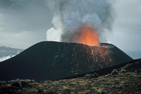
rexfeatures-5317639a.jpg
Eldfell Volcano, Heimaey, Westmann Isles, Iceland, 1973 (Rex Features)
Bárðarbunga was one of the most recent eruptions to occur in the country - it erupted over a six month period in 2014-15. The eruption took place in the Holuhraun lava field and there were no long-term sociological damages. The eruption was preceded by a swarm of 1,600 earthquakes, the largest of which being of magnitude 4.5.
So far, the recent earthquakes felt in Iceland have all been at magnitudes 4.0 and under.
Volcano enthusiasts wait with bated breath.
http://www.independent.co.uk/travel...t-ever-fagradalsfjall-reykjavik-a7865431.html