WEATHER OH BOY, HERE WE GO AGAIN 2-19-2019

Doomer Doug

TB Fanatic
200 million in path of new weather system. YIKES.

https://www.zerohedge.com/news/2019...jor-winter-storm-sweeping-northward-across-us


More Than 200 Million In Path Of Major Winter Storm Sweeping Across The US
Profile picture for user Tyler Durden
by Tyler Durden
Tue, 02/19/2019 - 15:35

This is approximately 60% of the entire American population, AccuWeather reported.

"Parts of 39 of the 48 contiguous United States will be impacted by the massive storm, including every state east of the Mississippi River. The storm will have such a large impact on so many because it will reach parts of 26 of the 30 most populous states," AccuWeather meteorologist Faith Eherts said.

As the storm gains momentum up the Tennessee and Ohio valleys by Wednseday, it will unleash snow and ice over the Midwest, Mid-Atlantic, and Northeast.

"Since this storm will have a great deal of moisture available to it from the Gulf of Mexico and the Atlantic Ocean, a substantial amount of precipitation is likely," said AccuWeather Meteorologist Tyler Roys.

While the Deep South deals with heavy rainfall, temperatures will drop enough for wintry precipitation from northern Texas to Minnesota and Maine.

"As the moisture reaches the mid-Atlantic on Wednesday, it will be cold enough for snow from Washington, D.C. to New York City."

Washington, D.C., Baltimore and Philadelphia metro areas can expect a quick burst of 3 to 6 inches of snow starting late Tuesday night into Wednesday, before the precipitation changes into ice then rain.

"Near the time of the change from snow to ice, it may be snowing at the rate of 1-2 inches per hour," according to AccuWeather Senior Meteorologist Alex Sosnowski.


A monster storm that started Sunday in California will quickly transverse across the country over the next 72 hours, spreading snow, rain, ice and a wintery mix to more than 200 million Americans.
 

Wise Owl

Deceased
usa_None_anim.gif


We have WAY more snow than we need now.........we don't need anymore. I thought I asked you folks out west to send that somewhere else? Sending it south so it can get even bigger was not an option.......... Canada and the Artic would have been better.......

Sheesh.......... (I need to get a sled to haul wood in for the wood stove.......and it reached a high of a whole 11 degrees today)


2 to 3 inches an hour????????????????????????????????? Really????????????????????? Good Lord, we already have almost 5 ft on the ground out there now.........where it hasn't been cleared that is.....
 

Doomer Doug

TB Fanatic
AL BORE STRIKES AGAIN!

Don't ya all know it is GLOBAL WARMING. I know that cuz Al Bore told me so, and then AOC told me global warming will kill us all in about a decade!:hof:
 

billet

Veteran Member
Broke a record high here yesterday at 89! Crazy hot for this time of year. Gonna be a smokin' summer!
 

Dozdoats

On TB every waking moment
https://alerts.weather.gov/cap/wwac...NC.RNKWSWRNK.0b04675559ca6dbf185fefb1ab95310d

Home > Alerts > North Carolina > Winter Storm Warning Issued by NWS Blacksburg (Southwest Virginia)
Message:
NOAA-NWS-ALERTS-NC125CE6D7EF60.WinterStormWarning.125CE6E74F50NC.RNKWSWRNK.0b04675559ca6dbf185fefb1ab95310d from w-nws.webmaster@noaa.gov
Sent:
15:24 EST on 02-19-2019
Effective:
18:00 EST on 02-19-2019
Expires:
16:00 EST on 02-20-2019
Event:
Winter Storm Warning
Alert:
...Expect winter weather this evening into late Wednesday...

.A strong area of high pressure will shift into the northeastern
United States, allowing cold air to wedge south along the eastern
face of the Appalachians. A winter storm approaching from the
west Gulf region will spread precipitation over this shallow dome
of cold air, producing a wintry mixture of snow, sleet and
freezing rain for large part of the Mid Atlantic region and
central Appalachians.

...WINTER STORM WARNING REMAINS IN EFFECT UNTIL 4 PM EST
WEDNESDAY...

* WHAT...Heavy mixed precipitation expected. Total snow and sleet
accumulations of up to 3 inches and ice accumulations of one
tenth to two tenths of an inch expected.

* WHERE...Portions of southwest Virginia and north central and
northwest North Carolina.

* WHEN...Until 4 PM EST Wednesday.

* ADDITIONAL DETAILS...Plan on slippery road conditions. The
hazardous conditions could impact the morning commute.

Instructions:
A Winter Storm Warning means significant amounts of snow, sleet and ice will make travel very hazardous or impossible. The latest road conditions for the state you are calling from can be obtained by calling 5 1 1. The public is encouraged to report snowfall and sleet amount and ice accumulation or wind damage to the National Weather Service via email at rnk.skywarn@noaa.gov...through Facebook or Twitter...or by calling 1...8 6 6...2 1 5...4 3 2 4. Pictures are greatly appreciated.

Target Area:
Alleghany
Ashe
Surry
Watauga
Wilkes

Forecast Office:
NWS Blacksburg (Southwest Virginia)
 

Martinhouse

Deceased
Wise Owl, can you tell me how to get to that radar map on your post #2? I haven't been able to find it that way since Intellicast changed over to Wunderground.
 

night driver

ESFP adrift in INTJ sea
we're sitting in about the 6 ring here in CLE. THOUGH there is a serious possibility that could change, either direction, making the next day or two INTERESTING....
 

Wise Owl

Deceased
Wise Owl, can you tell me how to get to that radar map on your post #2? I haven't been able to find it that way since Intellicast changed over to Wunderground.

http://images.intellicast.com/WxImages/RadarLoop/usa_None_anim.gif


I am amazed it still works but it does. I hate Wunderground..........total waste of bandwidth.... I switched over to the NWS and use that radar map instead. Accuweather email alerts are ok too. But wunderground must be a liberal site or something..........worthless.........................
 

Sacajawea

Has No Life - Lives on TB
NWS calling for anywhere from 6-10 inches of snow here, before it switches to ice on top. But who knows? Last time they forecast 1-3 inches and we got 9.5, following by ice a week later and ice another week after that. I'd need a salt dome, to store enough for that crap out here.

Been dumping woodstove ashes on the driveway, out of the path of where the dogs like to walk - so they don't drag it in the house.
 

Blacknarwhal

Let's Go Brandon!
Rain in SW lower MI, so the Weather Channel and Accuweather agree. There's a possibility of some "wintry mix" getting involved in that, but the early word says it will be mainly a rain event. The cold will come in after the wet, which means a good chance of drying out.
 

Martinhouse

Deceased
Wise Owl, thanks for the link. I got only the one map in it's animated form, but that's what I wanted the most, so it's great to have it back!
 

Wise Owl

Deceased
Wise Owl, thanks for the link. I got only the one map in it's animated form, but that's what I wanted the most, so it's great to have it back!

Yes, that's the way it always has worked. When they had it up on their webpage I copied the location from the gif and just put it into the address bar and bookmarked it. It's been in my favorites for years and years.
 

jward

passin' thru
We're back under advisories here, too...inch of ice, 3 to 5 snow. Im confident this wont close any schools or businesses though, since im already grounded due to truck's bearing... Yes, i do take this winter personally, and its become my arch nemisis LOL
 

Housecarl

On TB every waking moment
With the "Pineapple Express" having visited last week....also recall the "maintenance issues" up at the Oroville Dam.....

For links see article source.....
Posted for fair use.....
https://www.latimes.com/local/california/la-me-ln-mega-storm-dam-failure-20190218-story.html

Rare L.A. mega-storm could overwhelm dam and flood dozens of cities, experts say

By Louis Sahagun
Feb 18, 2019 | 7:55 AM

Scientists call it California’s “other big one,” and they say it could cause three times as much damage as a major earthquake ripping along the San Andreas Fault.

Although it might sound absurd to those who still recall five years of withering drought and mandatory water restrictions, researchers and engineers warn that California may be due for rain of biblical proportions — or what experts call an ARkStorm.

This rare mega-storm — which some say is rendered all the more inevitable due to climate change — would last for weeks and send more than 1.5 million people fleeing as floodwaters inundated cities and formed lakes in the Central Valley and Mojave Desert, according to the U.S. Geological Survey. Officials estimate the structural and economic damage from an ARkStorm (for Atmospheric River 1,000) would amount to more than $725 billion statewide.

2000

https://www.latimes.com/resizer/Pb_...-ln-mega-storm-dam-failure-map1-20190217/2000

In heavily populated areas of the Los Angeles Basin, epic runoff from the San Gabriel Mountains could rapidly overwhelm a flood control dam on the San Gabriel river and unleash floodwaters from Pico Rivera to Long Beach, says a recent analysis by the U.S. Army Corps of Engineers.

In a series of recent public hearings, corps officials told residents that the 60-year-old Whittier Narrows Dam no longer met the agency’s tolerable-risk guidelines and could fail in the event of a very large, very rare storm, such as the one that devastated California more than 150 years ago.

Specifically, federal engineers found that the Whittier Narrows structure could fail if water were to flow over its crest or if seepage eroded the sandy soil underneath. In addition, unusually heavy rains could trigger a premature opening of the dam's massive spillway on the San Gabriel River, releasing more than 20 times what the downstream channel could safely contain within its levees.

The corps is seeking up to $600 million in federal funding to upgrade the 3-mile-long dam, and say the project has been classified as the agency’s highest priority nationally, due to the risk of “very significant loss of life and economic impacts.”

The funding will require congressional approval, according to Doug Chitwood, lead engineer on the project.

Standing atop the 56-foot-tall dam recently, Chitwood surveyed the sprawl of working-class homes, schools and commercial centers about 13 miles south of Los Angeles and said, “All you see could be underwater.”

The dam — which stretches from Montebello to Pico Rivera and crosses both the San Gabriel and Rio Hondo rivers — is one of a number of flood control facilities overseen by the corps. Throughout much of the year, it contains little water.

A government study, however, used computer models to estimate the effects of 900-year, 7,500-year and 18,000-year storm events.

2000

https://www.latimes.com/resizer/QJ4...-me-ln-g-mega-storm-dam-failure-map2-web/2000

In each case, catastrophic flooding could extend from Pico Rivera to Long Beach, inundating cities including Artesia, Bell Gardens, Bellflower, Carson, Cerritos, Commerce, Compton, Cypress, Downey, Hawaiian Gardens, La Palma, Lakewood, Long Beach, Lynwood, Montebello, Norwalk, Paramount, Rossmoor, Santa Fe Springs, Seal Beach and Whittier. Officials say as many as 1 million people could be affected.

Among the communities hardest hit in a dam failure would be Pico Rivera, a city of about 63,000 people immediately below the dam. In a worst-case scenario, it could be hit with water 20 feet deep, and evacuation routes would be turned into rivers. Downey could see 15 feet of water; Santa Fe Springs, 10 feet.

In recent years, officials with the U.S. Department of Interior and the U.S. Geological Survey have sought to raise awareness of the threat of mega-storms and promote emergency preparedness. Part of the challenge, however, has been characterizing the scale of such storms. When scientists speak of a 900-year storm, that does not mean the storm will occur every 900 years, or that such a storm cannot happen two years in a row. It means that such a storm has a 1 in 900 — or .1% — chance of occurring in any given year.

The estimates used by the U.S. Army Corps of Engineers are intended to protect the region from a storm similar to the one that hit California during the rainy season of 1861-1862. That’s when a series of intense storms hammered the state for 45 days and dropped 36 inches of rain on Los Angeles. So much water fell that it was impossible to cross the Central Valley without a boat, and the state capital was moved temporarily from Sacramento to San Francisco.

Some researchers, however, say climate change has cast doubt on 20th-century assumptions. They argue that, in a warming world, regions such as California will experience more whiplashing shifts between extremely dry and extremely wet periods — similar to how California’s long drought was quickly followed by the wettest rainy season on record in 2016-2017. These intense cycles will seriously challenge California’s ability to control flooding as well as store and transport water.

Daniel Swain, a UCLA climate scientist, said hydrological and forecast data used by the corps must be updated.

“The Army Corps’ estimates of the impacts of an extremely serious weather event … are categorically underestimated,” he said. “That’s because we only have about a century of records to refer to in California. So, they are extrapolating in the dark.”

As an example, Swain said until recently it was thought a flood the magnitude of the 1861-1862 event was likely to occur every 1,000 to 10,000 years. New research has changed that view considerably, Swain said.

“A newer study suggests the chances of seeing another flood of that magnitude over the next 40 years are about 50-50,” he said.

Whittier Narrows, Swain added, is therefore just one of “many pieces of water infrastructure that may not be up to the challenge of the brave new climate of the 21st century.”

Such was the conclusion of a study conducted by UC Irvine researchers and published recently in the scientific journal Geophysical Research Letters. After examining 13 California reservoirs — most of them over 50 years old — the authors argued that the risk of dam failure was likely to increase in a warming climate. The study cited the 2017 crisis at Oroville Dam, when extreme water flows caused the dam spillway to disintegrate and triggered the evacuation of more than 180,000 people.

In the case of Whittier Narrows Dam, Travis Longcore, a spatial scientist at USC, suggested people had grown complacent about the effectiveness of the area’s flood control system. “People tend to forget about the power of Southern California’s river systems,” he said.

The San Gabriel River ranks among the steepest rivers in the United States, plunging 9,900 feet from boulder-strewn forks in the mountains down to Irwindale. It then meanders in a gravelly channel before arriving at lush Whittier Narrows — a natural gap in the hills that form the southern boundary of the San Gabriel Valley. From there, its flows are tamed in a concrete-covered channel for most of its final journey to the Pacific Ocean.

Now, based on the corps’ findings, L.A. County and municipal officials are working with the federal government to develop emergency plans that can be implemented if necessary before the repair project at the dam is completed in 2026.

Pico Rivera has undertaken an improved preparedness program, but only recently.

Robert Alaniz, a spokesman for Pico Rivera, said the city was using a $300,000 grant from the California Department of Water Resources to revise its existing evacuation plans, which use major thoroughfares crossing the San Gabriel River to the east and Rio Hondo to the west.

Separately, Los Angeles County Supervisor Hilda Solis said she discussed the importance of the Whittier Narrows Dam project with members of Congress during a visit to Washington, D.C., in January.

In the meantime, David Reid, a water historian and expert on the Whittier Narrows area, suggested “the false sense of security included in the phrase ‘900-year flood’ combined with the promises of 20th century water infrastructure have put us in a bind.”

“That’s because a mega-flood is impossible to predict,” he said. “And if the water infrastructure fails, we’re in big trouble.”

Comments (171)
 

Housecarl

On TB every waking moment
For links see article source.....
Posted for fair use.....
https://www.sfgate.com/weather/article/Las-Vegas-strip-snow-McCarran-Airport-13627192.php

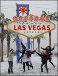
Las Vegas strip dusted in snow: 'It happened!'

By Amy Graff, SFGATE Published 7:02 am PST, Tuesday, February 19, 2019

"IT HAPPENED!" the National Weather Service office in Las Vegas tweeted when the first flakes of snow were reported at the famous gambling city's McCarran Airport Sunday night.

Social media soon exploded with photos and videos of snow on the famed Strip.

Snow falls periodically in the Las Vegas Valley, but it's unusual for it to be as widespread as it was over the weekend. Higher elevation areas on the western and southern edges of the Las Vegas area received one to two inches of snow.

Henderson, Nev., recorded 1 inch and Western Summerlin saw 2.5 inches.

The storm caused a nearly five-hour shutdown of Interstate 15 at the Nevada state line on Monday due to multiple accidents related to snow and ice. It was later reopened.

ALSO: Bay Area temperatures dive below freezing, triggering 'black ice' warning

The last time Las Vegas and the Strip saw similar significant snowfall was in 2008 when the airport measured three inches of accumulation. Snow has fallen two other times in the Las Vegas Valley this February but with much less sticking to the ground.

Another winter storm coming from the Pacific Northwest is expected to arrive on Wednesday and Thursday in Nevada.

The Associated Press contributed to this report.
 

AlfaMan

Has No Life - Lives on TB
I'm in Harrisburg,PA tonight. Were expecting 6" or more of snow starting around 6-7am. I've got two audits to do here tomorrow then I get to drive back to DC in this stuff.weather is expecting the heavy snow to change to sleet and freezing rain by lunch time.
Guess I get to play in 4wd tomorrow and test out the new tires on the blazer.
 

NC Susan

Deceased
Get a motel
Most roads all schools and courthouses closed


I'm in Harrisburg,PA tonight. Were expecting 6" or more of snow starting around 6-7am. I've got two audits to do here tomorrow then I get to drive back to DC in this stuff.weather is expecting the heavy snow to change to sleet and freezing rain by lunch time.
Guess I get to play in 4wd tomorrow and test out the new tires on the blazer.

https://6abc.com/weather/penndot-announces-vehicle-restrictions-for-wednesday/5145693/

PENNDOT announces Restrictions

PHILADELPHIA (WPVI) -- With snow in the forecast for Wednesday, PennDOT issued several vehicle restrictions for state highways.

The restrictions begin at 6 a.m. in the western part of the state. Restrictions for the Philadelphia region will be in place by noon.

A 45mph speed restriction may also be put in place, PennDOT said.

For the latest road conditions, check 6abc.com/Traffic.

VEHICLE RESTRICTIONS
Wednesday, February 20, 2019

6 a.m.

A full commercial vehicle ban (including buses) will be in place on I-70 in Fulton County (from the Maryland state line to the Turnpike) and I-99 from I-80 to the Turnpike.

On I-80 from I-79 to the I-99 interchange and on the Turnpike from New Stanton (exit 75) east to Carlisle (exit 226), the following vehicles will be prohibited:

-Empty, straight CDL-weighted trucks;
-All Large Combination Vehicles (double trailers);
-Tractors hauling empty trailers;

Any trailers pulled by motorcycles, passenger vehicles, pickup trucks or SUVs;
-All motorcycles; and
-All recreational vehicles and RVs.

12 p.m.

PennDOT and the PA Turnpike will prohibit only:

-Straight CDL-weighted trucks;
-All Large Combination Vehicles (double trailers);
-Tractors hauling empty trailers;
-Any trailers pulled by motorcycles, passenger vehicles, pickup trucks or SUVs;
-All motorcycles;
-All recreational vehicles and RVs

On the following roadways:

-PA Turnpike (I-76, I-276) from I-81 to I-95 (Exit 43);
-I-76 (Turnpike and non-Turnpike, New Stanton to Philadelphia);
-I-78 full length from I-81 to the New Jersey state line;
-I-80 from I-99 to the New Jersey state line;
-I-81 from the Maryland state line to the New York state line;
-I-83 from the Maryland state line to I-81;
-I-84 full length from I-81 to the New York state line;
-I-176;

-I-180 full length from Route 220/U.S. 15 to I-80;
-I-276; PA Turnpike
-I-283;
-I-295;
-I-380 full length from I-81 to I-80;
-I-476 (non-Turnpike, full length);
-I-476 (PA Turnpike, Northeast Ext.) from Mid County (exit 20) to Clarks Summit (exit 131);
-I-676;
-Route 22 from I-78 to the New Jersey state line; and
-Route 33 from I-78 to I-80.
 

Wise Owl

Deceased
I'll help! Where's our global warming? He promised us global warming! I was looking forward to farming and gardening in Zone 6, at least!

Summerthyme

Lol @ Summer............ I hear ya. It's a balmy 1 degrees up here in Western Maine. It was 0 so I guess it's warming up outside....... :lkick: :screw:

I sure am tired of carrying in 3 or 4 armloads of firewood every day.........

I am wanting May in the worst way this year. I will take the bugs over this constant snow/below 0/ more snow/more 0 stuff..........

I want green leaves and grass on that front yard, not 5 ft of freaking snow.........
:gaah::gaah::gaah:
 

Wise Owl

Deceased
Here we go...........

Hazardous Weather Outlook

Hazardous Weather Outlook
National Weather Service Gray ME
649 PM EST Tue Feb 19 2019

MEZ007>009-012>014-018>028-NHZ001>015-210000-
Northern Oxford-Northern Franklin-Central Somerset-Southern Oxford-
Southern Franklin-Southern Somerset-Interior York-
Interior Cumberland-Androscoggin-Kennebec-Interior Waldo-
Coastal York-Coastal Cumberland-Sagadahoc-Lincoln-Knox-Coastal Waldo-
Northern Coos-Southern Coos-Northern Grafton-Northern Carroll-
Southern Grafton-Southern Carroll-Sullivan-Merrimack-Belknap-
Strafford-Cheshire-Eastern Hillsborough-Interior Rockingham-
Coastal Rockingham-Western And Central Hillsborough-
649 PM EST Tue Feb 19 2019

This Hazardous Weather Outlook is for Maine, south central Maine,
southwest Maine, west central Maine, western Maine, New Hampshire,
central New Hampshire, northern New Hampshire and southern New
Hampshire.

.DAY ONE...Tonight.

Hazardous weather is not expected at this time.

.DAYS TWO THROUGH SEVEN...Wednesday through Monday.

Snow is expected Wednesday night and Thursday. Moderate
accumulations are possible especially in the mountains and foothills
of western Maine. Snow may change to sleet and freezing rain before
ending primarily over southern and central New Hampshire.

Another round of wintry weather is possible Saturday night into
Sunday.
 

seraphima

Veteran Member
Gee, umm .... +42 F here in Kodiak Alaska. No snow, and the lake ice is melting. Some of my protected perennials are starting to leaf out.
 

Flippper

Time Traveler
It was 5F last night. We are forecast for night time temps in the mid to lower teens clear into March-I have never seen anything like this before, we are getting December early January weather, we're getting lots of snow with this and every day I hear spring birds tweeting, I imagine many are starving as this time of year we are getting our thaws and bits of grass are showing. Even Lewiston Idaho is getting snow storms, warnings were out yesterday-they usually get a dusting in late December that lasts a day or so.

hell-freezes.jpg
 

summerthyme

Administrator
_______________
Gee, umm .... +42 F here in Kodiak Alaska. No snow, and the lake ice is melting. Some of my protected perennials are starting to leaf out.

Well, actually, for all my bitching, this has been a surprisingly open and relatively mild winter here south of Buffalo, NY. It was 0 degrees last night, but they're calling for 52 Sunday! And that's been more typical than not, all season. The heavy snows have almost all missed us to either the north or the south, often by as close as 10 miles either way.

I love a good old fashioned winter, but with hubby laid up after surgery again, and my spine acting up, I'm grateful to n8t have to fight several feet of snow or way sub-zero temperatures. These Grand Solar Minimum weather patterns are going to take some serious getting used to!

Summerthyme
 

jward

passin' thru
OMG!!!!!!!!!!!!
It's Winter!!!!!!!!!!
It might snow!!!!!!!!!!

:hof::hof::hof::hof::hof::hof::hof::hof::hof::hof::hof::hof::hof:

:zzz:

Lol snyper. In my defense, i want it to be clear that im not complaining bout the snow, or the ice, or even the folks who cant drive in it. My only gripe is all the business that are closing early or not opening at all coz of a little precip. Mamma needs some grown up conversation!
 

pops88

Girls with Guns Member
OMG!!!!!!!!!!!!
It's Winter!!!!!!!!!!
It might snow!!!!!!!!!!

:hof::hof::hof::hof::hof::hof::hof::hof::hof::hof::hof::hof::hof:

:zzz:

:smkd:

Yeah, you come to Vegas and get on the roads with people who can't even drive when it rains, or even drive on a good day...and then there's all the lost Californians....

:gaah: :sht:
 
Last edited:

jward

passin' thru
:smkd:

Yeah, you come to Vegas and get on the roads with people who can't even drive when it rains, or even drive on a good day...and then there's all the lost Californians....

:gaah: :sht:

Hey, we've all seen those lost CA souls trying to drive in it.,.nothing to laugh about:shkr: ;)
 

Publius

TB Fanatic
Here on the eastern side we're in for 4" to 7" of global warming goodness followed by wintery mix of freezing rain and sleet and then more of the same for the week end.
It's suposed to start snowing around 4:00Am and the temp is now at 27F and dropping
 

Housecarl

On TB every waking moment
For links see article source.....
Posted for fair use.....
https://www.heraldmailmedia.com/new...cle_73317089-25ba-5f76-9663-532738fbb199.html

California has gotten 18 trillion gallons of rain in February, with more on the way

By Hannah Fry Los Angeles Times (TNS) Feb 19, 2019 Updated 14 hrs ago

LOS ANGELES — California has already received an 18 trillion-gallon soaking this month — enough water to fill 27 million Olympic-sized pools — and the state’s wild winter isn’t over yet.

A series of storms, including a moisture-packed atmospheric river that slammed the state last week, has brought consistent rainfall in February that has reached nearly half the volume of Lake Tahoe.

Los Angeles has received its fair share of the rain, with more than 4 inches falling on the Southland since Feb. 1. San Diego has had more than 10 inches of rain this month, passing its average for the entire winter season, according to the National Weather Service.

The totals are likely to increase this week — though not by much — as another storm rolls into the region Wednesday night. That low pressure system is expected to bring less than a quarter of an inch of precipitation through Thursday, said Lisa Phillips, a meteorologist with the National Weather Service in Oxnard.

“It’s kind of a drier system,” she said. “We’ve gotten a decent amount of rain already. I think it’s more the cold that people aren’t going to be happy about.”

Cold air that’s being pushed from Canada’s inland area isn’t moving over the warmer Pacific Ocean waters, which means temperatures will remain chilly through the week. By Friday, highs will increase slightly to the mid-50s and low 60s, Phillips said.

The cold snap has already dropped temperatures into the low 30s in Southern California and into the 20s in the Bay Area and along the Central Coast.

Temperatures in Long Beach fell to 39 degrees overnight, tying a previous record set in the coastal city in 1965, Phillips said.

Some other local areas also might come close to record-breaking low temperatures in the coming days, she said.
 

zeker

Has No Life - Lives on TB
usa_None_anim.gif


We have WAY more snow than we need now.........we don't need anymore. I thought I asked you folks out west to send that somewhere else? Sending it south so it can get even bigger was not an option.......... Canada and the Artic would have been better.......

Sheesh.......... (I need to get a sled to haul wood in for the wood stove.......and it reached a high of a whole 11 degrees today)


2 to 3 inches an hour????????????????????????????????? Really????????????????????? Good Lord, we already have almost 5 ft on the ground out there now.........where it hasn't been cleared that is.....

I hear ya

we have at least 4 ft on the roofs and I am too old anymore to git'er'dun

I did the roof on the camper and my outdoor workshop and its now piled up to the eaves on both
 

Wise Owl

Deceased
No way I can pull snow off roofs anymore. I called out snow removal guy yesterday to come and get rid of the ice on the roof edge. AGAIN.......that will be twice this winter for that. He and his wife will be here this afternoon. He is happy to make the money and he will be back to plow and snowblow the drive and yard after this upcoming storm.
We are also going to get hit on Sun/Mon..........with yet another storm.

This is arthritis weather for sure........hurts like the dickens. Woke up with a stiff/sore neck and headache this morning as did my dh. We both have the heating packs wrapped around our shoulders/necks........gah......
 

SouthernBreeze

Has No Life - Lives on TB
Thundersnow and lightning, very very frightening, me …


Never saw/heard it before.

Doz, we had that going on here, yesterday. Thunder/lightening with sleet and a bit of hail mixed in. It's still storming, today, but with no sleet. We've been under flood warnings since yesterday. DH almost needs his boat just to get to our wood shed for firewood.
 

Publius

TB Fanatic
Here on the eastern side we're in for 4" to 7" of global warming goodness followed by wintery mix of freezing rain and sleet and then more of the same for the week end.
It's supposed to start snowing around 4:00Am and the temp is now at 27F and dropping


Looks like we will get the full 7" inches and we have some THUNDER SNOW happening here yes I was standing outside getting some firewood and it rumbled and more than once.
 
Last edited:

Shacknasty Shagrat

Has No Life - Lives on TB
This is an understanding of how the system works.
SS


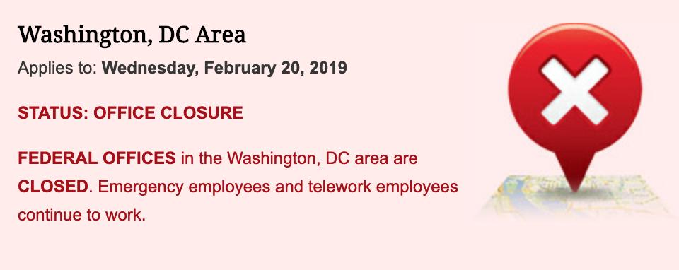
'D.C. Snowstorm Alters Fed Minutes Release
By Christopher Condon
February 20, 2019, 6:50 AM PST


The U.S. government’s closure on Wednesday during a snowstorm in Washington will affect the way the central bank releases the minutes of its Jan. 29-30 meeting, preventing news organizations from reviewing the document before it’s publicly available.

The Federal Reserve said the record of the meeting will be posted on its website at 2 p.m., as scheduled.

Normally, the Fed provides members of accredited news organizations access to the minutes ahead of the public release time at a central-bank facility, allowing the journalists time to prepare headlines and articles reporting the content also at 2 p.m. local time. That procedure for the media was canceled for Wednesday’s minutes release due to the inclement weather.

https://www.bloomberg.com/news/arti...release-to-be-altered-by-winter-storm-closure
 
Top