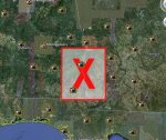
WTF?!? Is this?

Joann

Deceased
Yeah, WTH is the state wide X? I can still zoom in and see ground details so it doesn't block out. Hmm interesting.
 

mzkitty

I give up.
On the Mississippi, bridging 2 states, two colleges noted, near a .mil installation of some sort.

USDA Farm Service Agency.


Hmmmm.....


:popcorn1:
 

maric

Short but deadly
I can't get it to open but then again I'm on wireless and we got real bad winds & rain in the area.
 

mzkitty

I give up.
My son says if you go to the real google earth that red x is not there, so somebody made that but for what reason he can't say.
 

Guns-N-Moses

Senior Member
Description of what we're looking for?

I dont know if you need google earth to download and see this but WTF is it meant for?


http://www.google.com/url?sa=t&sour...sg=AFQjCNGl8pX7pAinXVKTVJ4YMLqF_0iLFg&cad=rja

What are we looking at?

Where does your link take us?


I tried to follow your link but my browser tries to open a file. Luckily my PCs security prevented the download (asks for my authorization).

Before I agree I like to know what I'm downloading and I'm already leery of anything from Google.com

Can someone tell us what this thread is about?


From what I can tell, it appears that you are referring to a specific location.

Can you provide the coordinates? I have Google Earth and can plug in the Long/Lat values if you can provide them, but am not comfortable downloading something without more information.

Thx.
 

mt4design

Has No Life - Lives on TB
Can't see what the link suggests but your description of the area made me think New Madrid fault...

I dropped the file on to Firefox and got a programming string that had these coordinates within it...

<north>32.34375</north>
<south>30.9375</south>
<east>-84.375</east>
<west>-85.78125</west>

Mike
 

Joann

Deceased
What are we looking at?

Where does your link take us?

Can someone tell us what this thread is about?


From what I can tell, it appears that you are referring to a specific location.

Good question. I donno. Here is the grab, when I launched from Google Earth first it did not show this X, same with G map.

Picture 1.jpg
 

medic38572

TB Fanatic
What are we looking at?

Where does your link take us?


I tried to follow your link but my browser tries to open a file. Luckily my PCs security prevented the download (asks for my authorization).

Before I agree I like to know what I'm downloading and I'm already leery of anything from Google.com

Can someone tell us what this thread is about?


From what I can tell, it appears that you are referring to a specific location.

Can you provide the coordinates? I have Google Earth and can plug in the Long/Lat values if you can provide them, but am not comfortable downloading something without more information.

Thx.


Guns and Moses I apologize for the the link and no info. Heres what happened. Today we were driving down the road and this fella had a bumper sticker on his pickup that had 01202013. Knowing this was inauguration day for the next president when i got home I googled 01202013 and this is the first link to come up.

http://www.google.com/search?q=0120...s=org.mozilla:en-US:official&client=firefox-a

Then I clicked on this link which explained the 01202013 bumper sticker, Bring back capitalism!

01/20/2013 Bumper Sticker

You've watched the liberals plaster their Subarus and Toyota Priuses with the 01/20/2009 bumper stickers for years. The inauguration is long gone and socialist policies are being enacted at high speed by the liberal-leaning Congress. Next stop healthcare. Why not speak out with an 01/20/2013 bumper sticker?

The liberals will undoubtedly argue that one should to give "that one" a chance, but we are giving him the benefit of the doubt. We are going so far as to assume that he will be successful in achieving all of his campaign promises including spreading the wealth, subsidizing bad business practices, raising costs by requiring caps on pollution and instituting socialized medicine. He has already been successful at subsidizing fiscal irresponsibility at the expense of those who live within their means. Nearly a year has passed since auguration and already nearly two trillion dollars has been flushed away. Never before has a government wasted so much so fast. There seems to be no end in sight with a liberal Congress backing all of Obama's socialist initiatives.

Our 01/20/2013 bumper sticker is a tasteful design with no taunting phrase at the bottom like "the end of an error." We've also made it a less obnoxious size - 6 inches by 1 3/4 inches which is large enough to read if you belong behind the wheel. The date alone makes the statement.

Note that if you place an 01/20/2013 bumper sticker on your property whether it is an automobile, a pair of boxer shorts or an aluminum baseball bat, you are taking a risk that some hopeful, "peace and love" liberal will lash out against you. We bear no responsibility for vandalism or angry verbal outbursts by those who can dish it, but can't take it.

Then I clicked a few more links the third link was the the link that brought up the Google earth pic with an red x in a square. The reason I clicked on it just out of curiosity was because it has NASA in the description underneath the link

byss.arc.nasa.gov/maps/mars/visible_kml/012/020/01202013.kml and when I clicked the link the the Google map cam up as mzkitty pointed out in the MS river between 2 states and the rest.

Actually it is on the state line between Henry co ALA and Ga in Clay Co in the center of a lake! but I don't know what it references other then that. I was interested in ideas.

Edited to add when you open it up you can actually scroll down and zoom up and down until the x go's away when you are focused very close to the earth.
 

colonel holman

Veteran Member
the big red x showed up for me, but when I clicked on zoom tool for more of a close-up, it disappeared, revealing a dam with manmade lake behind it, just north-upstream of Ft Gaines. Looks vulnerable to blown dam?
 

Creeper

Creeper
if you do a google search for "google earth red x" you will find lots of info. Basically, GE is trying to load an overlay at this spot, but the overlay has been deleted, or cannot be found. Usually you can get rid of it by un-checking things in My Places or Layers. There is probably one item under My Places or Layers that is trying to load a non-existant object.
 

Technomancer

Inactive
If you look at the place you got the file from, "http://byss.arc.nasa.gov/maps/mars/visible_kml/012/020/01202013.kml", you might notice that its coming from the maps of Mars at nasa

The file is for GoogleEarth to show Mars. That red X block is where the image isn't being loaded into GoogleEarth, its a square defined in the kml as the location to stretch a picture over the sphere. You get a red X because you're not actually loading the image that goes there.
The image it's supposed to load and stretch onto that part of the sphere/globe is at http://byss.arc.nasa.gov/maps/mars/visible_kml/012/020/01202013.jpg
And the picture itself:
01202013.jpg


If you were actually looking at Mars in GoogleEarth, it would have loaded not just that part of the map, but the entire planet of Mars, and instead of showing an "image not found" Red X everywhere, it would have loaded all the pictures and you would have seen pictures of the surface of Mars stretched/mapped over a sphere to look like the planet mars.


In other words, you found a random file out of the library of files that lets you use GoogleEarth to see Mars.
 
Top