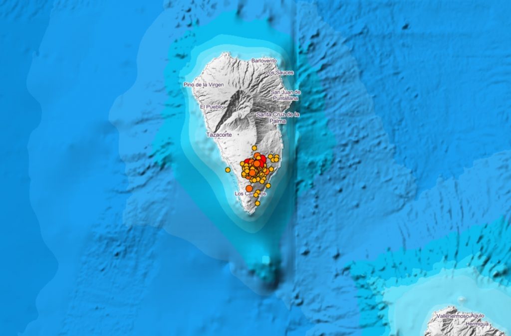
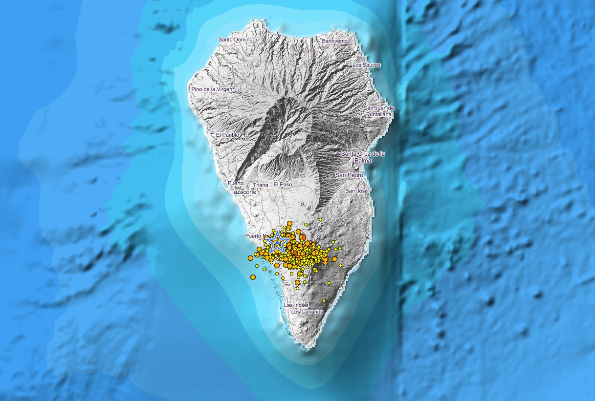
The seismic activity is picking up. This is from the local newspaper, so it is extremely accurate and timely. I am seeing NO SIGN of any movement north into the landslide zone. On the map the landslide zone is well north of where the magma and earthquakes are happening. The various colored "balls" are where things are popping. The area north with the giant hole is visible is where the rocks would have to slide into the ocean and cause any "mega tsunami." Obviously, there is NO SIGN of any thing like that at all. To do so all of the colored things would have to move into that giant hole and then you would get the rock mass falling into the ocean and KABOOM.
There have been 36 earthquakes recorded in La Palma since midnight, and two tremors in Tenerife…

www.canarianweekly.com
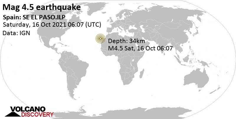
INTENSE EARTHQUAKE SO FAR OF 4.6 DEGREES THIS MORNING
2021/10/16 10:47:37 Written by Canarian Weekly
Tenerife
A total of 36 earthquakes have been registered on the island of La Palma since midnight last night, the strongest one of 4.6 degrees in Mazo, the highest magnitude felt so far since the eruption of the volcano began almost 4 weeks ago.
According to information from the National Geographic Institute (IGN), this 4.6 magnitude earthquake was registered at a depth of 37 kilometres at 4:41am this morning, and was followed up by a 4.5-degree quake at 6.07am in the same area and at the same depth, both felt by the population of the island.
The rest of last night’s seismicity oscillated between 2.3and 3.1 degrees of magnitude. 22 movements were registered in Fuencaliente, while in Mazo there have been 14 movements recorded by the IGN.
There have also been two small earthquakes recorded in Tenerife during the night, one of 1 degree in Santiago del Teide at a depth of 5 kilometres; and another in Guía de Isora of 1.7 at a depth of 4 kilometres.

")


")