Solar Grand Solar Minimum part deux

TxGal

Day by day
The Oppenheimer Ranch Project has a new podcast out:

Minor Volcanic Eruptions Could Cascade Into Global Catastrophe - National Volcanic Threat Assessment - YouTube

Minor Volcanic Eruptions Could Cascade Into Global Catastrophe - National Volcanic Threat Assessment
5,436 views
Premiered 11 hours ago

View: https://youtu.be/EUV39KS-kWc
Run time is 6:02

Synopsis provided:

Minor volcanic eruptions could ‘cascade’ into global catastrophe https://bit.ly/3FAz2aP
Eruptions in the Cascade Range during the past 4000 years https://on.doi.gov/30Yxubw
2018 National Volcanic Threat Assessment https://on.doi.gov/3ptbDSW
The USGS Has Just Listed These 18 North American Volcanoes as "Very High" Risk https://bit.ly/3szoXY0
Native American Names For The Cascades https://bit.ly/3yZb32B
 

TxGal

Day by day
Winter generally brings snowfall, of course. What I'm watching for are earlier season than usual snows, record snowfalls, and later season than usual snows. These could be 'one-offs' or a signal of a GSM gathering steam.

Heavy snow falls across wide areas facing Sea of Japan - up to 32 inches in 24 hours -- Earth Changes -- Sott.net

Heavy snow falls across wide areas facing Sea of Japan - up to 32 inches in 24 hours


The Asahi Shimbun
Sun, 26 Dec 2021 15:14 UTC

Pedestrians trudge through deep snow
© Shuichi Doi
Pedestrians trudge through deep snow accumulating in central Aomori on Dec. 25.

Heavy snow was forecast over northern and western parts of the country facing the Sea of Japan on Dec. 26 and warnings were issued urging residents to be vigilant against snow storms, surging waves and the deep chill.

The bad weather is expected to continue until Dec. 28, according to the Japan Meteorological Agency, citing a winter pressure pattern with a severe cold air mass spreading above the archipelago.

The agency also warned that low-lying areas on the Pacific side of Japan could experience heavy snow.

Over the 24-hour period through 2 p.m. on Dec. 26, Myoko in Niigata Prefecture recorded the largest single-day snowfall of 82 centimeters, followed by 72 cm in Daisen, Tottori Prefecture, and 69 cm in Minakami, Gunma Prefecture.

View: https://youtu.be/H0ks1mtd_jo
Run time is 0:52

View: https://youtu.be/DcIySroQXdc
Run time is 8:28

Tokyo also had a light dusting, the season's first, early on Dec. 26, the agency said. It occurred 17 days earlier than in 2020 and eight days earlier than an average year.

Japan Airlines Co. canceled 22 flights from airports in Hokkaido and Niigata Prefecture on Dec. 26.

East Nippon Expressway Co. was expected to close off the Horinouchi Interchange and Yamato Smart Interchange of the Kanetsu Expressway in Niigata Prefecture from 3 p.m. the same day.

Projected snowfall over the 24-hour period until 6 p.m. on Dec. 26 for each region was 90 cm for Hokuriku; 70 cm for Tohoku; 60 cm for Kanto-Koshin, Kinki and Chugoku; 50 cm for Hokkaido; 30 cm for Tokai; 10 cm for northern Kyushu; and 5 cm for Shikoku.

For the following 24 hours, projected snowfall for Hokuriku came to 70-90 cm; 60-80 cm for Kinki and 50-70 cm for Tohoku and Kanto-Koshin.
 

ktrapper

Veteran Member
Just found out today that the roof on the IGA grocery store and Buffalo Fuel Station in Delta Junction where we used to live collapsed yesterday I think from snow and the 24 hours of rain on that. They are getting three more days of snow. That’s the only grocery store within about 85 miles.
Friend said the roads were really bad, ice.

I know up here on the North Slope we have a snow pile already as big as all of last years pile.
 

TxGal

Day by day
Ice Age Farmer has a new podcast out (finally!). Not good at all, especially since many countries are now in winter:

Farmers, Truckers STOPPED as Food Supply Collapses - YouTube

Farmers, Truckers STOPPED as Food Supply Collapses
79,366 views
Premiered 13 hours ago

View: https://youtu.be/g8V6CxBIdo8
Run time is 13:50

Synopsis provided:

As the unv'd are locked out of farmers markets and grocery stores, so too are unv'd farmers precluded from selling their grains. Ministers who warn of impending food shortages are promptly removed from office. The mainstream food supply is now in full collapse, and we must be creating ALTERNATIVE food supplies.
 

TxGal

Day by day
The Oppenheimer Ranch Project has a new podcast out:

Avalanche Warnings In 6 Western States, Snow Continues To Pile Up - Iceland - Do Auroras Make Noise? - YouTube

Avalanche Warnings In 6 Western States, Snow Continues To Pile Up - Iceland - Do Auroras Make Noise?
5,865 views
Premiered 18 hours ago

View: https://youtu.be/7KOmcNeK678
Run time is 13:02

Synopsis provided:

Western US to close 2021 with record cold and piling snow https://bit.ly/32yyGDc
Snow and cold will make for difficult post-Christmas travel across the western and northern United States https://cnn.it/3FD029F
Snow expected to continue as winter storm warnings extend from Seattle to San Diego https://nbcnews.to/3pucoLJ
Palisades Tahoe Closed Due to Heavy Snow Conditions https://bit.ly/3etz60a
NorCal storm live updates: I-80, Highway 50 remain closed, 69K without power https://bit.ly/3H6TBfs
Power Outage US https://poweroutage.us/
GFS Model Total Snow https://bit.ly/3pyssvK
Hazardous Winter Weather Conditions for Portions of the West, Northern Plains and Northeast https://www.weather.gov/
Dams burst in northeastern Brazil as region hit by floods https://reut.rs/3sKKT2i
Scientists Identify A New Type Of Storm Called An 'Atmospheric Lake' https://bit.ly/3qwyCvK
Worldwide Volcano News https://bit.ly/3y58XgJ
Fagradalsfjall volcano update: continuing ground deformation has reached same pre-eruptive February values https://bit.ly/3z0R7fQ
Strong earthquake activity in Fagradalsfjall mountain, Krýsuvík-Trölladyngja volcano https://icelandgeology.net/
Reykjanes peninsula - earthquakes https://bit.ly/3rprWPn
LIVE: Iceland Volcano in Geldingadalir https://bit.ly/3euwOOg
Magma Chamber Video In Icelandic https://bit.ly/3mBjH2c
Do Auroras Make Sounds We Can Hear? The True Answer Is Surprisingly Complicated https://bit.ly/3EJWqBH
 

TxGal

Day by day
Martinhouse, are you doing okay up there?

We have an arctic blast coming in New Year's Day down here. It's going to drop our temps into the upper 20s for a few days, then thankfully we get warmer again.

I know if we're going to get it, you usually do, too. I hate winter!
 

nomifyle

TB Fanatic
Its 78 today with sunshine, but on Sunday its predicted to snow and then a couple of days later it will be in the 50's. No more shorts and flipflops after that for awhile, maybe. This is not unusual for Louisiana.

God is good all the time

Judy
 

Martinhouse

Deceased
TxGal, we're supposed to have mid to high sixties the rest of this week, and then down to 21 for Saturday's overnight low. After that. 40s and 50s daytime high temps with lows from just below to just above freezing for the rest of the ten-day forecast. Not bad at all for this time of year.

I belatedly planted my garlic and a bunch of grocery store onions yesterday. They and my garlic, which was also sprouting. They should start growing right away, as they are potted,,, in the greenhouse. I discovered that one of the cabbages I'm storing in my back porch has oodles of roots growing around the cut edge of the stalk, so I'll cut out the core and plant that, too. It'll make a lot of little balls of tender green leaves to feed the chickens and bunnies. Guess I need to check the other heads for roots. And I think I'll plant any carrots I have if they have enough top left on them to start growing their greens again. I'll be dehydrating a huge picking of kale soon and then let it grow a new batch. All the broccoli is huge and has little head up to 2" in diameter now. I'll only take some of the big bottom leaves off of those plants. I've been giving away the broccoli heads because they won't liquefy in the blender and I can't swallow those little beady things that they are made up of. But this year I'm going to try dehydrating them and crushing them up with the mortar and pestle.

Kale tastes great with noodles and potatoes, and broccoli goes best with rice, and I have plenty of those,

So while I could get mighty chilly or even freeze to death from this GSM, I certainly won't starve!

I've been taking advantage of these extra warm days to spend about half an hour at noon, sitting in the sun with my pants legs and shirt sleeves pushed way up, then turning and pulling the back of my shirt all the way to my shoulders. I sit on the south side of the back porch so there's no chill breeze and it's in full sun. Free vitamin D!!!!!
 

TxGal

Day by day
Adapt 2030 has a new podcast out:

Sinkholes are Beginning to Show the Next Phase of Earth Changes - YouTube

Sinkholes are Beginning to Show the Next Phase of Earth Changes
21,873 views
Dec 28, 2021

View: https://youtu.be/un5RdzZFNjA
Run time is 10:33

Synopsis provided:

Sinkholes across the coast of the Dead Sea with record rains and snows through N. Africa and the former Fertile Crescent back up claims that 2024 the planetary orbits not seen since 79AD will have effects on our planets crust breaking infrastructure. You need to think of remoteness and community moving forward.
 

TxGal

Day by day
Here's the 2nd from Oppenheimer:

Tahoe Shatters 50-Year December Snow Record With 16+ Feet Of Snow - Record Cold Canada -55 Windchill
9,918 views
Premiered 11 hours ago

View: https://youtu.be/k2M6m-GNk-Y
Run time is 17:54

Synopsis provided:

Tahoe shatters 50-year December snowfall with more than 16 feet of snow https://bit.ly/317z5fp
Western US states hit by record freeze and heavy snow https://bit.ly/3EBVxL2
Idaho ski resort closes due to 'overwhelming' snowfall https://bit.ly/3ENQCHn
Winter Storm Shuts Down 81 Miles of Interstate in the Sierra Nevada https://nyti.ms/3JmaAMG
10-hour delays possible around Tahoe as Highway 50 hits capacity https://bit.ly/3Hj8f3j
Here's when the next round of big snow is expected in Colorado https://bit.ly/3sObvPY
Westwide SNOWTEL Snowpack Map https://bit.ly/3mHUCCP
West Remains Unsettled and Severe Storms/Heavy Rain Possible in Mid-South https://www.weather.gov/
GFS Model Total Snowfall US https://bit.ly/3zas6yW
Western Canada hit by winter blast, extreme cold warning VIDEO https://bit.ly/3sEbFcG
Western Canada under extreme cold warning - wind chill reaches -55 C https://tgam.ca/3euwI9o
USGS records one of the largest Frackquakes in the Permian Basin https://bit.ly/3ewV42w
Four earthquakes hit the Columbia area over several hours Monday, USGS confirms https://bit.ly/3sDimM7
Worldwide Volcano News https://www.volcanodiscovery.com/volc...
Reykjanes Microtremor http://hraun.vedur.is/ja/oroi/faf.gif
Reykjanes peninsula - earthquakes https://bit.ly/3rprWPn
Melting of the Antarctic ice sheet under current global warming trends could cause sea levels to rise by as much as 17 FEET by the end of the millennium, study warns https://bit.ly/3ezE7US
Woolly mammoths survived on mainland North America until 5,000 years ago, DNA reveals https://bit.ly/3JiFSE0
Massive New Bird Flu Outbreak Could Be 2022’s Deadly Pandemic https://bit.ly/3qA6Y15
 

TxGal

Day by day
Record Cold And Snow Grip Western U.S., Canada Suffers First -50C (-58F) In December Since 1998, + Historic Snowfall Hits Western Japan And South Korea - Electroverse

Snow-Tokyo-e1640687465252.jpg

Extreme Weather GSM

RECORD COLD AND SNOW GRIP WESTERN U.S., CANADA SUFFERS FIRST -50C (-58F) IN DECEMBER SINCE 1998, + HISTORIC SNOWFALL HITS WESTERN JAPAN AND SOUTH KOREA
DECEMBER 28, 2021 CAP ALLON

RECORD COLD AND SNOW GRIP WESTERN U.S.

A severe Arctic outbreak descending deep into the CONUS has delivered record-breaking lows to the Pacific Northwest and unprecedented December snows to the mountains of California and Nevadafreezing air and binding snow continues to close highways, delay flights, and shut state offices across multiple states.

Emergency warming shelters were opened throughout Oregon and western Washington, among other places, as polar cold drove the mercury down into the teens–and beyond, with forecasters warning the blast could have more than week left to run.

The holiday snow blew into the Pacific Northwest from the Gulf of Alaska, dumping 6 inches (15.2cm) across the Seattle area.

More than a foot (30+cm) was reported near Port Angeles across the Puget Sound on the Olympic Peninsula.

Portland, Oregon, also received unusually large accumulations, forcing state officials to declare an emergency. In Multnomah County –home to Portland– six severe weather shelters are open with plans to open additional sites. Seattle city leaders also opened at least six severe weather shelters starting Saturday through at least Wednesday.

“They’re talking right now like it’s going to be, you know, four or five days before we get above freezing again,” said Keith Hughes, of West Seattle American Legion Hall Post 160, where a warming center was set up. “This is not a short event.”

Among the many low temperature records set over the past few days were NW Seattle’s 22F (-5.6C) on Dec 26, which broke the city’s previous record from way back in 1924, according to the National Weather Service, and nearby Bellingham’s 9F (-12.8C), which was a full three degrees colder than its previous record from 1971:

View: https://twitter.com/NWSSeattle/status/1475462947770015744

Record lows were also recorded in Ketchikan, Alaska over the Christmas weekend, according to Ben Linstid, a meteorologist with the NWS in Juneau: “Zero degrees (-17.8C) was the new record set on both days … the old records were 6F (-14.4C) in 1964 on Saturday, and 5F (-15C) all the way back in 1917 on Sunday,” Linstid told krbd.org, adding that even colder temperatures are expected by the new year.

Returning to the CONUS, unprecedented snows over the mountains of California and Nevada closed key highways.

View: https://twitter.com/CaltransDist3/status/1475529736247918592
Run time is 0:15

At Donner Pass in the Sierra, officials with the University of California, Berkeley’s Central Sierra Snow Laboratory, said Monday that recent snowfall has smashed the snowiest December record of 179 inches set back in 1970.

The record is now 193.7 inches (almost 5 meters), with yet more snow on the cards:

View: https://twitter.com/UCB_CSSL/status/1475511462588211200

The Northstar California Resort in Truckee closed its mountain operations on Monday amid blizzard conditions. The ski resort has received more than 6 feet (almost 2 meters) of snow over the last 48 hours, according to the resort on Facebook:

1640786053120.png

Despite AGW Party claims of a never-ending CO2-induced drought, the snowpack in the Sierra is now standing at between 145% and 161% of normal across the range, according the state Department of Water Resources on Monday, with more snow –as well as widespread record-breaking cold– expected as we enter 2022:


GFS Total Snowfall (inches) Dec 28 to Jan 13 [tropicaltidbits.com].

JAN 2:

GFS 2m Temperature Anomalies (C) Jan 2 [tropicaltidbits.com].

JAN 3:

GFS 2m Temperature Anomalies (C) Jan 3 [tropicaltidbits.com].

CANADA SUFFERS FIRST -50C (-58F) IN DECEMBER SINCE 1998

Environment Canada has said all of Alberta and most of British Columbia and Saskatchewan, along with parts of Manitoba and Ontario, have been placed under extreme cold weather warnings.

The wind chill is ranging between -40C and -55C (-40F and -67F) in Edmonton and Calgary, the agency said — many of the ski hills in and around Edmonton and Calgary, as well as in the Rocky Mountains, have been closed due to the extreme cold.

Environment Canada said brutal Arctic air remains entrenched over western and central Saskatchewan, with extreme cold expected to persist into next week.

Historic lows have been registered in multiple locales, including in both Rabbit Kettle and Deadmen Valley, NT, where sub -50C readings were logged–the first time Canada has suffered temps below the -50C mark in December since 1998:

View: https://twitter.com/ThierryGooseBC/status/1475124381923770372

Many cities in Western Canada have already opened emergency shelters and warming centers, including Vancouver. While in Edmonton, officials there have suspended non-essential snow clearing due to the extreme cold, noting that it was too risky.

HISTORIC SNOWFALL HITS WESTERN JAPAN…

Heavy snow continued to hit locales along the Sea of Japan coast on Monday, with many vehicles stranded, air and railway traffic disrupted and many cities in western Japan registering record snowfall.

Hikone in Shiga Prefecture received 68cm (2.23ft), while Asago in Hyogo Prefecture saw 71cm (2.33ft) in a 24-hour period through early Monday — both are the highest-ever accumulations in Japan Meteorological Agency (JMA) record books, which date back to 1893.

“It has been a while since I’ve seen this much snow,” said one local.

View: https://twitter.com/NHKWORLD_News/status/1475347851911835649
Run time is 0:53

The JMA warned that heavy snowfall as well as icy roads and high waves could continue throughout the week, and also cautioned against possible lightning and strong wind gusts due to extremely unstable atmospheric conditions.

Elsewhere, and as reported by Sayaka Mori on Twitter (see below), snow totals hit 213cm (7ft) in Sukayu, while all-time December snow records also fell in Obama, Noheji, Maizuru and Chizu.

They were also measuring accumulations in meters across the cities of Kyoto, Nagoya and Hiroshima, reports kyodonews.net.

View: https://twitter.com/sayakasofiamori/status/1475356245184114689

Traffic jams due to record-busting wintry weather have been noted up and down Japan, and have stranded many people in the snow, including one man in Toyosato: “I have not moved for four hours,” he lamented.

Other jams, including one on a section of the National Route 8 in Hikone, stretched further still — to some 2km (1.24 miles):


Vehicles stranded Hikone, western Japan, on Dec. 27 due to record-breaking snow. [Kyodo]

Snowstorms snag travel in Japan

Flights in and out of the Sea of Japan coastline and the northern island of Hokkaido were also canceled, continues the kyodonews.net article, with train services also disrupted.

View: https://twitter.com/Brave_spirit81/status/1475735279076093955
Run time is 1:05

AND SOUTH KOREA

Extreme cold and heavy snowfall has also been hitting large parts of Korea, where temperatures have dropped to as low as -25.4C (-13.7F) in some regions, namely in Cheorwon, Gangwon Province.

The mercury began falling Saturday, and by Sunday, the city of Seoul registered -16C (3.2F) — the capital’s coldest December temperature in 41 years (since the -16.2C (-2.8F) set back on Dec 29, 1980).

The Korea Meteorological Administration issued cold wave alerts across the majority of the over the weekend.

Swathes of Korea were also blanketed by heavy snowfall. On Saturday, Gangwon Province received 55.9cm. While Hallasan, on Jeju Island, experienced a rare 16.6cm (6.5 inches), which closed the runway at Jeju International Airport Sunday morning.

The COLD TIMES are returning, the mid-latitudes are REFREEZING in line with historically low solar activity, cloud-nucleating Cosmic Rays, and a meridional jet stream flow (among many other forcings, including the impending release of the Beaufort Gyre).

Prepare accordingly — learn the facts, relocate if need be and grow your own.
 

TxGal

Day by day
California's Snowiest December On Record (17 Feet), Duluth Declares First Ever Snow Emergency, + Record-Breaking Cold Continues To Grip Western Canada - Electroverse


record-snow-SN-e1640775431313.jpg

Extreme Weather GSM

CALIFORNIA’S SNOWIEST DECEMBER ON RECORD (17 FEET), DULUTH DECLARES FIRST EVER SNOW EMERGENCY, + RECORD-BREAKING COLD CONTINUES TO GRIP WESTERN CANADA
DECEMBER 29, 2021 CAP ALLON

CALIFORNIA’S SNOWIEST DECEMBER ON RECORD (17 FEET)

Sierra snowpack accounts for 30 percent of the fresh water across the entire state of California, and the pack is currently at unprecedented levels for the month of December.

“We have gotten incredible amounts of snow over the last couple of weeks,” said CNN meteorologist Jennifer Gray.

As of December 27, statewide snowpack was standing at 153% of the average to date, and 50 percent of what is expected by April 1 (the end of the snow season).

“We have actual set records,” said Gray. “This has been the snowiest December on record.”

According to the latest data compiled by UC Berkeley Central Sierra Snow Lab, this month’s snowpack now stands at over 202 inches (nearly 17 feet / 5.2 meters), accumulations that comfortably best the prior all-time record of 179 inches set back in the December of 1970.

Berkeley researchers said the snow was “deep and hard to get through,” and it took them 40 minutes to get to where the measurements are taken just 150 feet away from the lab’s front door.

View: https://twitter.com/KTVN/status/1475710873712873472
Run time is 0:38

However, even in the face of all this, even as all-time, record-smashing snow literally smacks these researchers in the face, this was the message they felt compelled to convey: As climate change accelerates and winter temperatures increase, snowfall is expected to decrease.

Andrew Schwartz, lead scientist and station manager of the Sierra snow lab, continued: “Ultimately, what’s happening right now in terms of climate change with our precipitation here on the summit is that we’re actually seeing increasing precipitation, but the difference is we’re seeing a reduction in snowfall and an increase in rain” … “So that matches our warming signal; with that warming, we have actually moved away from some of our snowfall.”

They’re all over the place, aren’t they — warm-mongers, such as Schwartz, have been charged with keeping a spiraling, complex lie straight, and they’re failing, miserably. Their models and alarmist rhetoric are stretching ever-further from our climatic reality, yet their trust in The Message is unwavering, even as they spend 40 minutes wading through feet upon feet upon feet of snow to reach a measuring station just 50 yards away.

Mother Nature continues to mock the catastrophists, including those ‘scientists’ that –just a few weeks ago– produced a study claiming that snow in the Sierras could be all-but gone in just a few short decades: Should greenhouse gas emissions continue unabated, so the study goes, winters of low snow, or even no snow, could become a regular occurrence in as little as 35 years:


Schwartz said it himself, too, concluding: Record-breaking snowfall aside, “we’re not going to have [snow] for a whole lot longer. So when we have months like this, I’m very excited for them.”

View: https://twitter.com/PlacerSheriff/status/1475876161326497792
Run time is 0:15

View: https://twitter.com/CBSNews/status/1476100732457791488
Run time is 0:32

Back in the real world, heavy snow is forecast to continue throughout the week (see GFS below), which will not only add to California’s already record-breaking December totals, but also to the Northern Hemisphere’s snow mass as a whole, which is now pushing approx. 350 Gigatons above the 1982-2012 average (as of Dec 27), according to the Finnish Meteorological Institute (FMI), and accelerating:


[FMI]

GFS TOTAL SNOWFALL (DEC 29 – JAN 14):

GFS Total Snowfall (inches) Dec 29 – Jan 14 [tropicaltidbits.com].

GFS TEMP ANOMALIES (DEC 29 – JAN 12):

GFS 2m Temperature Anomalies (C) Dec 29 – Jan 12 [tropicaltidbits.com].

DULUTH DECLARES FIRST EVER SNOW EMERGENCY

The West’s historic cold and snow is now spreading eastwards, including into the midwestern state of Minnesota where snow totals, as of Monday morning, had hit 18 inches in St. Mathias, south of Brainerd, according to the NWS.
The snow persisted through Monday and Tuesday, and by Tuesday afternoon, after another yet another storm hit the North Shore, the port city of Duluth declared its first ever snow emergency.

The emergency went into effect 1PM Tuesday and is set to end 6PM Wednesday (unless another round of snow sweeps the city) — all vehicles had to be cleared from snow emergency routes by 9PM on Tuesday to avoid being ticketed or towed.

Duluth snow getty
A snow plow drives up an icy Lake St. on Sunday morning in Duluth, Minnesota. [Alex Kormann]

Before now, Duluth did not have the criteria or infrastructure in place to declare a snow emergency; but over the summer, the city installed more than 2,200 snow emergency signs and created emergency routes for plowing — a curious move given that “global warming” is soon about to disappear snowfall entirely.

RECORD-BREAKING COLD CONTINUES TO GRIP WESTERN CANADA

In another blow to those AGW heat-seekers, extreme cold continues to grip the Canadian provinces of British Columbia and Alberta this week, which is holding many thermometers at record low readings.

The entire province of Alberta remains under an extreme cold warning, as a “prolonged deep freeze” is set linger well into next week, according to Environment Canada — temperatures are forecast to hold well-below the seasonal average with wind chill values continuing to touch –55C (-67F).

As reported by cbc.ca, the breathtaking temperatures saw at least 15 communities across the province set new daily temperature records on Monday alone, including Edmonton International Airport’s –41.6C (-42.9F), which busted the old record of -38C (-36.4F) set in 1992; the Airdrie area dropping to –40.6C (-41.1F), which broke the previous record of –36.1C (33F) from 1968; and Banff usurping the 1934 benchmark of -34.4C (-29.9F) with a new record of –37.2C (-35F).

Western Canada’s extreme cold forced B.C. ferries to shut down a ship due to frozen pipes and inoperable washrooms; snow-clearing workers sent home in Edmonton due to conditions being “too risky”; and Calgarians facing issues like bursting pipes, long wait times for battery boosts, and increased risk of frostbite as the wind chill there touches -43C (-45.4F).

It’s a similar scenario south of the border, too, in Washington state, where record lows are also prevailing.

“Make sure all your hose faucets are disconnected and covered,” Dom Ulrich with Southwest Plumbing told KIRO 7 TV; “you can use a Styrofoam cover, you can cover it with rags, plastic bags, anything — just to help insulate it and keep it from the cold temperatures.”

Ulrich said you may not know the extent of frozen pipe damage until things warm up — that’s when the water will start to leak through any cracks that formed.

The COLD TIMES are returning, the mid-latitudes are REFREEZING in line with historically low solar activity, cloud-nucleating Cosmic Rays, and a meridional jet stream flow (among many other forcings, including the impending release of the Beaufort Gyre).

Prepare accordingly — learn the facts, relocate if need be and grow your own.
 

EE80

Contributing Member
Here's the 2nd from Oppenheimer:

Tahoe Shatters 50-Year December Snow Record With 16+ Feet Of Snow - Record Cold Canada -55 Windchill
9,918 views
Premiered 11 hours ago

View: https://youtu.be/k2M6m-GNk-Y
Run time is 17:54

Synopsis provided:

Tahoe shatters 50-year December snowfall with more than 16 feet of snow https://bit.ly/317z5fp
Western US states hit by record freeze and heavy snow https://bit.ly/3EBVxL2
Idaho ski resort closes due to 'overwhelming' snowfall https://bit.ly/3ENQCHn
Winter Storm Shuts Down 81 Miles of Interstate in the Sierra Nevada https://nyti.ms/3JmaAMG
10-hour delays possible around Tahoe as Highway 50 hits capacity https://bit.ly/3Hj8f3j
Here's when the next round of big snow is expected in Colorado https://bit.ly/3sObvPY
Westwide SNOWTEL Snowpack Map https://bit.ly/3mHUCCP
West Remains Unsettled and Severe Storms/Heavy Rain Possible in Mid-South https://www.weather.gov/
GFS Model Total Snowfall US https://bit.ly/3zas6yW
Western Canada hit by winter blast, extreme cold warning VIDEO https://bit.ly/3sEbFcG
Western Canada under extreme cold warning - wind chill reaches -55 C https://tgam.ca/3euwI9o
USGS records one of the largest Frackquakes in the Permian Basin https://bit.ly/3ewV42w
Four earthquakes hit the Columbia area over several hours Monday, USGS confirms https://bit.ly/3sDimM7
Worldwide Volcano News https://www.volcanodiscovery.com/volc...
Reykjanes Microtremor http://hraun.vedur.is/ja/oroi/faf.gif
Reykjanes peninsula - earthquakes https://bit.ly/3rprWPn
Melting of the Antarctic ice sheet under current global warming trends could cause sea levels to rise by as much as 17 FEET by the end of the millennium, study warns https://bit.ly/3ezE7US
Woolly mammoths survived on mainland North America until 5,000 years ago, DNA reveals https://bit.ly/3JiFSE0
Massive New Bird Flu Outbreak Could Be 2022’s Deadly Pandemic https://bit.ly/3qA6Y15
FEAR PORN
 

TxGal

Day by day
Hulunbuir, China Suffers Coldest Day Ever (-54.4F); Seoul Registers Lowest Temp Since 1980; Big Blizzards Batter Russia And Nepal; 13 Feet Of Snow Buries Towns In Turkey; + Vancouver Sees Coldest Temp Since 1969 - Electroverse

snowmageddon-turkey-e1640862784566.jpg

Extreme Weather GSM

HULUNBUIR, CHINA SUFFERS COLDEST DAY EVER (-54.4F); SEOUL REGISTERS LOWEST TEMP SINCE 1980; BIG BLIZZARDS BATTER RUSSIA AND NEPAL; 13 FEET OF SNOW BURIES TOWNS IN TURKEY; + VANCOUVER SEES COLDEST TEMP SINCE 1969
DECEMBER 30, 2021 CAP ALLON

HULUNBUIR, CHINA SUFFERS COLDEST DAY IN HISTORY (-54.4F)

Historic cold and snow has been buffeting eastern Asia in recent weeks, including the nations of China, Japan and South Korea–more on the latter below.

Following the host of Chinese locales breaking all-time low temperature records this week (which include Tuli River’s -42C (-43.6F); Fuyuan’s -42.3C (-44.1F); Wuying’s -43.3C (-45.9F); and Jiayan’s -44.4C (-47.9F)), the city of Hulunbuir has bested them all with its low of –46.9C (-54.4F) — thought to be the city’s coldest temperature ever recorded.

Hulunbuir is located in northern China’s Inner Mongolia autonomous region, and although the area is used to the cold, such a fierce and widespread chill –with much of northern China holding below -40C– has proved problematic for authorities.

As a result, major supermarkets have been instructed to increase supplies of certain necessities, and people have been urged to stay indoors, reports the South China Morning Post.

View: https://twitter.com/RedHinggan/status/1474969466002108417

Since Dec 23, some 70 percent of China has experienced freezing temperatures, bitter winds, and snow after a severe Siberian cold wave descended deep into the country, with many locales, far more than I’ve mentioned above, enduring their lowest temperatures on record.

A meteorologist based in Beijing told the Global Times that this cold wave is “very powerful” and that it is impacting the majority of China, bringing blizzards to some parts which, in combination with the cold, are disrupting the power supply.

“The extreme weather will influence the power and energy supply in southern areas since the snow will have negative effects on the grid and the transmission of electricity,” noted one energy expert,as reported by manilatimes.net.


SEOUL REGISTERS LOWEST TEMP SINCE 1980

Much like China, over the past few days, South Korea has been hit by historic snowfall and record freezes as the accumulative effect of low solar activity accelerates the cooling of Earth’s lower atmosphere — the troposphere.

South Korea’s lowest lows have been felt in northern parts of the country, as you’d expect — Cheorwon, located in Gangwon Province, registered the country’s coldest temperature this week — the -25.4C (-13.7F).

However, the biscuit was taken by Seoul — despite the well-documented Urban Heat Island effect, which has been found to skew metropolises and built-up areas to the warm side, the nation’s capital still managed to log a legendary low of -16C (3.2F) this week — the city’s coldest December temperature in 41 years, since 1980.

And with regards to the snow, Gangwon Province has notched as much as 56cm (22 inches) in recent days, while 17cm (6.7 inches) has been registered in what is considered the warmest part of South Korea, Jeju Island.

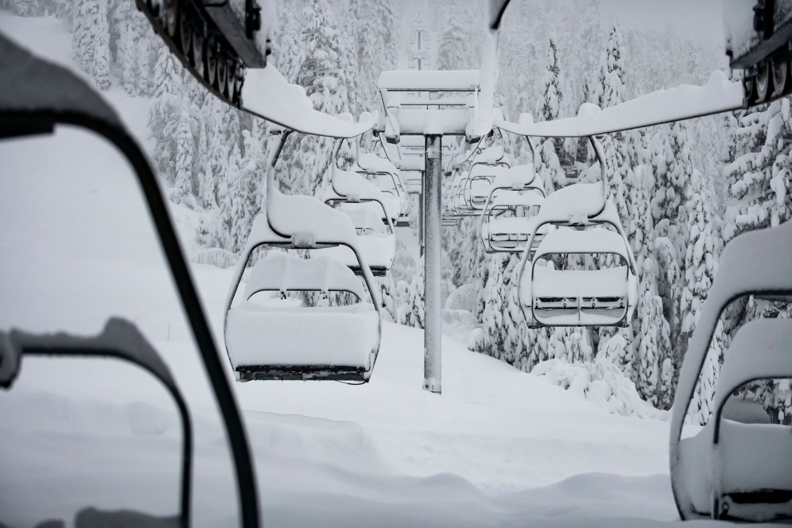
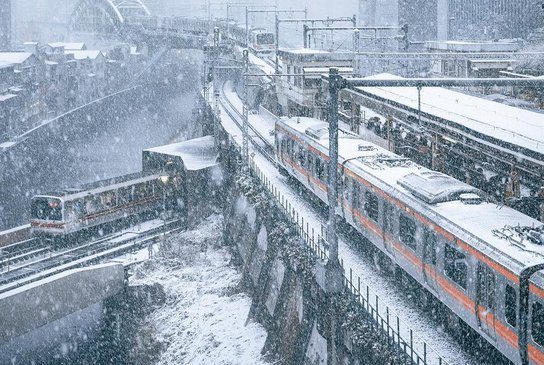
Transport disruptions and flight cancellations have arisen across all of East Asia, particularly in Japan where they’re measuring snow totals in the feet (7+ft in Sukayu):


BIG BLIZZARDS BATTER RUSSIA…

Shifting attention east, and to the Republic of Bashkortostan, also called Bashkiria –a republic of Russia located between the Volga and the Ural Mountains in Eastern Europe– a “mad blizzard” has descended, causing traffic chaos.

As collated in the Forces Of Nature video embedded below, footage shows multiple vehicles captured by the snow in Bashkiria, where a severe blizzard has left the region struggling to cope.

A number of rescue operations are underway, according to the regional department for emergency situations, including on a section of the M-5 highway which is clogged with buses, trucks and cars due to the inclement weather.

View: https://youtu.be/aH8pQV5WbrQ
Run time is 2:41

The story is a similar one in the far northeast of Russia, in the city Murmansk, near Finland, as this video from Is it close ? shows:

View: https://youtu.be/lezLlr-n1n0
Run time is 1:51

…AND NEPAL

Headed back to the southeast, heavy snowfall and sub-zero cold has swept the landlocked South Asian country of Nepal.

A recent report from Phungling in Taplejung stated that heavy snowfall (2+feet) in recent days, particularly at elevations of 3,400 metes (11,000 feet), has led to disruptions to “normal life” and a sharp drop in the mercury.

One local, Pema Sherpa, said that people have not been able to go outdoors due to the snowfall, and that children and the elderly people have been affected the most due to the freezing cold.

View: https://youtu.be/AoBbCDGDGkE
Run time is 0:20

13 FEET OF SNOW BURIES PARTS OF TURKEY

Turkey has been battered by intense snowfall and extreme frosts this month. Benchmarks have been falling, and people have been dying in the anomalous cold.

Particularly in eastern Turkey, and at elevations above 1,500 meters (4,900 feet), historic snowfall has managed to quite literally bury a number of locales, most notably in Muş province where persistent heavy snowfall has seen accumulations climb to more than 4 meters (13+ feet), according to local media reports.


Turkey snow

Adem Toprak, a worker who has been involved in snow-clearing operations, told Reuters he had a hard time believing the scale of the snow depth at first, and how the accumulation could be in meters.

“We live in the city center. They said that the snow depth was around four meters here, but we didn’t believe that. We came and saw that the snow depth here exceeded four meters,” he said.

Despite reopening roads, they would soon be blocked again because of the heavy snowfall, according to local officials.
“Since the first day of snowfall, we had to reopen the roads of approximately 185 villages in our city twice,” said Seyhmus Yentur, secretary-general of Mus Special Provincial Administration. “Our fight against snow continues uninterruptedly for 24 hours with 59 construction machineries and 90 personnel,” he added.

The cold has also been noteworthy.

Low temperatures in the valleys have been approaching -40C (-40F), which is astonishing given that the records for these regions rarely descend below -30C (-22F).

Göle, for example, aptly known as ‘The Siberia of Turkey’, is currently an ice box: “We are frozen, even the water in our homes is frozen,” said local man Aleaddin Kılıç, who noted the mercury had been regularly dipping to -30C (-22F) overnight, freezing fountains, and coating trees in a thick white frost.

Eastern Turkey has become somewhat accustomed to anomalous cold and snow this month.

As have parts of the West, as the below footage (from Dec 22), shot in Istanbul, reveals:

View: https://twitter.com/CaptainGhazi/status/1473609234403241987
Run time is 1:55

VANCOUVER SEES COLDEST TEMP SINCE 1969

After Canada’s first sub -50C in December since 1998, the polar cold has persisted and spread.

Vancouverites can usually count on relatively mild winter conditions, at least compared to typical Canadian chill — but not this month: According to The Weather Network, Vancouver, B.C. reached a low -15.3C (4.5F) on Dec 27, which they described as “a radical departure from seasonal norms,” and the coldest temperature that Vancouver has seen in the past 52 years, since 1969:

Vancouver record

The freezing weather can be credited to an Arctic outflow “funneling bitterly cold air down into southern B.C., which is then prevented from escaping”.

The fierce chill paired with Vancouver’s unusually snowy Christmas has made this a unique weather month, continues the article. But the uniqueness hasn’t just been confined to Vancouver; all of Western Canada has been holding exceptionally cold (and snowy) of late:


As has the Western U.S.:


And this extreme cold will continue dominating into the New Year, when it will then start spreading eastwards:


GFS 2m Temp Anomalies (C) Jan 1 – Jan 4 [tropicaltidbits.com].

The COLD TIMES are returning, the mid-latitudes are REFREEZING in line with historically low solar activity, cloud-nucleating Cosmic Rays, and a meridional jet stream flow (among many other forcings, including the impending release of the Beaufort Gyre).


Prepare accordingly — learn the facts, relocate if need be and grow your own.
 

TxGal

Day by day
This eruption is still blowing high enough to potentially impact weather; 12 km is over 39K feet. Up there on the VEI scale.

12km high ash cloud from Tongan volcanic eruption continues to spread -- Earth Changes -- Sott.net

12km high ash cloud from Tongan volcanic eruption continues to spread

RNZ
Wed, 29 Dec 2021 11:07 UTC

This picture taken on December 21, 2021 shows white gaseous clouds rising from the Hunga Ha'apai eruption seen from the Patangata coastline near Tongan capital Nuku'alofa.
© Mary Lyn Fonua
This picture taken on December 21, 2021 shows white gaseous clouds rising from the Hunga Ha'apai eruption seen from the Patangata coastline near Tongan capital Nuku'alofa.

The Hunga Tonga Hunga Ha'apai volcano continues to erupt intermittently, and ash has been detected in all directions up to 30km away.

The head of Tonga Geological Services, Taaniela Kula, said that the ash cloud had risen to heights of 12km and the direction of ash had varied with the wind conditions.

"On Tuesday, ash was drifting east but shifted directions last night to north east and has continued to drift in a northerly direction today," he said.

Overall, the amount of ash, steam and gas being spewed from the volcano has reduced, in comparison to last week, Kula said.

He noted that the volcano was about 60km away from uninhabited areas, and that no earthquakes had been detected on their seismometers.

View: https://youtu.be/TclWTkL-Wtg
Run time is 1:05

View: https://youtu.be/orBM7Nrp3b4
Run time is 0:53

This indicated that the magma chamber, which is feeding the eruption, is unlikely to be deeper than 7km below the ocean floor.

Currently the danger grade for the ash fall is orange, with red being the most severe. While no one has reported ash falling on houses yet, Kula advised that the public should take measures to protect their rainwater catchment and storage systems, should ash make landfall.

Kula said that people need to make sure they continue to sanitise and maintain their rainwater tanks, to stop the growth of a particular algae bloom that results from ash contamination.

Flight from NZ cancelled

Meanwhile, the flight from New Zealand that was scheduled to arrive on Tuesday was cancelled due the volcanic activity at Hunga Tonga Hunga Ha'apai.

Matangi Tonga online reports the flight was meant to bring in the funeral cortege of the late Lord Ma'afu.

Tonga's Deputy Prime Minister, Lord Ma'afu, died on 12 December at the Auckland City Hospital, New Zealand.

Air New Zealand's flight to Tonga on 21 December was also cancelled due to the same volcanic activity.
 

TxGal

Day by day
Adapt 2030 has a new podcast out. Seed catalogs are already in the mail, it might be a good time to get serious with home gardens:

Breakdown of Agriculture and Basic Services 2022-2024 - YouTube

Breakdown of Agriculture and Basic Services 2022-2024
12,528 views
Premiered 18 hours ago

View: https://youtu.be/0CJrwtt6IVs
Run time is 18:39

Synopsis provided:

Fertilizer shortages are slated to sweep the globe in 2022, which will reduce global crop output and spike prices as the highest bidder gets the grains. Same time organic yields are 25% less than chemical fertilizer, so can farmers switch? Sri Lanka is a perfect guide to allow us a glimpse into the future with basic services limited and supply capacity shrinking.
 

TxGal

Day by day
Wavy Jet Stream = Big Temp Contrast (-38F in MT, +87F in AL); Record Cold And Snow Hit Alaska; + Saskatchewan Breaks 16 Low Temp Records, Sets New Power Usage - Electroverse

snow-fairbanks-2-e1640947731116.jpg

Articles Extreme Weather GSM

WAVY JET STREAM = BIG TEMP CONTRAST (-38F IN MT, +87F IN AL); RECORD COLD AND SNOW HIT ALASKA; + SASKATCHEWAN BREAKS 16 LOW TEMP RECORDS, SETS NEW POWER USAGE
DECEMBER 31, 2021 CAP ALLON

WAVY JET STREAM = BIG TEMP CONTRAST

The global warming hypothesis can’t explain this one: The boundary of a buckling, meridional jet stream flow–brought about by historically low solar activity, is cutting right through the heart of America, causing anomalous heat on one side (+87F in Alabama) and a bone-chilling freeze on the other (-38F in Montana).

When solar activity is HIGH, the jet stream is tight and stable and follows somewhat of a straight path. But when solar activity is LOW, such as it is now, that meandering band of air flowing 6 miles above our heads becomes weak and wavy, it effectively buckles which diverts frigid Polar air to atypically low latitudes and replaces it with warmer tropical air.

The jet stream reverts from a Zonal Flow to a Meridional Flow and, depending on which side of the jet stream you’re on, you’re either in for a spell of unseasonably cold or hot weather and/or a period of unusually dry or wet conditions — it just so happens that boundary is currently cutting down the middle of the CONUS:


GFS 2m Temperature Anomalies (C) Jan 1 [tropicaltidbits.com]

This is the true mechanism behind the U.S.’s, and indeed the planet’s, growing temperature contrasts, rather than the benign increase of atmospheric CO2–with the latter gaining such traction in the MSM, I suspect, due to it being a key component of The Great Reset: the plot to reform society in the interest of the few, to ‘build back better’ for the elites.

Look to the lack of investment in fossil fuels over the past few decades, at how out of favor this crucial commodity has fallen; look at the shortages and record energy prices currently gripping every developed corner of the planet, hurting the purse strings of everyday families. Before you can ‘build back’ you need a collapse, and this is what’s being orchestrated now — it appears those on high intend for us to take each other out in the form of civil war–the best answer to which is to start getting along; to find common ground; to reject ideological groupthink; to realize that there is no Left vs Right, rather there are simple beings with complex emotions and crippling confusion, forever bumping into walls of depression in search of meaning.

Left vs Right is itself a construct — one which serves the system, not we the people.

Turning our attention back to the weather (ha!), in a further blow to the AGW Party, the anomalous cold looks set to prevail — low temperature records will be challenged across the CONUS, and indeed across Canada and Alaska, and even Mexico, too:


GFS 2m Temperature Anomalies (C) Jan 1 – Jan 16 [tropicaltidbits.com]

RECORD COLD AND SNOW HIT ALASKA

Alaska ‘Icemageddon’ warning”, is how the BBC puts its, so you know it must be bloody cold…
The BBC article begins with record warmth (the 19.4C (66.9F) logged on Kodiak island, Sunday: AGW hypothesis in tact), but as discussed above, AGW can’t in any way, shape, or form explain the historic cold gripping a much larger portion of the state.

In the south-eastern town of Ketchikan, for example, temperatures dropped to -18C (-0.4F) on December 25 & 26 — the town’s coldest Christmas period of the past century+, with the old records being the -14.4C (6F) in 1967, and the -15C (5F) from 1917.

The extreme freeze prompted warnings of an “Icemageddon” from authorities, continues the BBC article, as torrents of rain and snow have left ice as hard as cement coating the roads.

“Ice is extremely difficult to remove once it has binded to the road surface. Even though air temps were warm… roads were at sub-zero temps, which caused ice to bind to the surface,” tweeted the Alaska Department of Transportation and Public Facilities.

The ice is expected cling to the roads until at least March or April, said Climate Scientist Rick Thoman, of the Alaska Center for Climate Assessment and Policy.

View: https://twitter.com/AlaskaWx/status/1475989746757238788

The snow has been just as extreme as the cold.

The Fairbanks area has been hit by its fiercest mid-winter storm since 1937. So much fell on Sunday that it caved in the roof of the only grocery shop in the town of Delta Junction, 95 miles (153km) south-east of Fairbanks. While an observation site at Denali National Park has now registered 74.5 inches (1.9 meters) of snow this month, making it the snowiest December on record.

View: https://twitter.com/NWSFairbanks/status/1476284527412604931

These are scenarios Thoman is keen to put down to climate change: “When all the pieces come together in a warming world we’re going to get these unprecedented events, that’s what we expect,” he said.

However, and as discussed many times before, the establishment’s global warming hypothesis has been drastically altered over the years so as to fit observations due to it failing to predict them — but these extreme weather events we’re seeing, and particularly these dramatic swings between extremes, are due to less energy reaching the jet streams due to low solar activity, and not to man’s insignificant atmospheric CO2 contributions.

IPCC, 2001: “Milder winter temperatures will decrease heavy snowstorms…” was the original prophesy:

(Instagram post here I can't bring over, please see the article at the link)
Run time is 0:12

View: https://youtu.be/wIVdV7qdMiE
Run time is 0:54

SASKATCHEWAN BREAKS 16 LOW TEMP RECORDS, SETS NEW POWER USAGE

I’ve reported on British Columbia and Alberta in recent days, but the historic cold is no by no means confined to the east of Canada — the far east has seen record snow in recent days, and in Saskatchewan, record cold has prevailed.

Saskatchewan continues to grapple with frigid weather as 2021 draws to a close, leading to a host of records being broken across the province, reports thestarphoenix.com.

SaskPower says the province has broken its peak power record as homes and businesses used 3,868 megawatts to fight the freeze. The previous all-time record of 3,792 MW set four years ago to the day, on Dec 29, 2017 — and SaskPower says the new increase (of 76 MW) represents the electricity required to power some 76,000 homes.

Honing in on the records, some sixteen communities across Saskatchewan experienced record low temperatures on Tuesday alone. Furthermore, many of the busted benchmarks were truly historic, including Regina’s moose-hugging low of -38.6C (-37.5F), which beat out the all-time record of -37.2C (-35F) set in 1884(!); Swift Current’s -39.1C (-38.4F), which bested 1917’s -36.1C (-33F); and Leader’s crippling -42.6C (-44.7F), which smashed the previous record of -37.2C (-35F), set back in 1924.

Environment Canada have an extreme cold weather alert in place for much of the province, forecasting an extended period of dangerous temperatures; as a result, their meteorologists have urged people to take “extraordinary precautions“, while SaskPower have asked folks to be self-sufficient for at least 72 hours: with water, non-perishable food, a flashlights, a clock and radio, a first aid kit, blankets, and also a copy of Al Gore’s book “Our Choice” and Greta Thunberg’s “No One Is Too Small To Make A Difference”–you know, to burn…

The COLD TIMES are returning, the mid-latitudes are REFREEZING in line with historically low solar activity, cloud-nucleating Cosmic Rays, and a meridional jet stream flow (among many other forcings, including the impending release of the Beaufort Gyre).

Prepare accordingly — learn the facts, relocate if need be and grow your own.
 

TxGal

Day by day
Adapt 2030 has a new podcast out:

2022 Global Grain Supplies & Fertilizer Shortage Forecast - YouTube

2022 Global Grain Supplies & Fertilizer Shortage Forecast
2,964 views
Premiered 5 hours ago

View: https://youtu.be/VAIWLX24pXA
Run time is 12:23

Synopsis provided:

Fertilizer shortages are slated to sweep the globe in 2022, which will reduce global crop output and spike prices as the highest bidder gets the grains. Same time organic yields are 25% less than chemical fertilizer, so can farmers switch? Sri Lanka is a perfect guide to allow us a glimpse into the future with basic services limited and supply capacity shrinking.
 

TxGal

Day by day
Well, we had a high of 81 yesterday, which is nearly a record for the day and really too warm for January. This morning we're sitting at 22 (updating to 21, ugh), which is a bit on the cold side. All cattle troughs are frozen, I'll go out in a little while to start breaking them up. Fortunately the pond is warmer and no ice is evident.

I really hate winter.

Martinhouse, how are you doing up there? I'd think you're even colder.
 
Last edited:

TxGal

Day by day
The Oppenheimer Ranch Project has a new podcast out:

Significant Storm to Impact Central and Southern U.S. - Exceptional Drought Ending - Iceland Update - YouTube

Significant Storm to Impact Central and Southern U.S. - Exceptional Drought Ending - Iceland Update
5,636 views
Premiered 19 hours ago

View: https://youtu.be/k1wD3hG1dzs
Run time is 8:47

Synopsis provided:

Frigid air to maintain grip on Pacific Northwest to kick off the new year https://bit.ly/31gJTb7
Light freezing rain, significant snowfall ring in 2022 around Mid-Michigan https://bit.ly/31hopuL
Subzero temps expected to kick off the new year in Southwest Colorado https://bit.ly/3JJjdkK
Snowstorm could dump up to 9 inches of snow in area; Winter Storm Warning in effect until Sunday https://bit.ly/3pJlsfE
Georgia severe weather: Strong to severe storms possible Saturday into Sunday https://bit.ly/3eJFHnn
Significant Storm to Impact the Central and Southern U.S. https://www.weather.gov/
Map shows almost all of California out of ‘exceptional drought’ after week’s storms https://bit.ly/3EPedaq
Here is a video he took of the Superior / Louisville fires https://bit.ly/3mQ9Wxc
Worldwide Volcano News https://bit.ly/3y58XgJ
Magma on its way up the crust in Fagradalsfjall mountain https://icelandgeology.net/?p=9950
Reykjanes peninsula - earthquakes https://bit.ly/3rprWPn
 

Martinhouse

Deceased
TxGal, it looks like I'm a bit warmer than you are there. I woke up at 8:15 and the computer said 24 in my area. When I fed the cats a few minutes ago, both thermometers behind my house read 34 degrees. It must be really warmer in the entry to my back porch ...the water in the cats' bowl was not frozen... but seven or eight feet away, from it, out on the sidewalk, an oil=change pan full of rainwater was frozen with what looked like pretty thick ice.

When I call my sister later, I'll find out what her temp was around six AM when she usually gets up.

Tonight's supposed to be five degrees colder. overnight than last night was.
 

TxGal

Day by day
TxGal, it looks like I'm a bit warmer than you are there. I woke up at 8:15 and the computer said 24 in my area. When I fed the cats a few minutes ago, both thermometers behind my house read 34 degrees. It must be really warmer in the entry to my back porch ...the water in the cats' bowl was not frozen... but seven or eight feet away, from it, out on the sidewalk, an oil=change pan full of rainwater was frozen with what looked like pretty thick ice.

When I call my sister later, I'll find out what her temp was around six AM when she usually gets up.

Tonight's supposed to be five degrees colder. overnight than last night was.

I'm really glad for you! We can see ice coating the trees, truck and car, fence lines. We either had some wet precip or the humidity froze from yesterday's high temps, I have no idea. Wind is really, really kicking up. I still haven't gone out yet. I'd like to wait until it gets up to 32....but if not by 11 or so, I'll probably go out. I know the cows will come running when they see me, I just don't want them to hurt themselves on the slick ground. I'm sure they'd like some warm hay :-)

I really hate winter....
 

TxGal

Day by day
I just posted the below on Dennis' Weather thread:

We're at 25 now with full sun and windy. Interestingly, the sun has been shining for several hours now, and still we have an ice sheen on the trees, fencelines, etc. Our cattle troughs are still frozen, not a hint of a melt on top (and they're black).

Usually the sun is strong enough to have the fencelines and trees dripping as the ice melts off. Not happening yet. This is somewhat reminiscent of last February's 10-day nasty freeze here...we never got warm enough to start a melt. It's almost like the sun light just isn't strong enough, and this is Texas, for heaven's sake!
 

BenIan

Veteran Member
So. La. - took the puppy out at around 3 am. Still very humid & warm. Probably low 70s. Took her out again after sun was up. It’s probably upper 50s right now and drizzling. Supposed to be in the 30s by sunset and around 29 when we get up in the morning. I think the high yesterday was 81.
 

Martinhouse

Deceased
TxDal, my sis said she forgot to check her temp when she first got up. Her thermometer showed 28 when we were talking, so I expect her earlier temp was around 24 like mine was.

Tomorrow morning's going to be the awful one here! Then again Thursday night/Friday morning. Brrr!

I HATE WINTER!!!!!

But spring will come. Hopefully, by some time in May, at least, if the GSM is reasonably kind to us!
 

Martinhouse

Deceased
Updated forecast now says we will be getting down to 20 overnight here, and the same on Thursday night.

It is 27 outside now and it's 40 in my greenhouse, with no sun. So I think I won't lose anything in the greenhouse if it is 20 degrees outside tomorrow AM. I did put a sheet of the 1" Styrofoam insulation behind my big pots of impatiens, since the plants are huge and were leaning against the plastic of the west side of the greenhouse..

Last year we had one single-digit night and even the kale across the outer side of the greenhouse got a tiny bit nipped. I had covered everything with sheets or mattress pads but still lost my poinsettias and coleus. Don't want to let that happen this year!
 

TxGal

Day by day
We were supposed to be 26 overnight, but right now it's 21 and we had a very heavy frost. Not sure what our low was, I'd guess 20. We're forecasted to drop into the 20s overnight tonight, too.

Martinhouse, if we were that low, I'm guessing you're lower...hope not!

And I just read that upwards of 2500 people were without power in Bryan/College Station. Oh my....
 
Last edited:

TxGal

Day by day
Three new podcasts from the Oppenheimer Ranch Project, here's the first:

Minus 13 Ties The Record - Extreme Cold Sweeping The Nation - Welcome To 2022! - YouTube

Minus 13 Ties The Record - Extreme Cold Sweeping The Nation - Welcome To 2022!
2,833 views
Premiered 19 hours ago

View: https://youtu.be/Wm_MZhTJcK0
Run time is 4:06

Synopsis provided:

The record low for this date in Pagosa Springs is minus 13 back in 2011. We just hit that!
The Sun (solar cycles) drive climate not man! It's the Sun!
 

TxGal

Day by day
The second one from Oppenhemer:

First Snow Of Winter Is Coming To The US South & Mid-Atlantic - Kentucky Declares State Of Emergency - YouTube

First Snow Of Winter Is Coming To The US South & Mid-Atlantic - Kentucky Declares State Of Emergency
3,943 views
Premiered 17 hours ago

View: https://youtu.be/Smg3iuBE_Kc
Run time is 7:15

Synopsis provided:

The first snow of winter coming for parts of US South and Mid-Atlantic https://cnn.it/3zmrV3E
Kentucky state of emergency declared as powerful storms hit https://bit.ly/3EOljMv
Winter snow storm could slam parts of N.J. with 4-6 inches https://bit.ly/3mOMQr1
US SNOWFALL ANALYSIS https://www.weather.gov/crh/snowfall
GFS Model Total Snow US https://bit.ly/3HwZFya CMC
Model Southeast US https://bit.ly/3pOsG1W
Quick-Hitting Mid-Atlantic Winter Storm; Northwest Very Inclement https://www.weather.gov/
It rained fish over a Texas town this week in a bizarre weather event https://cnn.it/3mPnLw0
 

TxGal

Day by day
The third new one from Oppenheimer:

Cosmic Patterns And Cycles Of Catastrophe- The Cosmic Clock Cycle - The Yuga - Precession - Rocks - YouTube

Cosmic Patterns And Cycles Of Catastrophe- The Cosmic Clock Cycle - The Yuga - Precession - Rocks
3,597 views
Premiered 9 hours ago


View: https://youtu.be/s3E4y6Mbq-Y
Run time is 15:03

Synopsis provided:

For decades many scientists have been trying to put the pieces together about ice-age cycles and evolution. Tonight we discuss the current findings and what we can glean from the data. The Role of Geomagnetic Field Intensity in Late Quaternary Evolution of Humans and Large Mammals https://agupubs.onlinelibrary.wiley.c...
Cosmic Clock Cycle https://bit.ly/3EHAAi4
Ice Age Temperature Graph https://bit.ly/3qIwd1d
Earths Magnetic Field Strength vs Time http://bit.ly/39nqgxo
Reality Check with Jay Weidner
https://www.youtube.com/c/REALiTYCHeC...
 

TxGal

Day by day
Record December Snow: Sierra Snow Lab Logs 214 inches, Yosemite Registers 171 Inches; More Extreme Cold Engulfs Canada And The U.S.; + Scandinavia Set For -49F As Arctic Air Returns To Europe - Electroverse

Scan-49F-e1641208162781.png

Extreme Weather GSM

RECORD DECEMBER SNOW: SIERRA SNOW LAB LOGS 214 INCHES, YOSEMITE REGISTERS 171 INCHES; MORE EXTREME COLD ENGULFS CANADA AND THE U.S.; + SCANDINAVIA SET FOR -49F AS ARCTIC AIR RETURNS TO EUROPE
JANUARY 3, 2022 CAP ALLON

RECORD DECEMBER SNOW: SIERRA SNOW LAB LOGS 214 INCHES, YOSEMITE REGISTERS 171 INCHES

Record-busting December snow settled in California.

The UC Berkeley Central Sierra Snow Lab logged one last inch late on Dec 31, taking December 2021’s total to 214 inches (5.44m).

The highest ever recorded.

View: https://twitter.com/UCB_CSSL/status/1477323959179702272

Historic totals were also registered at central California’s Yosemite National Park.

171 inches (4.43m) of snow was reported at Tuolumne Meadows, smashing the area’s previous all-time record of 143 inches (3.63m) set back in 1996 (solar minimum of cycle 22).

View: https://twitter.com/GRobert1963/status/1477565263000354819

A myriad of benchmarks were also broken at nearby Lake Tahoe.

Here, some 5 ski resorts have already picked up more snow than all of last season:

Image

MORE EXTREME COLD ENGULFS CANADA…

Following the breathtakingly-cold temperatures which hit last week, Environment Canada is advising Western residents, particularly those in B.C., to prepare for yet more “extreme cold” due to return Jan 3.

The weather office says wind chill values of -45C (-49F) will persist until the end of the week.

Snowstorms are also expected to continue — Highway 3 from Paulson Summit to Kootenay Pass is forecasted 60 cm (23.6 inches) of snow on Monday; Fraser Canyon, including Lytton, are on for as much as 50 cm (19.7 inches) of global warming goodness; with the Coquihalla Highway between Hope and Merritt set to see up to 30 cm (11.8 inches).

Environment Canada has issued a number of warnings, adding that prolonged periods of very cold wind are also expected in the Fort Nelson area, with wind chill values of -45C (-49F) continuing through the end of next week.


GFS 2m Temperature Anomalies (C) — “swing between extremes” [tropicaltidbits.com]

…AND THE U.S.

A bitterly cold Arctic airmass, responsible for driving the mercury as low as -41F in Montana, has now descended all the way south to the Gulf of Mexico.

This has resulted in a stark shift of gears for those in around Falcon Lake, TX -for example- as the locale plunged from 99F to 37F in a little over 24 hours–a reality serving as further evidence of the historically low solar activity we’ve been receiving in recent years:

The Sun appears to be slipping into its next Grand Solar Minimum cycle–a multidecadal spell of reduced solar output where the solar disc can be devoid of sunspots for months or even years at a time. The result on Earth’s climate will be one of violent swings between extremes: Intense bursts of heat will linger in one area while a teeth-chattering chill will dominate nearby, and then the regions will ‘switch’ — it is this unpredictable chopping and changing that will hasten the failure of our modern food production systems — crops will fail, on a large scale, and famine will quickly ensue. And it’s all tied to less energy entering the jet streams.

For more, see:


SCANDINAVIA SET FOR -49F AS ARCTIC AIR RETURNS TO EUROPE

Europe has been a prime example of extreme temperature flip-flopping during these past few weeks:

Back in the fall, parts of the continent were suffering their coldest-ever readings for the time of year, and rare November snow was hitting the UK, disrupting football matches. Then, a mass of mild air –dragged up from Africa– dominated over the Christmas and New Year period, breaking records in some nations. But now, that anomlaous holiday season warmth is about to be chased by another historic freeze.

During the first two weeks of December, extremely cold air tanked thermometers across Sweden to well-below -35C (-31F). An astonishing –43.8C was registered in the municipality of Naimakka on Dec 6 — a new all-time December low for not only Sweden, but for Scandinavia as a whole; while a number of other locales also busted Dec lows, including in Karesuando with its -41.9C (-43.4F) on Dec 7 and then its -42C (-43.6F) just a day later, on Dec 8. The only previous occasions when the municipality of Karesuando saw December lows south of -40C (-40F) was back in 1885, 1898, 1915, 1919, 1969, and 1986.

And now, hot on the heels of that Christmas warm-up, Scandinavia’s sub-40C lows from December look set to be surpassed.

Eyeing the latest forecasts, northern Sweden, as well as neighboring Norway and northern Finland, should brace for extreme winter conditions by the end of this week as Arctic air is set to engulf the region, bringing lows of -40C to -45C (-40F to -49F).

The freeze is predicted to drop south, too — to the Baltic nation of Estonia, where -20C (-4F) is expected.

Shifting west, Iceland could drive as low as -30C (-22F).

While Scotland is on -12C (10.4F), and heavy snow.

And finally, and looking more central, lows of Europe -15C (5F) and beyond are on the cards for continental Europe before too long, even at elevations of well-below 1,000 meters (3,280 ft) — lows of -20C (-4F) aren’t being ruled out (though this forecast is less certain, as it is becoming harder and harder to predict the increasingly erratic nature of the meridional jet stream flow).

If alarmists want to claim Europe’s mild Christmas as evidence of the “climate crisis”, then they also need to address the bouts of historic cold sandwiching it, and, crucially, the climatic mechanisms/forcings behind them…


ELSEWHERE

Rare snow blanketed parts of Saudi Arabia’s north-western city of Tabuk on New Year’s Day.

Snow continued falling on Jebel Al Lawz, as well as the mountain areas of Al Dhahr and Alqan, on Sunday, as temperatures held around the freezing mark.

View: https://youtu.be/oTvEsqE6_ZU
Run time is 1:14

View: https://twitter.com/wolvestravelers/status/1477261324220567554

Saudi snow
has become a more common sight in recent years, with 2020 and 2018 also bringing substantial totals.

While in Afghanistan, a much needed cool-down, bringing with it widespread snow, has been reported here, too.

According to local reports, at the end of December, snow covered more than half of the country — this is good news for the next growing season (with much of this water now locked-up in the mountains until spring), and it’s also positive for the Northern Hemisphere Total Snow Mass chart, which (as of Jan 1, the latest datapoint) is holding some 300 Gigatons above the 1982-2012 average:


[FMI]

The COLD TIMES are returning, the mid-latitudes are REFREEZING in line with historically low solar activity, cloud-nucleating Cosmic Rays, and a meridional jet stream flow (among many other forcings, including the impending release of the Beaufort Gyre).

Prepare accordingly — learn the facts, relocate if need be and grow your own.
 

Martinhouse

Deceased
TxGal, I do't know what the temp was earlier, as I just woke up at 8:30 this morning, but computer says it's now 25 and outside the back door, where I feed the cats, it's 23. I imagine it was colder around 6:00 or 7:00 but not by much as it's 39 in my greenhouse, which is only one degree cooler than it wwas yesterday morning.

It's only 52 in my kitchen, colder than yesterday, probably because it was cloudy all day yesterday and the house and greenhouse don't get to build up any extra heat.

The next three nights should be a little better, but it's supposed to get real cold aain Thursday night. Thank goodness the rest of the forecast shows sunny days

I HATE WINTER!!!!!

EDIT - Oops! I typed this an hour ago or more, and then forgot to post it.
 
Top