Story Aunt Gus & Little Bear's Great Adventure Book 1 (Complete)

Kathy in FL

Administrator
_______________
Aug 3 – 4: Lake Roosevelt National Recreation Area & Coulee Dam, Washington


Weather: 102F/67F

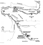
Driving Route:
Picture1.png

August 3rd – Lake Roosevelt
Drove way too long again today – nearly eight hours with stopping to go just over four hundred miles. Don’t get me wrong, it was an interesting and scenic drive most of the way but it was still too long. Sure we “gained” an hour, but when your butt is dragging from long distances and ouches-gained-in-the-line-of-duty that doesn’t particularly matter. And my knees were pinging like crazy. Still are, but a couple of acetaminophens have knocked it back down to tolerable level at the moment. Hitting my right knee once was all it took. I pulled over for fuel – and a “not red slushie please” – and pulled out the largest Band-Aids I had and after smearing them with antibiotic cream, spraying my knees with Bactine, and doing my best not to curse in front of Benny after hitting my elbow that wasn’t feeling all that grand either, I used the Band-Aids as protectors then slid my trusty knee pads on. Dang but I wish I’d had those things yesterday.
Picture2.jpg
With the hour we “saved” it was barely one o’clock when we pulled into our camp for the next two nights; Coulee Playland just outside Coulee Dam in the Lake Roosevelt National Rec Area. Nice place. Nice staff. Nice people all around. The place was crowded but everyone was out to have a good time and get out of the heat. And believe me there was some heat. Today’s high was 102F.

Between the heat and my knees, I knew for a fact that I needed to take the remainder of the day easy. I told Benny I was going to use my commonsense but that didn’t mean we weren’t going to have fun. Also, even though the rec area didn’t have a junior ranger program, I was going to see if there was a patch in visitor center that he could have at the end of our stay if he learned some new stuff. Well color me surprised. The rec area had just revamped their Junior Ranger materials and Benny was going to be one of the first kids to try them out. Let me tell you he was thrilled … and so were the rec area personnel.

“I could not believe that they didn’t realize who you were!” A skinny, freckle-faced volunteer gushed, referencing yesterday’s incident.

“Uh, take it easy. You’re going to hurt something if you don’t.”

She laughed like it was the funniest thing she’d heard all summer. Geez. Her friend looked at me apologetically and explained, “She has celiac. And allergies to other things out the ying-yang. She says she could have used an Aunt Gus when she was growing up.”

I turned and saw the gal … about my age I guess … was looking at me with adoration. That was a bit too much and making me feel like yakking. I got her to let me climb down off the pedestal and reminded her she went through what she did as a kid so that she could be someone’s Aunt Gus now … or in her case Aunt Kirsten. That thrilled her to death, and she admitted it was why she was so into the children’s programs at the parks.

Finally managed to get loose without hurting her feelings by telling her we didn’t want to take up all of her time with other kids and thanks for being so nice. Bleck. I hate schmoozing people and hate schmoozing nice people even more but I needed out of there because her “nice” was beginning to rub up against my issues and make me uncomfortable enough I was going to wind up with foot-in-mouth issues. I got Benny and I heading for the Bunchgrass Prairie Nature Trail to get my knees loosened up.

“What was she being so weird?” he asked, letting me know that I hadn’t been the only one reading to get out of there.

“Because sometimes nice people don’t know how to tone it down. They just sometimes get on a roll and the rest of us get steamrolled.”

“I was feeling pretty flat. Like a pancake,” he said while making a face.

“Know the feeling. Let’s just try and not steamroll them right back. The world needs all the nice people it can get. It would be awful for us to turn a nice person into one that wasn’t so nice. Someone else might need them.”

He sighed. “Girls are weird.”

I laughed. “Yes. Yes we are. When I park, don’t let me forget to bring the water. The trail isn’t long but …”

“… better safe than sorry.”

“That’s my smart Little Bear.”

I’ve got the start of an idea. I’m going to teach Benny survival skills. Real life ones. I just need to figure out how to do it at the kid level. And the ones that work with him, I’ll post to the blog. It is going to take me a some thinking time to set this up but I’m pretty sure I can pull it off. If I could train some of the knuckleheads in high school this shouldn’t be much different.

The Bunchgrass Nature Trail was only a quarter-mile trail that started on the west side of the Spring Canyon Campground. While normally covered in wildflowers and the like, the heat had all but the hardiest of the cacti completely wilted down to ground level. Not even any lizards were in sight. At the end of the trail I can’t say my knees felt better, but they didn’t feel worse so it was on to the next hike.

Mission Point Trail was a one-mile, very easy trail from the Kettle Falls Campground at St. Paul’s Mission, that combines history and nature. There were sign-thingies that explained the history of the falls, the mission, and the Hudson Bay Company’s influence on the area. The view of the river, as well as the abundance of plants along the trail, made the ouches I endured worth it.

“Benny? Aunt Gus … er …”

“You need to rest your knees?”

“Sorry to say that I do. Sorry Little Bear.”

“I’m not. Your knees are ugly and I bet they hurt.”

“Well, maybe not hurt exactly but they’re getting really sore and I need to use my head and let them heal up a bit more before a full hike. How about we go back to camp and take the kayak out?”

“Can we? But your knees will get wet. There could be nasties in the water.”

“I’m not going to go swimming. I’ll put waterproof bandages on and then put my neoprene pants on. How does that sound?”

He gave it a thought reminding me of a curious chick and then nodded before asking, “What about your elbow?”

“It’s just bruised. My funny bone didn’t think the rock it clipped was funny at all.”

He gave me a look my answer deserved but let it go. I know it sounds like I was letting him boss me around, but the truth is I was just trying to help him feel he had some control or could exercise a say so. This helped him to control his fears. I’d woken to find him in bed with me with the crew lined up on the edge of his bed like they were watching over us both. It had taken him some time to arrange them and then sneak in bed without me waking up. I have no idea how much sleep he’d gotten so I planned on an early night for both of us.

We made it back to camp – no traffic jams despite the number of people on the roads – and took the kayak out. Paddling felt good though my muscles were sore. We only spent two hours on the water and we were both ready to head back to camp to enjoy the nice site we have.

I didn’t feel like cooking but didn’t want to pay for take-out. I had a couple of beef hot dogs left and cooked them in the solar cooker. It didn’t take long and the corn cobettes were finished at nearly the same time. I wasn’t hungry but I knew I needed to eat if I didn’t want the pain relievers I’ve been taking to upset my stomach.

Thankfully our site had electric even if it didn’t have water. I thought about taking a hot shower but was only able to shower off near the dock as the regular showers had a long line of people waiting to use them. A couple of women with kids saw me rinsing down Benny and decided to do the same. We laughed together and it felt good. I know I’m not Benny’s mother but I’m also starting to be okay when people assume that I am. So long as Benny isn’t upset by it, I’m not going to make a big deal out of correcting people. I will never take Penny’s place, but I don’t mind having my own.
 

Kathy in FL

Administrator
_______________
August 4th – Grand Coulee Dam

Another hot day but cool enough that I had to wake up in the middle of the night and turn the vent fan off. I wasn’t expecting that but at least it gave me a reason to wake up and take a couple Advils, trying to see which painkillers worked best. To be honest I couldn’t tell the difference so I am sticking with acetaminophen since it is what upsets my stomach the least.

Good grief it was hard to get up and moving this morning. Benny watched me climbing down from the platform bed and said, “I think you need another day off from hiking Aunt Gus.”

I sighed. “I hadn’t planned on this.”

“It was an accident. We can just play here. The crew doesn’t mind,” he said sounding way too mature for his age.

I looked over and grinned. “You are a stinker winker, but if you aren’t upset, I think I’ll take you up on your offer. But I’ve got another idea. How about we go check out the dam? The visitor center is supposed to be cool.”

He blinked in surprise. “We can really go look at the dam?”

“Yeppers. Let me get us some breakfast and we’ll do that very thing.”

I managed a passable omelet stuffed with cheese, diced ham, diced bacon, and a few onions. I also managed to toast a couple pieces of gluten free bread without burning them, though it was a near thing. A short glass of milk and a shared can of OJ and we were on our way.

The dam and surrounding towns are in what is considered the northeastern tip of central Washington’s semi-arid desert. The Grand Coulee Dam Visitor Center was a lot more than I expected. It was built in the late 1970s as part of the dam’s power plant expansion and was designed to resemble a generator rotor. To bump its celebrity up a notch, an evening laser light show was added all the way back in 1989. The nightly Laser Light Show seasonally offers more history told in a giant way on the face of the dam.

In 2004 the center was retrofitted for seismic, life-safety, and accessibility standards. In the words of our guide, it isn’t earthquake proof but is as earthquake resistant as is currently possible. The visitor center has been further renovated several times since then.

Grand Coulee Dam was the key to the development of power on the Columbia River — the greatest potential source of hydroelectric energy in the United States, or so says the sign thingies I helped Benny to read. Grand Coulee Dam forms Lake Roosevelt, extending 151 miles upstream to the Canadian border. It has a 600-mile shoreline and a surface area of 82,000 acres.

Another sign-thingie read: The dam provides water to irrigate approximately 600,000 acres in the Columbia Basin Project. In addition to its irrigation and power functions, Grand Coulee Dam is a primary factor in controlling the floods on the Columbia River. That is a lot of freakin’ water.

Putting that description in perspective, Grand Coulee Dam dwarfs the Great Pyramids of Egypt and generates more power than a million locomotives, making it currently the country’s largest hydroelectric project. It also makes it one of the largest concrete structures in the world, containing almost 12 million cubic yards of concrete. It towers 550 feet above bedrock (as high as the Washington Monument) and is 500 feet wide at the base. There is enough concrete in the dam to build two standard six-foot wide sidewalks around the world at the equator.

Or as Benny put it, “Whoa. That’s crazy big Aunt Gus.”

After the visitor center we managed to get slots on the shuttle bus that takes people to the pumping plant where they get to see the gigantic pumps that lift water from Lake Roosevelt to be delivered throughout the Columbia Basin Irrigation Project. The shuttle bus then took us across the top of Grand Coulee Dam for crazy cool views of Lake Roosevelt and the Columbia River.

One of the questions in Benny’s Junior Ranger booklet was what was a “coulee”? Personally I had no idea and had been wondering the same thing. We found out it is a geological term which means a ravine or deep gully, usually dry, which has been cut by water. The Grand Coulee of eastern Washington was formed over millennia by the eruption of lava which solidified and was later swept away by massive Ice Age floods. It is these successive floods that carved and shaped the coulees and other landforms that are so prominent throughout the area.

Fun factoid: The only natural forest in Grant County is located in a canyon of the coulee. Called Northrup Canyon, it is located across the highway from Steamboat Rock State Park, a Washington state park within easy driving distance of our campground, and is open to hikers. And I almost caved to my personal desires until I wracked my blasted knee again. It took everything I had not to sound off like a sailor.

And who should spot me looking like an idiot? Kirsten the Really Super Nice Person. But I gotta admit she surprised me.

“Er … sorry about the gushing earlier,” she said with a deprecating chuckle. “I didn’t meant to go all Aunt Gus Gleek. Um … you okay?”

“I would if I could stop doing the stupid and hitting my knees on stuff,” I told her with my own chuckle.

“Tell me you are taking it easy.”

Benny Big Mouth answered for me. “Aunt Gus is using commonsense and giving her ouches a break today.”

Kirsten smiled and said, “And that makes her a very smart Aunt Gus.” Turning back to me she asked, “If you aren’t doing anything in particular, we’re about to start a Junior Ranger fun camp. It can last as long as two hours. The kids rotate through stations, but they aren’t required to stay for all of them. The parents normally sit on the benches and take advantage of the free wifi.”

I looked at Benny, and the boy who had just been telling me he was starving to death was giving me the most gawd awful puppy dog eyes. I looked at him and slowly grinned and then he did that Snoopy dance of his.

“Okay, that’s enough of that. What are the rules?”

“I have to use manners, my indoor voice, and at least try even if I don’t get it all right.”

“Good deal.” I made a funny face and gave him a look that said I’d be watching. He laughed. He knew I didn’t mean I didn’t trust him to behave. It was to let him know I wouldn’t be far and he could come to me if he needed to.

The hour passed quickly. I spent the time working on my idea for Benny but mostly I spent the time being relieved and watching Benny interact with other kids successfully. There were a couple of kids that were too rambunctious for the setting but they only stayed for one activity before leaving with their adults. Benny wasn’t the only one relieved, and it wasn’t just kids. I really do think that Benny will be okay if I have to put him in school so long as it is in a small group setting.

There was boy about Benny’s age that had Downs who was struggling to participate because of some of the “energetic” kids. He and Benny stuck together and teamed up to finish some of the activities designed for old kids. The boy was actually a better reader than Benny is on some days but his coordination was a problem. The boy’s name was Adelio and with him leading, they became buddies and finished all the stations before time was up.

“Did you have fun?” I asked as we headed to the van.

“I did. Even with those big kids making too much noise and knocking things over.”

“Good. You reading to eat?”

“I’m staaarrrrvvvving.”

“You’re always starving,” I said with a laugh.

I was tired. Still am. So we just went back to camp and enjoyed some free time. Or enjoyed it after I fixed a bunch of finger foods since I really wasn’t feeling the love – or clean up – of pulling much else out. Cheese, sausage, gluten-free pretzels, jell-o with fruit mixed in (at least I was trying for healthy), ants on a log (celery with peanut butter and raisins), and frito corn chips with some salsa. Hey, it covered the major healthy food groups … veggies, fruits, meats, and dairy. Fine. It wasn’t the best dinner on record but better than nothing. I even had us finish off the milk so I could make fresh for tomorrow.

I was sitting in the camp chair trying not to snooze while Benny was goofing around playing with his discovery toys when I heard a rumble and noticed the plastic table cloth on the picnic table in the next site over was blowing pretty good. I forced myself to stand up, move from beneath the awning, and look at the sky. I sniffed the air and Benny asked, “Is it gonna rain?”

“If it doesn’t it is making noise like it wants to. I’m going to roll the awning away to keep the wind out of it. You can keep playing out here unless it starts … “ There was a crack. “… lightning.”

Benny knew the drill and gathered up his toys and got in the van. Rain hasn’t really affected us too badly on our Adventure, and I know this area of the country is really needing rain, so I decided not to get hacked off. I grabbed stuff off the table I hadn’t put away yet after the awning was secured and got inside as well.

I was going to try and catch up with recording the mileage and all the rest, but the rain is still falling and it is putting me to sleep. Time to hit the hay. I have at least six hours of driving tomorrow. It gets us where we are going, but man is it tiring. I don’t know how Dad did it day in and day out like he did.

Resources:
Park Map: LAROmap1 (nps.gov)
Grand Coulee Dam: Grand Coulee Dam | Bureau of Reclamation
https://www.nps.gov/laro/planyourvisit/upload/LARO-Mini-Jr-Ranger-Packet-2020.pdf
 

Kathy in FL

Administrator
_______________
Aug 5 – 7: North Cascades National Park, Washington (Part 1)

Weather: 89F/59F
Driving Route:
Picture1.png
August 5th – Newhalem

I feel like I need to be singing that old Willie Nelson song “On the Road Again.” Dad used to sing it every time he left for a long-haul trip. Now I really know how he must have felt. I’m not sure if I could make this our way of life or not. It is still under consideration, especially now that the blog income has stabilized at about $600 to $700 per month not including bonus dollars that come in dribs and drabs (silly ladder vid which is still paying dividends, cash at Glacier NP, etc.). Most of that is from affiliate links, but I still get a nice bit of change from the ladder people because I use it for everything, from getting the Kayak up and down off of the van to that time I had to lean it again the tree so the bear cub could climb down and Momma Bear would stop hanging around the camp having a snit fit. They also liked the one where you could see it leaning against the van while we laid on the top of the van looking at the stars. Six hundred a month is not enough to cover us when we find a place to park for longer duration but by then I will hopefully figure out what I want to do long term as a career.

Being a nomad sounds fun on the surface, but I suspect we’ll do better someplace we can put down roots at least part of the year. Where that might be I don’t know. I had a feeling that Key West was permanently in the rearview mirror when we left, and now that Groucho and Stella are settling in nicely in Lake City it is definitely not something I’m likely to want to go back to. Jacksonville? Maybe. Especially if I decide to get a bachelor’s or master’s instead of just my Associates degree. But I’m not sure that is going to happen either because of money. I don’t want to take out student loans, but I don’t want to use all the estate for it either. And I still have no idea what I want to do long term, I just know housekeeping or waitressing isn’t what I want, though if that is what it takes to put food on the table my pride won’t get in the way. I’ll do whatever I have to do for Benny.

We’ve arrived in Washington State and we’ll be here and in Oregon for the remaining three quarters of the month. Then we’ll be in California until about mid-September before turning and heading east. That’s going to be a lot of miles to cover. There are some concerns I’m going to need to address as well. I’m going to have deal with Seattle three times, but we won’t be staying there at all. I’m going to need to do another major grocery run coming up here soon but I’m going to try and make it happen someplace besides Seattle.

The seasonal rioting has picked back up and become more violent again although after they tried to get that semi to jack knife and so many of them (those that didn’t die) got sent to jail because of all those other people in those passenger cars got maimed during the same incident they don’t riot on the interstate system so much anymore. And after the federal courts said that people can take those organizations to court for what their members do that has also started to change things. It is bringing to light how much money is being funneled through organizations that are supposedly 501C(3)’s. And they are now having to be specific where the money is going and even their members are shocked that it is getting funneled into a lot of people’s personal pockets, and not just as professional protestors.

Portland I only have to go through once. People tell me it used to be a nice place to live. There’s now so many no-go zones that getting through there is going to be like threading a needle that has a crooked eye. The same will be true when I have to skirt Los Angeles, but I’m more worried about the gang violence there. I definitely won’t be traveling at night through those locations that’s for sure. I’ll likely bring the kayak inside the van when I’m going through those cities. Inconvenient, but it might be for the best.

But enough of the depressing adulting I’m going to have to spend energy on. North Cascades National Park is beautiful despite what they are calling a momentary spike in temperature. It was 89F degrees for today’s high and is making the drought in this area of the country more difficult. We spent the rest of the day after arriving in the Newhalem area and working on Benny’s Junior Ranger booklet.
Picture2.jpg
One of our first stops was the Sterling Munro Viewpoint. In addition to the viewpoint, it has an accessible 330-foot boardwalk. It offers excellent views of the Picket Range up the Goodell Creek drainage. The trail begins from outside the northwest corner of the North Cascades Visitor Center, another quick stop where we picked up the Junior Ranger materials for Benny.

From there we hit the River Loop Trail. It was nice to be out of the van and enjoying the fresh air and scenery. It was a 1.8-mile loop that also began from a corner of the North Cascades Visitor Center, this one the Northeast. The trail led through a variety of forest growths to a peaceful gravel bar with wide river views. This trail gives access to loops A & B in Newhalem Creek Campground and the amphitheater. I sorta wish we were in that campground tonight but the one I was able to reserve is nice also.

Another trail that led from Newhalem campground is the Rock Shelter Trail. The path is wheelchair accessible; 1000 ft long with easy grades. While on the trail we got to view a 1,400 year old hunting camp sheltered by a large boulder alongside Newhalem Creek. There was also a short spur trail that led us to an old growth cedar glade.

All we did was short trails today, most of them less than a mile long. I would have preferred a couple of longer trails but we covered more ground this way. My knees are almost completely back to normal. I mean they are still ugly and I have to keep them bandaged, but they feel mostly normal. I’m happy about that for a fact.
Picture3.jpg
"Trail of the Cedars" Nature Walk began at the suspension bridge in Newhalem. It was an easy 0.3-mile gravel loop that meandered along the banks of the Skagit River through stands of old growth forest. From there, the short loop took us through an interesting mix of cedar trees including scorched trees that have remained standing from a fire way back in 1922. On the back half of the trail sits the Newhalem power station building, which is neat. We ended the hike by soaking our feet under the bridge while enjoying the aquamarine currents as they go rolling by. It was a short trail, but it's definitely worth a stop!
Picture4.jpg
Ladder Creek Falls was our next stop. It is located behind the Gorge Powerhouse in Upper Newhalem. The 0.4-mile loop trail showcases the power of nature. It leads to the falls through manicured gardens that have been enjoyed by visitors to the Skagit Hydroelectric Project for over 75 years. We crossed the foot suspension bridge to the powerhouse and followed the signs. There were some steep steps, but they had handrails. The falls are illuminated by a nightly lightshow running from dusk to midnight all year long. The trail was built to celebrate the construction of the powerhouse. Since its construction, the falls have shrunk considerable but are still beautiful.

From there I deemed it best we headed to camp which was in the Colonial Creek South Campground, a remote, but busy campground in an old growth forest. No services. No wifi. No cell signal. Not even the booster could pick up a signal strong enough to do anything with. I had warned people yesterday that might be the case and in all honesty, I don’t have a problem with connectivity being out of range for a few days. That means I get to skip some of the adulting chores that were becoming a real chore.

Dinner was a little later than I wanted and I had to cook it on the Bio-Lite because there were no electric hook ups (poor, poor pitiful me). I had also wanted to get the permit for taking the kayak out, but the ranger station was closed by the time we pulled into the campground. On the plus side our camp was just a row up from the walk-in sites and I could take the kayak straight down to the water. On the negative/positive the site was so tree covered that the solar wouldn’t charge so I have to remind myself to make sure that it does it while we are out during the day.

Benny and I are going to get a little extra sleep tonight. We both need it. And the hamster seems comatose for once. Better take advantage of it while I can.
 

Kathy in FL

Administrator
_______________
Aug 5 – 7: North Cascades National Park, Washington (Part 2_

August 6th – Mile Posts and Hiking

People are still complaining that the weather is too warm. I don’t know, Benny and I are enjoying it. Not to mention it was only a balmy 78F. People are crazy if they think this is hot. And the humidity is normal-ish to us and everyone else is acting like a limp biscuit. Better than being cold, that’s for sure. That said, I am glad that I have been keeping our water tank and extra water containers topped often as much as possible. You never realize how much water you go through in a day until you are restricted from replacing what you use. Good thing that I wash dishes the way I learned to for a sailboat. It is all about water conservation. I snuck that in as a lesson for Benny. It is amazing what he knows but I want him to know why he knows things as well, not just it is the way that Aunt Gus told him to do it.
Picture5.jpg
First meal of the day was breakfast burritos. I used sheets of aluminum foil as our “plates” so I didn’t have to do dishes except for the skillet and spatula. I also kept the cook space wiped down as I went. Used to be this stuff was just out of habit, one instilled in me by Grandma Barry. My OCD plays a part in that as well I suppose. But lately I’ve been trying to teach Benny things for just in case. And I’m having to figure out how to verbalize why we do the things the way we do them. When you are trying to explain it to someone, especially a kid, you can’t just say “because” and have it stick as a lifetime habit. Even, or maybe especially, little kids need a reason why.

It takes longer to think about it and talk about it that it did to do and as soon as breakfast was cleaned up and our lunch was prepped when head to the first and what I thought would be the shortest of the day’s trails.
Picture6.jpg
Happy Creek Forest Walk was at Mile Post 134. It was a little confusing because it was also called “nature trail” in a couple of places. It might have been asking too much to make sure that all of the signs called it the same thing but that’s just my one complaint for the day that I’m allowing myself. Benny thinks it is hilarious making a game out of “seeing the Brightside” or “finding a silver lining.” There was one woman that was really having a go at a ranger because there were enough parking spaces near a trailhead. I mean she was “angry with her whole face” as Dad would have said. Benny and I were really getting into “not complaining” but we were both having a hard time finding something nice to say about the situation. I was about to pull a Grandma Barry and recite, “If you can’t say anything good then say nothing at all.”

But Benny was concentrating so hard that I decided to give it a moment. Then he smiles and said, “She had nice teeth. I mean you could really see them good when she was growling and spitting and stuff. They were almost white like teeth are supposed to be.”

Oh, I nearly lost it right there. And these two guys that were riding motorcycles must have overheard our game because I thought they were going to fall out too. Sometimes I am very grateful for our “issues” because it makes us more human than some people want to act.

The forest walk or nature trail, whatever they wanted to call it, was billed as a .03-mile loop. But then I found out at the trailhead there was an optional 2-mile roundtrip spur to a waterfall. I decided why not and that is the trek we took.

At the trailhead was a very informative sign-thingie that described the history of the area and had a map of the trail. The first part of the trail was an ADA compliant loop through the old growth forest of 0.3 miles mostly on well-kept boardwalk made of that fake wood created from recycled materials.

“Hey look Aunt Gus. It’s the same stuff as around Old Faithful!”

“Good eyes Little Bear. And what did they say that it is made of?”

He recited what he remembered, and we got a grin and nod from a ranger that was walking the trail doing their “checks” they do as part of their job. The right branch (south) was all on boardwalk and overlooked Happy Creek. Halfway around the loop is the junction with the trail to Happy Creek Falls. The return part of the loop has more gravel trail as it wanders around the old trees. The entire loop is very shaded, even on a sunny day and there were a lot of families with young children on it.

Even with a shallow grade, the boardwalk can be pretty slick when wet according to safety signs. I asked Benny what he thought people should do when there were “slick when wet” signs after a couple of old kids came running/skidding down the board.

“Slow down,” he answered.

“Key-rect,” I responded right about the same second one of the kids landed square on their butt nearly taking down three other people. All I could think is they start idiots off young these days and that I didn’t want to ruin my nephew by having him be one.
Picture7.jpg
From the nature trail, the trail to the falls was of a completely different character and I was glad not to be sharing it with knuckleheads like those kids. The initial section climbed away from Happy Creek on a duff tread into a more open forest and a peek-a-boo view of Ross Lake and Jack Mountain. Pretty cool. Bonus coolness was that the trail traversed about 100 feet above State Route 20. Neat view, just had a lot of road noise.

At 0.4 miles, a boot trail came in from a pullout on SR 20 which was like overflow parking. At 0.9 miles, the trail climbed steeply through moss covered rock outcrops. It was at this point that the trail became quite rocky. After leveling off and re-entering the old forest, the trail followed Happy Creek again. Then there was another short climb along the creek that passed some antique saw mill equipment, before reaching the base of the falls. The falls are a series of short steps down a steep gully. In spring and late fall, the falls are normally fairly full. In late summer, they are a more of a trickle between the rocks. Right now, during this drought, the water flowing between the rocks would have been happy to be called a trickle.

Back down the trail we went and before I could pull out there were three cars fighting over my parking spot. Unbelievable.

I finally got loose of the traffic and headed to Ross Dam Trail at Mile Post 134. From the parking lot there the trail dropped steeply for 0.8 miles to a gravel service road. We went left on this road for a short way, then turned right down an incline to the top of Ross Dam. Benny and I hung out around the dam for a few minutes then crossed it and continued north along the west shore of Ross Lake where it looped back to the parking area. Not bad but … nope, no complaints or I’ll wind up having to do the chicken dance for Benny. And doggone he is just waiting to swoop in and catch me complaining too.
Picture8.jpg
The last trail we did was Thunder Creek Trail at Mile Post 130, near the south end of our campground. It is a 4-mile there and back trail which was our longest of the day. An interesting sign-thingie was at the beginning of the trail: Like the rest of the North Cascades, Thunder Creek and its surrounds have been inhabited and traveled through continuously for nearly 10,000 years. Some major changes have happened in that time, though–perhaps most spectacularly the creation of Ross and Diablo Lakes by the Skagit River Hydroelectric Project, beginning in the 1920s. What used to be a wild river tumbling down from glacial peaks is now a series of brilliant turquoise lakes–Ross Lake and Lake Diablo, just next to the Thunder Creek Trailhead. Without those lakes–and the subsequent construction of Washington Highway 20, connecting East to West across the spine of the North Cascades–these trails would not exist. Highway 20 was completed in 1972, only 4 years after the creation of North Cascades National Park, and with it came Colonial Creek Campground and easy access to the network of trails that now spans the North Cascades.

The trail started off in an old-growth forest and took us on a path into the heart of the park, following the cloudy-blue, glacier-fed creek from its lower forested reaches to its origins high on the slopes of Park Creek Pass. The trail can be taken to multiple points depending on your goal. Day hikers can take an easy stroll two miles to the first bridge, or do a longer, more strenuous hike up to Fourth of July Pass or farther along the main trail. Our goal was Fourth of July Pass.

The first half mile followed Thunder Arm of Diablo Lake. The turquoise color of the lake and stream was because Thunder Creek carries a heavy load of “rock flour,” ground by the many glaciers of its headwaters. The trail was opened by prospectors and trappers. Mining developers and the US Forest Service made major improvements to it in the early 1900’s.
Picture9.jpg
The trail wound through some exceptionally large old cedar and fir trees, with periodic views of the creek. The woodland wildflowers were very pretty and even I noticed that it looked like the Creator had been in an artsy mood the day he designed the place. We also saw a lot of birds including owls, woodpeckers, and osprey near the creek. We saw some deer, animal tracks for other varmints in the mud along the bank, and even what I think was a bear track though it was a dry one so it had to be at least a day old. Whew. At around 1.5 miles the trail crosses Thunder Creek on a large wooden bridge and then it was up to junction where we had a picnic lunch before turning around and coming back the same way.
Picture10.jpg
The day was still warm so we went back to camp, after letting Benny finish up and earning his Junior Ranger stuff, grabbed the kayak (and permit) and headed to Diablo Lake to relax while paddling around.

I’m hoping we get to do more tomorrow but there is some doubt. Ranger said during the nightly amphitheater program that it looks like a weather change is coming through.


August 7th – Drizzles and Kayaks

What the heck happened to the weather?! Just two days ago the high was 89 degrees F. Today it was a freaking high of 67F and the next couple of days it is only supposed to get to 64F. Is this place bipolar or what? LOL
Picture11.jpg Picture12.jpg Picture13.jpg
Drizzly weather all day today. Not good for hiking. It was good for kayaking however despite it being cold. Neoprene gear for the win. Thank goodness Benny’s still fits. I’m glad I was able to find them long in the legs and arms for him.

Pretty much been just one of those days like I used to do for us in Key West. We paddled. That’s it. The scenery was incredible but beyond that we just paddled. It rained most of the day but we were in neoprene with rain ponchos. We pulled to shore to eat lunch and then paddled some more. It was the coolness rather than the rain that had me returning to camp.

Both Benny and I are pleasantly tired. And so relaxed if you were to pick us up we’d be like Meemo’s old cat when it tried to pretend it didn’t have any bones. Benny wasn’t even bothered by the ranger program being cancelled because we took care of getting his Junior Ranger badge yesterday. I sent him into the van to dry off and change while I got the kayak back on top and secured. Sure has been a lot easier to do with the come-along straps and securing it with the bike lock.

That was most of the packing that I had to do for our move to a new camp tomorrow since we keep everything packed up all the time and don’t leave stuff in camp when we aren’t here. White Bean Chicken Chili with cornbread patties. Benny likes that kind of chili best. My favorite is the stuff Dad used to make using the McCormick seasoning packets and kidney beans and ground beef. Grandma Barry and Meemo used to have “canning sessions” where they’d preserve food in jars to have like convenience foods. It is how they’d take care of the fruits and vegetables they used to get at farmers markets. Grandfather Barry and Judge Phelps used to make moonshine. Well, not moonshine exactly but they made their own wines and then would make liqueurs and stuff like that. Okay fine, those two fine, upstanding gentlemen did make moonshine but I wasn’t supposed to know about it … or at least pretend I didn’t know about it. It was one of those, “Harrumph, let’s not tell your grandmother about this” things. LOL Grandfather had a walkway and ramp built from the house to his “man cave” just so The Judge could keep coming over after his arthritis started getting so bad.

Memories. There’s days they make the hamster go nuts and days like today it is so chill it’s almost like I don’t have one that acts like it is on speed most of the time.

I do wish I had helped Grandma Barry more with her and Meemo’s projects like that. I did fine helping in the “garden” and building things for her but most of the time I rattled her for that one thing. Other stuff it didn’t bother her but when she had her pressure cookers and jars out it did. I do know that Lawrence got all that stuff. I’m not sure how he did, I think Meemo had something to do with it. It is in the storage space in Jacksonville. Maybe when I find out where Benny and I are going to live I might try digging that stuff out and using it. Though if we have to stay in the van I don’t know how it would work. Maybe I need to do some research on the best way to use the dehydrator. I know there is more I can do with it. Grandmother Barry used to make these dehydrated treats for me from yogurt, she would make fruit roll ups, and she made jerky for all of us … beef, chicken, turkey, and fish. Maybe I should start with those types of projects before I get into what Grandma and Meemo called “canning.” But they used jars, not cans. I never did get a good explanation for that.

I’m going to go roll Benny back into his covers and then I’m going to hit the hay. I’ve got a bit of driving tomorrow.

Resources:
Wilderness Trip Planner (nps.gov)
The Best Ways to Wash Dishes on a Boat   - The Boat Galley
 

Sportsman

Veteran Member
Thank you. I'm all caught up now, and really enjoying the travelogue commentary. Your characters exhibit such insightful thoughts, especially considering their age. I sure hope you continue the Aunt Gus and Little Bear saga after the adventure trip ends.
 

Kathy in FL

Administrator
_______________
Aug 8 - 13: Mount Rainier National Park, Washington (Part 1)

Weather: Remained cloudy and overcast right up until we reached Rainier.
Driving Route:
Picture1.png
August 8th – Ohanapecosh
Seattle is a version of hell in my opinion. Even in the prettier areas you can tell there is a lot of the funk of degradation. Lots of homeless. Lots of graffiti. Lots of worn out and broken down. Lots of depression. Reminds me of the pictures I saw of some places in France that are now no-go zones.

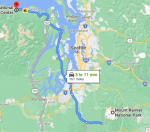
Four and a half hours, 200 miles, (including stopping) to get to Mount Rainier and I’m glad I stopped and got gas before Seattle so I could wait until after Seattle to fill up again. When I stopped for gas the first time, I sent all the messages that I had saved in draft and uploaded additions to the blog. Got two messages through the blog I didn’t expect. A note from that guy Paul Mendez to remain situationally aware as there are a lot of underreported crime issues on the West Coast and a note from Flyboy saying hello and thank you for the contact, that he is in Jacksonville and already has a job lined up flying the emergency response helicopter for a hospital out that way. Flyboy I sent congratulations to and then sent Mendez a thank you, was doing just that and staying out of the big cities as much as possible. At my second re-fuel stop I got a similar email from Groucho and a thank you for sending him our itinerary for the next month. They planned on being in and out of touch themselves during their transition and getting the business up and running.

There were some emails I needed to read but I didn’t get a chance until we got to the Jackson Visitor Center which was the only place in the park with free wifi, and that could be slower than a herd of snails traveling through peanut butter.

However, before we got to the visitor center, we stopped at a few of the roadside attractions. There was Inspiration Point that was a large pullout 20 miles west of Ohanapecosh, where we are camped. It offered spectacular views of Mount Rainier and the Tatoosh Range.

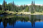
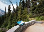
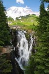
Just a little further down the road (19 miles from Ohanapecosh) was Reflection Lakes. This is the location for the iconic picture where you see Mount Rainier's reflection in a subalpine lake.
Picture2.jpg
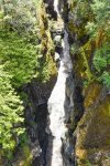
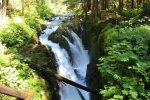
Then before we reached our campsite we stopped lastly at Box Canyon, 12 miles west of Ohanapecosh. From the bridge, you can gaze 180 feet below at water rushing through a narrow slot canyon carved by the Muddy Fork of the Cowlitz River. There was a short half-mile loop trail around the gorge.
Picture3.jpg
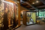
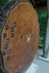
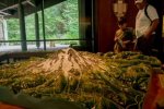
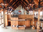
Our next stop was the Ohanapecosh Visitor Center. I’ve seen better visitor centers but this one was still nice and the rangers were nice to all of the kids coming in for their Junior Ranger booklets or to get them signed off on. Benny asked if we could look around before heading to camp and I didn’t see why not. Two of the most interesting things we saw was the tree rings display showing a slab of wood that had started to grow in 1293 and the 3D display map of Mount Ranier.
Picture4.jpg Picture5.jpg
Finally I told him it was time for us to check in to our campsite. The Ohanapecosh campground is on the southeast side of Mount Rainier and is surrounded by old growth forest and crossed by a beautiful snow-fed river. Numerous hiking trails originate both in and nearby the campground. Ohanapecosh is thought to be a Taidnapam Indian word for "standing on the edge" of the Ohanapecosh River. There is no view of Mt. Rainier directly from the campground, but the camp are convenient to several other hiking hubs. We didn’t have any hook ups but there was a picnic table, flush toilets, fire grates, and the most important, potable water.
 

Kathy in FL

Administrator
_______________
Aug 8 - 13: Mount Rainier National Park, Washington (Part 2)

August 9th – Ohanapecosh Hiking

Woke up early to try and spend the day hiking around the Ohanapecosh area. Didn’t even have to leave camp. And I’m glad because the crowds were pretty bad. Nice people for the most part, but the number of people still impacted our experience.
Picture7.jpg
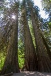
First came the Grove of the Patriarchs Trail. It wasn’t long, 1.1 miles. The Grove is just west of Stevens Canyon Entrance on the Ohanapecosh River. The goal of the trail was to walk along the river to an island of ancient western red cedar, Douglas-fir, and western hemlock. Some of them are a thousand years old. The emerald water of the river is very cool too. It's everything else that was the problem.

I wouldn't rate the cloudy, sometimes rainy time we were there as a busy day in the park, and yet by the time we got to the loop it was a circus. Cars were parked for hundreds of yards along the roadway near the trailhead as the lot was filled up, and buses and vans were dumping even more people to the loop. It's clear the trail has become a focal point for families to visit in the park, and even though it’s one of the furthest from the Seattle area there were a lot of “locals” there.
Picture8.jpg
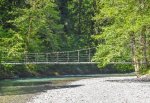
The crowds wouldn't have been so bad except for the suspension bridge, it became a bottleneck. As cool as it is, it is only suitable for one or two people to cross at a time, and won't support people coming from both directions at the same time. Naturally, you can expect to wait quite a while to cross the bridge to get to the loop, and then once you're on the loop you're trapped until you can wait the long time it will take to get across again.

With that aside, the trees were super impressive along the loop. Washington is a state filled with massive trees, but somehow the ones in the grove are even bigger. In my opinion, people should enjoy Grove of the Patriarchs at their own peril. It's got nice scenes, but it takes way more time that a normal 1.5 mile trail should just because of the crowds and that bridge.
Picture9.jpg
From the visitor center area we then got on the Hot Springs Nature Trail. The 0.4-mile trail winds through more old-growth forest and the site of an early hot springs resort. Benny had fun with the sign-thingies that had historical information on them all along the trail. They told of when visitors flocked here to take advantage of the warm water that was believed to have healing properties.

You can't soak in the springs anymore (they are not large enough to want to anyway), but the rushing waters of the nearby Ohanapecosh River, and the historical references made it another popular trail for families with kids. I noted that Benny was much better behaved than some of the kids in the area and I made sure to let him know when we had a break. He beamed at me noticing and I think I need to put more effort into reinforcing positive behavior.

We started up a small hill and into the forest on nice wide trail for about 0.3 miles. Along the way, we passed the main hot springs area, and then an open, grassy meadow along a boardwalk that took us above the runoff from the hot springs. That is where the resort lodge used to sit. We arrived at a T-junction after 0.3 miles which is where the Silver Falls Trail began.

We found out at the ranger show tonight that the story of the old springs resort is much deeper than the sign-thingies let on. At one time the Ohanapecosh Hot Springs consisted of more than a dozen springs (some as hot as 120 F). In 1913, while this area was within national forest lands, Eva O’Neal established a commercial tent camp at the springs. Owing to the springs’ growing popularity, local entrepreneur N.D. Tower developed a resort at them in 1921. By this time thousands of folks were flocking to the springs for their supposed therapeutic powers. Tower contracted a crew to construct a road to the springs from Packwood. By 1925, Tower and investor Dr. Albert W. Bridge had constructed a small hotel and two bathhouses in addition to a tent camp and several cabins. They had grandiose plans for the springs to build a great resort.

However, in 1931 Mount Rainier National Park was expanded to include the hot springs in a move that some considered a land grab. The resort was allowed to continue on in a small scale but all additional development of the area was curtailed. The resort eventually added more cabins in the 1940s, but the facilities were considered substandard and an embarrassment to the park. By 1960, economics and environmental concerns had closed the resort down and in 1967 all of the buildings were removed. Today, nothing remains of the old resort, bathhouse, and soaking pools. The park service has allowed the springs to revert back to their natural state and all that remains of the springs now are boggy seeps that flow into the nearby river.
Picture10.jpg
We continued on the boardwalk past several steps and came to a junction. Turning right was a continuation of the short Hot Springs interpretive trail. It led past more pools returning to the visitor center. The Silver Falls loop continued straight soon crossing a little cascading creek.

Shortly after crossing the little cascade, we crossed the much larger Laughingwater Creek that was crashing down from the Cascade Crest. And just beyond that was another junction where the Laughingwater Trail takes off right to cross SR 123 before climbing through the old-growth forest on its way to Three Lakes. This is also the route to the falls.

The loop bent left soon coming to a vista of Silver Falls. Earlier in the season the falls would thunder and careen over tiered ledges before plunging 40 feet into a deep pool. Due to the drought and the time in the season the falls weren’t quite as impressive but since there is nothing like this in Florida one way or the other, Benny and I still considered it to be extraordinary.

Towering firs and hemlocks lined the waterway. The river continued through a deep and narrow chasm resembling a flume. There were these birds there called Dippers searching for tasty insect larvae in the rapids. They would perch on ledges and rocks in the spray zone when they weren’t “fishing” for their dinner. We continued hiking but were careful to stay behind the railings at the ledges beyond are wet and slippery and more than a couple of folks ignoring commonsense have slipped and met a bad ending in the rocks and fast-moving waters below. That was another safety lesson … there are reasons for rules around water.

We crossed the river on a high bridge where the river churned directly below in a tight rocky chasm. At about 1.3 miles we came to a short spur leading to a spectacular viewpoint right at the falls. If it’s spring, there were warnings to prepare to get wet from the spray. It isn’t Spring and the drought had the water flow less than normal, even for this time of year.

The next point on the trail was a junction with the Eastside Trail. We traveled a few feet down that trail for the advertised view of the rapids above the falls and then back where we continued on the loop by hiking left. The trail climbed a small rise traversing the slopes where it briefly brushed against a wall of mossy ledges with overhanging shelves—then skirts a small seasonal wetland pool before slowly descending.

At. 2.7 miles the trail returns to the Ohanapecosh Campground terminating next to the Amphitheatre at the west end of the campground bridge spanning the Ohanapecosh River. The water was more sedate than upriver but was still beautiful.

We weren’t hiked out, but we were a bit peopled out and the weather was cloudy and looking towards more drizzles. I decided to just give Benny time at the Ohanapecosh Visitor Center again so he could complete as many of his Junior Ranger activities as possible

“Do your knees hurt?” Benny worried.

“No Benny Bear, I just figure I’m not the only person that should be getting something out of our days and since there are so many people, I want you to have a chance to look at all the displays and stuff that you could need for your Junior Ranger book.”

Well he was all over that answer and was no longer concerned that we’d stopped hiking when we both still had a lot of go left in us. After that we went back to camp and between drizzling downpours, Benny got the chance to ride his bike and play with his discovery toys. When the rain got too heavy he and I stayed in the van, him working on his Junior Ranger activities pages and me getting some adulting done in the form of drafting some articles for the blog and cleaning up some budget and receipt paperwork, and scanning some other bits and pieces that I’ve been collecting so that I could recycle the originals.

Dinner was soup and cornbread patties with a cup of butterscotch milk for dessert. The warm milk made Benny sleepy and he is now asleep and I think I’m going there myself despite it being early. A little extra rest isn’t going to hurt anything.
 

nancy98

Veteran Member
Aug 5 – 7: North Cascades National Park, Washington (Part 2_

August 6th – Mile Posts and Hiking


"There was one woman that was really having a go at a ranger because there were enough parking spaces near a trailhead."

"because there WERE enough parking..." or "were not"??
 
Last edited:

Kathy in FL

Administrator
_______________
Aug 8 - 13: Mount Rainier National Park, Washington (Part 3)

August 10th – Lakes, Peaks, and Loops
Picture11.jpg
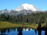
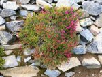
To save some driving, I focused today’s hiking along SR 410. We started with a very short one to wake our muscles up. Tipsoo Lake is an easy 0.5-mile walk around a picturesque subalpine lake. The lake was surrounded by a gorgeous wildflower meadow. Benny asked me to take closer pictures of some of the flowers so that he could get the colors right for one of his junior ranger pages. I was happy to do just that and then we were off to our next hike, a longer on.

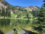
Crystal Lakes Trail was roughly 6.3 miles long and was located 4.5 miles north of Cayuse Pass. One of the highlights of the trail was that we saw elk and mountain goats. The first 1.5 miles of trail climbed through dense forest on a series of switchbacks. Along this portion of the hike, we got to see views of Mount Rainier until it was blocked by Crystal Peak. The next mile of trail led to the forested Lower Crystal Lake, the smaller of the two lakes. Benny and I took a brief snack and water break here before continuing to Upper Crystal Lake.
Picture12.jpg
The open basin containing Upper Crystal Lake lay just 0.5 mile beyond the lower lake. There were wildflowers blooming all over the place. From that point, it was Crystal Peak that dominated the view rather than Mt. Rainier.

There were wilderness camps at both Lower and Upper Crystal Lakes. The camps require backcountry permits and were full when we passed by them going back to the van to head to our next trail
Picture13.jpg
At Tipsoo Lake we found the Naches Peak Loop Trailhead. It was only three and a half miles long and is one of the most popular hikes in the park. Parking was a challenge, but I managed to wedge the van in a spot much to the disgust of someone else that had been hoping I wouldn’t fit so that they could have the spot.

Heeding the warning posted at the visitor center I made sure to spray Benny and I really well but bug repellent. Another tip was to travel the trail clockwise because, going that way, it provides the best views of Mt Rainier. It started out along the Pacific Crest Trail at Chinook Pass and headed south, traversing the east side of Naches Peak 1.6 miles until intersecting the Naches Loop Trail. We continued the loop and returned to Tipsoo Lake in 1.4 miles, follow the Naches Loop Trail along the west side of Naches Peak.

The remainder of the day was driving and pulling out at the various turnouts and viewpoints. It would have been nice to have gotten more done but the crowds made it slower to get anything accomplished. We went back to camp after that and we’ve been spending another quiet evening except for the two ranger activities we attended. The first one was a combination slide show and camp singalong for kids. The one after that was on stargazing.

Tomorrow we head to the Sunrise area and it will be a full day. Benny helped me to prep our food for tomorrow and right proud of himself he was. It is time for us to get some sleep.
 

Kathy in FL

Administrator
_______________
Aug 5 – 7: North Cascades National Park, Washington (Part 2_

August 6th – Mile Posts and Hiking


"There was one woman that was really having a go at a ranger because there were enough parking spaces near a trailhead."

"because there WERE enough parking..." or "were not"??

were not

My grammar program has a bad habit of messing with contractions. Sorry about that.
 

Kathy in FL

Administrator
_______________
Aug 8 - 13: Mount Rainier National Park, Washington (Part 4)

Picture14.gif


August 11th – Sunrise Was Almost Sunset On My Sanity

My sanity was sorely tried today. Me being in danger is something completely different than Benny being in danger. I’m not sure I’m ready to talk about it but I better do something to get it out of my system.

We packed up and moved camps this morning, or prepared to move camps by packing up and leaving Ohanapecosh for the last time. It was a nice camp but I think both Benny and I were ready for some new scenery since we’d done the area almost to death.
Picture15.jpg
The big activity of the day was going back to the Sunrise area and doing a longer trail. I was a little concerned about crowds as I’d discovered that August was the peak time for hiking and backpacking in the Sunrise area. Fortunately, we also found out that any time of day at Sunrise is spectacular, with wildflower bedecked meadows and the mountain so close that with binoculars you can follow the progress of climbers heading for the summit.

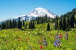
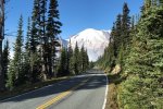
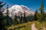
I didn’t have any sense of what was to come, the day was gorgeous, the weather perfect, and Benny and I were in great moods and ready to get some wiggles out. On the drive to Sunrise, just when you think the scenery can't get any better, Sunrise Point (6,100 feet) comes into view, with peaks in every direction. We pulled into the viewpoint parking lot for a closer look. On a clear day there are views of Mount Adams, Mount St. Helens and Mount Hood (south), Mount Baker and Glacier Peak (north) and Mount Stuart (east) and we got all of them. The sky was a pure cerulean blue

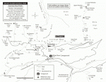
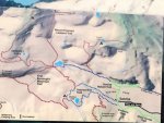
After stopping at Sunrise Point, we continued to Sunrise and prepared to hike. There are a lot of options up there, but we were after the main Sunrise trail with a few added spur trails. It would be about nine miles round trip and I had a full pack with food, water, and other supplies. The one thing we weren’t going to have to worry about was snow. Most trails at Sunrise are snow-free by August, and all are well-signed. Hikes in the area range from nature trails to strenuous hikes and backpack treks. As part of our hike prep we stopped by the Sunrise Day Lodge (rangers are on the ground floor) to check trail conditions and grab a trail map. There is also the Sunrise Visitor Center and I promised Benny a good look around after our hike was over.

I was excited for this trail because it is billed as offering something for just about everyone. You can choose to do a leisurely walk to Shadow Lake or a strenuous hike to the Burroughs Mountains, whatever suits your fancy. This winding trail offers spectacular views of Mt. Rainier towering above and the Emmons Glacier Moraine 3,000 ft. below. Mountain wildflowers were at their peak I’d heard they were everywhere along the path. There would even be some wildlife for Benny to see, primarily squeaking picas squeak and whistling marmots.

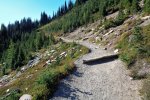
Starting in the Sunrise parking lot we headed uphill then then along the Sourdough Ridge Trail which would take us to Frozen Lake. The hike to Frozen Lake on Sourdough Ridge Trail was a short and sweet trip that offered great views of Mount Rainier from atop Sourdough Ridge. There wasn’t much elevation gain at that point so we were able to warm up without a lot of undue physical stress. The trail was well-signed so there were no worries about taking a spur to nowhere or in a direction we didn’t intend to go. The trail saw peak congestion in late morning and early afternoon which was why I wanted to take that direction first thing.

There was another signpost atop Sourdough Ridge. Here, the trail evens out and is largely flat and even. Following the trail map and signs we kept left at the signpost, and continued along the top of the ridge until we found the trail marker pointing to the turnoff for the lake. There was a mild descent off the ridge to Frozen Lake. When we got there … wow. And holy smokes that water was like ice when Benny and I tested it with our hands. I had us both use hand sanitizer where we came into contact with the water. E. Coli and other waterborne nasties are not joke. We also stopped for a mini-picnic as I figured multiple snack stops would suit the day better that waiting until we got back to the van to eat.
Picture16.jpg
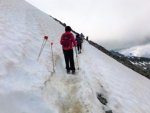
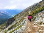
We also spent a bit of time enjoying watch the mountain goats … or were they sheep … graze on the mountainside. I’ll have to remember to ask Benny tomorrow. He’s asleep and I’m still dealing with leftover feelings. Beyond Frozen Lake the foot traffic reduces as the trail splits in to five different trail options. We proceeded in a straight direction from the junction towards Burroughs Mountain and the Mt. Fremont Lookout Trail and Tower. The trail slowly began to gain elevation and narrowed down in width with twisting and turning points. On walking over just 0.3 miles there were big snow patches to cross on the trail.

That’s right happy campers. We were told the snow would be all gone and that was a big ol’ nope, as in not true. And the trail over the snow frankly … horrified me might be too strong of a word but people were going in both directions over a trail that wasn’t much more than eight inches wide with a sheer drop off.
Picture17.jpg
The snow on the trail was soft and slushy and that made the trail difficult to pass by with ease. A wrong step or little slip could lead to fall of one hundred plus feet into a rocky valley. We had a clear view of Berkeley Park and Mount Fremont from that point on the trail and thankfully the Mount Fremont Ridge trail was looking snow free.

After watching one guy having to use his inhaler, I realized I was probably experiencing a little altitude sickness, but it didn’t stop us though I did slow down trying to give my metabolism a little time to catch up. I also decided to get to the Mt. Fremont Tower from the snow-free trail rather than use the Burroughs Trail after hearing from others that the snow mass was even worse further along. Yes, it meant turning around and recrossing the narrow snow trail, but I deemed it to be more prudent.

On returning to the Frozen Lake junction, we continued our hike on Mt. Fremont Ridge which would take 1.3 miles to reach the Lookout tower. The trail started from a meadow and then slowly gained height before passing sign-thingies indicating that Frozen Lake serves as the water supply for Sunrise.
Picture18.jpg Picture19.jpg
Just like in the other parks we’ve been to, fire Lookout towers always attract many visitors and hikers. Fremont Fire Lookout Tower is one of the 4 lookout towers that are located at one of the highest peak in Mount Rainier National Park. We continued north on the Mount Fremont Trail with a steady climb on rocky terrain along the ridge. We had great views of the Cascade Range, Mount Rainier and a distant view of Lookout tower. The wildflowers bloomed on the side of the trails finding their way out of rocky terrain.

At some places the trails narrowed down to one-direction passing forcing hikers to take turns, but it was safe and not as dangerous as crossing the snowy path on Burroughs Mountain trails. And the views of Mount Rainier, Emmons glacier, Berkeley Park, Lodi Creek, Willis Wall, Mount Ruth and Fremont Fire Lookout tower were phenomenal.

The two-story tower was built in 1934 and is still in use by park rangers. The stairs and catwalk around the tower are open for anyone to use but inside the glass walls is sealed.
Picture20.jpg Picture21.jpg Picture22.jpg Picture23.jpg
While we were up at the Fremont Lookout Tower I heard some unwelcome news from a group traveling the Wonderland Trail. A piece of a trail I had meant to use as a detour was closed for repairs. Lovely. I hadn’t counted on that. Looking at the map the only way that didn’t add an excess of miles was to head back to the Burroughs Mountain trail and cross the snow once again. Ugh.
 

Kathy in FL

Administrator
_______________
Aug 8 - 13: Mount Rainier National Park, Washington (Part 4)
August 11th – Sunrise Was Almost Sunset On My Sanity (Part 2)
Picture24.jpg Picture25.jpg Picture26.jpg
Turning us back around again we got to the Sunrise Trail junction and then continued back up the ridge to the top of Burroughs Mountain. It was worth it for the spectacular view of Mt. Rainier. There was a sign-thingie at Burroughs Mountain Summit that let us know our elevation was 7,828 feet. We had a very close up view of Mt. Rainier from that point as well as the small Inter Glacier which drains into the Glacier Basin below and to the south.
Picture27.jpg Picture28.jpg
From here we were able to head back to the Sunrise Rim Trail to follow that down passed Shadow Lake to the Wonderland Trail. We stopped first at an area called Glacier Overlook then took a swing by Sunrise Camp before making another snack and water break at Shadow Lake. Gorgeous even though the area was crowded by my hiking standards. Not as crowded as Glacier National Park but certainly more crowded than anything we’d done in Yellowstone. I guess with Mt. Ranier being so close to Seattle and northern California it got a lot more “local” traffic than the other mountain parks. It was the crowds of people on the trail that was the undoing of the day.
Picture29.png
Some people just don’t know how to wait their turn. And when that occurs it can change the entire dynamic of how people work … together or against each other, with commonsense and without. What that meant was that for whatever reason people weren’t taking turns in a narrow part of the trail that passed over a steep and rocky incline.

I was trying to “wait our turn” but people were pushing from both directions and just getting out of the way was not an option at that point. Suddenly, immediately in front of us something happened and an older lady lost her balance and slid off the trail. Her husband made a grab for her, but was barely holding on. There was no time to think. I pushed Benny up against the mountain's wall on one side of the trail and then hit the ground and reached over to add my strength to the man’s only I had to slide over to keep the woman from going down the slope further.

“Benny, I need the rope out of my pack! Toot sweet Little Bear!”

Then a voice running up said, “Hey Lady! We’ll use my rope! I’ll tie off on this tree. Can you boost her up or do you need me to come down?”

“Just get me a tied off rope. I’m only operating with one hand here. I’ll secure her and then boost.”

“Sounds like a plan,” another voice agreed. Turns out they were two professional climbers that had done Rainier the week before and were just out bringing in some of their gear.

A climbing rope slid down to me and I managed to secure the woman one handed, and then using two by letting my butt hang in the breeze as I braced on some outcroppings. The woman was all but unconscious and dead weight. I had to “walk” her up as those up above pulled.

The crowds going either way on the trail were backing up. The people closest to us knew and understood a rescue was underway but the message wasn’t carrying back in either direction fast enough to stop some of the pushing. There were just too many people on the trail, there was no railing, and the older couple were in distress. The woman was only semi conscious and her husband, who wouldn’t listen and was at the edge trying to verbally encourage his wife even though she wasn’t responding, had some kind of medical event. It caused him to stumble and lose his balance … and I never taught Benny that sometimes you have to let people fall or they’ll take you down with them.

The man didn’t mean to. He hadn’t even grabbed Benny. He just fell that direction and Benny reached out instinctively to keep the man on the trail when he swayed. A five-year-old kid, even one big for his age, is not strong enough to control the fall of a six-foot adult male.

I had just parked my butt on the edge of the trail as the climbers took the older woman down to a wider section and I watched it all happen in bright freaking’ 4K. My heart stopped. I mean I could feel it make this huge SLAM in my chest and then just stop. Luckily the rest of me was still in motion.

I’m rappelling as fast as I’ve ever done and managed to get ahead of them. I was prepared to do what was necessary to stop them, but the man’s backpack hung up on a sharp rock stopping their slide. I could hear the man wheezing … that’s about all I could hear though they tell me that people were screaming above us which is what brought the climbers back in a hurry … and he had a death grip on Benny.

“Hang on Son. Just hang on.”

The man was thinking of Benny. That’s what detoured any anger I might have felt.

I got up to their level and said, “Let me have him. I’m going to tie him off to me and then tie you off so I can get you loose.”

“Just take care of the boy and my wife. I … I … my chest …”

“Your wife is safe. And no way would she appreciate you being left here swinging in the breeze,” I told him.

From the corner of my eye I saw another rope drop down. “When you get them tied off, use the second rope to walk up with! It’ll help share the weight! We’ve got guys up here that are going to be pulling with both ropes!”

“Coming up with a medical emergency! The man is reporting chest pains!” I called up.

“Medical assistance is already waiting up top.”

It didn’t take long. I mean it felt like forever but it really was a matter of minutes from what I was told afterwards. Witnesses say they’d never seen a woman do it, or couldn’t believe a woman was doing it. Bah. Plenty of my crewmates in the training program could have done the same thing. There’s technique for hauling another person’s weight. And for all the guy was tall he wasn’t solid and wasn’t dead weight like his wife, he was at least trying.

“Don’t put any pressure on yourself, just don’t fight me.”

He snorted without responding verbally but did cooperate. I was still a few feet from the top when yet another rope came down and with it another climber who helped me get the man and Benny up and firmly onto the trail. That’s when I got my first look at Benny and kinda had a reaction of my own.

I absolutely refused to let anyone take Benny from me and I only stayed around long enough for the rangers to get there and take over the care of the older couple, both of whom were seriously banged up, especially the wife. The husband had apparently tried to shield Benny and had taken a few lumps for it.

“I … I’m so sorry …” he muttered, still more gray than was healthy.

Benny was the one that answered, “It’s okay. You didn’t mean to. And Aunt Gus came and got us really fast.” All I could do was nod my head as a form of agreement because I was too busy trying to keep my teeth from chattering or from telling all of the idiots on the trail to mind their own frickin’ business and stop taking frelling pictures of us all.

Finally there was a break in the crowd on the trail and I grabbed Benny up and took off. My body just could not stay still any longer and the damn brain hamster was going all She-Hulk and threatening all sorts of nasty things if I didn’t get Benny down on terra firma where the Ark was. Yes, I knew there was firm ground under my feet, but it wasn’t registering as “safe.” Safe was at the van. Safe was out of the crowd. Safe would not be happening until I could look Benny over and force myself to believe he wasn’t hurt.

Adrenaline kept me moving the rest of the way with Benny riding on my back and me carrying my pack like a sling. I can’t even make myself stop until we are back in the parking lot and at the van. I put him down – sent a rude gesture at a car that honked their horn telling me they wanted our parking spot - but by then I was shaking so bad that I needed a serious moment to calm myself so I can doctor his scrapes and bruises.

I finally remembered to use the breathing techniques one of my trainers had taught me which helped immensely and calmed myself down enough that I could doctor him up. He had a ding by his right eyebrow, it wasn't split but bleeding a little, and one of his knees was mildly scraped up. I crawled us up into the van and shut the door and held him. I wasn’t crying. I was beyond that. The panic just wouldn’t turn loose.

I held him and said, “Aunt Gus has you.”

In a muffled voice he says, “Uh huh. You have me tight.”

Realizing I had him pressed so tight he practically couldn’t breathe I forced myself to turn loose and mutter, “Sorry. Having a moment here.”

He pats my arm and asked, “Were you scared Aunt Gus?”

Trying to stay honest I answered, “Yeah, but not until afterwards and I guess that is kinda silly but I had you by then. So, more reaction than fear. How’s your boo-boo’s?” I couldn’t do anything but allow myself to hug him again.

“Better. Um … can I have a snack?” he asked hopefully.

I nearly laughed but I was still too close to hysteria. “Yep my Bottomless Pit Nephew. Better yet, let’s get you some lunch.”
 

Kathy in FL

Administrator
_______________
Aug 8 - 13: Mount Rainier National Park, Washington (Part 5)
August 11th – Sunrise Was Almost Sunset On My Sanity (Part 3)


Picture30.jpg

Forcing myself to do something constructive helped in the same way it helped when first Grandfather Barry, then Grandma Barry, Dad, Lawrence, then Penny left my life. Every good thing comes to an end, but this time Benny didn’t leave me. It was both a relief and a huge fear that was trying to swallow me hole. The ordinary act of getting a meal for my nephew helped me to steady myself and let me refuse to allow the brain hamster to control me.

I had already prepped the meal and all I basically did was grab our picnic cloth and the rest of it and take us over to a grassy area and set it out so Benny could it. My appetite was non-existent but from experience I knew I needed to at least east a few bites.

During our lunch a man and woman jog up. “I thought it was you.”

Feeling extraordinarily defensive I said, “Excuse me?”

“Aunt Gus and Little Bear. And no, you aren’t in trouble but everyone is on the lookout for you. You didn’t hang around at the accident site and we just wanted to make sure you are okay.”

Slightly abashed and wondering what I was in for now I said, “Oh. That. Um … I guess I should be asking if the older couple is alright, I … I …”

Benny piped up and said, “She was having a moment. She was worried about me.”

“I bet she was,” the woman said not missing a beat. “Do you mind if we take a little of her time?”

“Just don’t upset my Aunt Gus,” he said giving them a look I’d never seen on his face before. It was very Barrymore and looked so much like Dad, Lawrence, and Grandfather Barry I nearly started shaking again.

“That isn’t the plan,” the woman said. “We’re off-duty rangers and just trying to do our job and get a statement of what she saw. And maybe what you saw too if your aunt says it is okay.”

Well I gave them my statement and allowed them to ask a few questions of Benny making him feel important for remaining calm and letting people help him. It was mainly a formality as several people had been videoing what had happened.

“Is there any way for me to make a request that pictures of Benny don’t get posted online?”

“Footage was confiscated so it is unlikely to happen, but I’ll pass the word. The angle was wrong to get anything too personally identifiable. The only reason we were sure it was you and your nephew involved is because you gave your full name to the medic and the first ranger on the scene recognized you from your blog.” She laughed when I made a face.

“Sorry, don’t mean to be unappreciative. I just never meant to … whatever is happening. I don’t want to make myself out to be more than I am.”

The guy said, “It’s copacetic. But sometimes you wind up being more for people and that’s not a bad thing. You sure neither of you need to see a medic?”

Benny held out his scuffed shin and said, “Aunt Gus already fixed it.”

Getting myself looked at was a definite no although I did manage to frame it as, “No thank you.” Nor was I interested in any kind of award like they started to mention. Nope, nope, nope. That I shut down faster. You shouldn’t get an award for doing the right thing. Nothing I did was above and beyond my training. I did have to give them my cellphone number for any potential legal issues. It was a couple of men using an excess of testosterone that pushed their way through that caused the older lady to trip in the first place. I hadn’t seen that action but the three men were found and “detained” by the park service after they were identified.

We finally got shed of the rangers. I know that sounds less than appreciative and I certainly wouldn’t say it that way to anyone else. I have learned to manage and control my mouth … most of the time. But I really didn’t want or need the attention they were trying to pay me. Like I said, I know that sounds rude, but I was just done for a lot of reasons. I wanted to give Benny some normalcy as well. Maybe I wanted to give it to him due to my own needs. Either way that’s the way it was.

Benny asked, “Are we done here Aunt Gus?”

“You feeling okay Little Bear?”

“I just want to go do something else. Those people talked at us too much.”

Trying to show some manners I said, “They had a job to do I suppose but I admit I’m ready for it to be over as well. We need to get on to the Jackson Visitor Center and then the new camp but what do you think about one more hike. You know, just to prove we can.”

“Is it a long one?”

“Your knee bothering you?” I asked in concern.

“No uh uh. You fixed it. I was just wondering.”

“Well it is a short one but if you’d rather …”

“Can it be one on my Junior Ranger list?”
Picture31.jpg Picture32.jpg Picture33.jpg
“Actually that’s where I got the idea from. It is called Emmons Vista Overlook and it starts right over there.”

Another name for the trail is Silver Forest Trail.

Of all the scenic trails originating from the Sunrise Visitor Center, this one had to be the easiest. The trail was basically flat and followed the ridge parallel to the road we came in on. The wildflowers were amazing with insects hopping from blossom to different colored blossom. Why the area is called the “Silver Forest” is because of the many old dead trees along the trail… standing and fallen. My imagination got the better of me and they looked like bleached white skeletons scattered everywhere across the open landscape. Each is a unique sculpture created by a long-ago fire and many, many years of severe weather.

The best things about the Silver Forest hike are the spectacular views of Mt. Rainier and the Emmons Glacier/Moraine. And it was much less travelled than the other trails in the area. From many vantage points we could see the giant moraine that was carved by the Emmons Glacier as it retreated from the Ice Age. However, contrary to what many glaciers are doing, this one is currently extending, not retreating. Why you may ask? Because a thick cover of debris (caused by a huge landslide from the side of Tahoma Peak in 1963), acts like an insulator for the glacier-ice beneath.

The glacier is the birthplace of the White River, named for the glacier sediment it carries. I was glad that our binoculars weren’t damaged and both Benny and I used them to advantage, making us feel like we were a part of the landscape.

From the trailhead we headed downhill on a gentle slope. In a short distance the trail forks. If we had headed right we would have hooked up with the trail to Shadow Lake and Burroughs Mountains. Instead we took the left fork. There are two observation platforms not far from each other along the trail. The first one had great views but the second one opens up a bit more for a slightly better view. There were also covered benches to sit and enjoy the amazing vista.

The next trail sign says the trail continues a short 0.6 miles, but that’s only as far as the “maintained” trail goes, a total of 1 mile from the parking lot. We walked it but didn’t continue it beyond the maintained area. Coming back we ran into a guided ranger walk but didn’t try to join up. I would have if Benny had asked but it seems we were both just ready to go.

Interesting Factoid: Mount Rainier is the most glaciated peak in the contiguous US, and the Emmons Glacier happens to have largest surface area of any glacier in the contiguous United States.
Picture34.jpg
Once back at the van we headed to the Paradise area of the park. Part of me regrets saying goodbye to Sunrise but another part of me needs to move on. First stop after we got to the Henry M Jackson Memorial Visitor Center was to turn in Benny’s Junior Ranger stuff and get him the badge. I wanted something to have as a memory other than the almost-disaster. The rangers there were nice and apparently still had the APB out on us and I had to assure them we’d given statements and didn’t need medical attention. Thankfully they did this privately and didn’t make a spectacle which I was dreading.
Picture35.jpg
The visitor center was pretty cool. Benny and I both liked how the beams in the ceiling were exposed and that the exhibits were on the open second floored instead of being squished together with the information desk below. There was also a book and gift shop with things that tempted me to spend my money on, but I only purchased the hiking medallions for Benny to put on his walking stick which is getting full enough that people are noticing and commenting on how many hikes he has been on.

There was even a cafeteria though I refused to give into the temptation of picking anything up. Outside of the visitor center is the historic Paradise Inn, a concessioner-operated hotel, which also offered lodging, a dining room, and a gift shop.
Picture36.jpg
From there we had to hustle to our campsite which was in Cougar Rock campground. It was just as treed over and rustic as Ohanapecosh was. There were 173 sites and no hook ups, but they did have picnic tables, flush toilets, picnic tables, and potable water. What was funny was there were signs to watch out for foxes as they are known to frequent the camp looking for food. There is also a dump station which is something I really needed.

I have decided to start Benny’s survival training tomorrow. No time like the present and I need to stop over complicating it. He’s ready. The question is, am I? We’ll start out with something he already knows the basics of … Leave No Trace. Maybe I’ll do it the same way they do in Scouts and he can earn badges or pins or belt loops or something. I already saw a patch in the gift shop for Leave No Trace so that will be an easy one to work on.

Benny is asleep and I think I’ve finally written the heebie jeebies out of my system. Today really knocked me off my pins. I … I guess I have to get used to the possibilities but the idea of losing Benny just isn’t acceptable, I don’t care what the reason is. All good things come to an end but that isn’t the ending I have ever envisioned. He will eventually leave as he is meant to when he grows up, but I need to make sure he grows up. That’s my job, my purpose. Today scared me. It scared me bad. Maybe I’m not ready to be over it after all.
 

Kathy in FL

Administrator
_______________
Aug 8 - 13: Mount Rainier National Park, Washington (Part 6)
August 12th – Meadows and Peaks (Part 1)


I wound up having to drink not one but two cans of caffeine water to get to sleep last night. I managed to get enough sleep to function today, but it wasn’t enough to let go of yesterday’s upset. I think I was able to not be overbearing with Benny, but it was in the back of my mind.
Picture1.jpg
During breakfast of omelets, I carefully mentioned my idea about survival skills to Benny … and trying to have prizes for completing some of them. “For instance, I think you are old enough to learn about the Seven Principles of Leave No Trace. And there are patches that would work as a prize.”

“Would it be like schoolwork?”

“Well, I plan on it going into your portfolio so I suppose that is a yes.”

“What if I don’t do good?”

“Do well, not good. And I think you will. And even if it is challenging at first, we can work on it until you conquer whatever it is. Besides, I don’t expect you to climb Mount Everest in the beginning.”

“What’s an evrist?” he asked with obvious worry.

Despite the lingering upset I almost laughed. I told him, “Don’t worry about it. I was just exaggerating. I just mean that I’m not going to start out with something impossibly difficult at first. That wouldn’t be fair or fun. The point is to learn, not be scared. Plus, you already know some of this stuff, I just want to make sure you know it well enough you can use it in an emergency.”

He was unsure but willing, but when he heard today’s lesson he got on board. “Leave No Trace” is a cornerstone for most of my Scout and Navel Cadet paths. The Seven Principles of Leave No Trace are: Plan Ahead and Prepare, Travel and camp on durable surfaces, Dispose of waste properly, Leave what you find, Minimize campfire impacts, Respect Wildlife, and Be considerate of others. Long ago it was just the statement “Take only pictures, Leave only footprints” but these days they are a little more literal. There’s also another one frequently mentioned, “Minimize the impact of social media.” That’s one that is paid attention to the least. It was all stuff that Benny was already familiar with, but we still went over it and the why’s of the principles throughout our day until I was sure that we’d covered all of the age-appropriate skill points.

We were out of camp by 6 am since we had a lot of hiking to do today. The roadside attractions we stopped by today, in no particular order, were Paradise Valley Road – a one-way scenic road, the Reflection Lakes, and Inspiration Point. We’d already stopped at all of them when we first entered the national park, but it was nice to stop again for a different perspective and less drizzly weather.

Then we did the three Paradise Meadows Trails that left from the visitor center parking lot. The lower parking lot is for visits longer than two hours. You can park at the upper lot if you get there very early or get lucky but I preferred the lower lot because of the trailhead at the far western end. There’s a signboard there that directs to each of the trails in the area. Our warm up hike was the Nisqually Vista Trail. The trail was only a little over a mile and even families with strollers can use it.
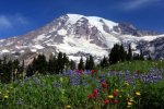
Picture2.jpg
We climbed the stone stairs to the asphalt path above. turned left at the junction to Nisqually Vista, then climbed briefly before we descended to another signed junction. We had a choice; either direction would take us in a loop. We decided to go counterclockwise and passed a few, nice viewpoints. At the farthest point (just over 0.5 mile) was the best and final viewpoint, with an interpretive sign describing the Nisqually Glacier. The glacier has receded quite a bit over the years, leaving what looks like an elongated gravel-covered mound. The bottom, or snout, of the glacier has a nearly vertical face, where meltwater from above washes over and erodes it.

We looked around but didn’t stay long because even though we started early, several people showed up not long after we did. We continued on the loop and arrived back at our starting point.
Picture3.jpg
Our next trail was twice as long and called Deadhorse Creek Trail & Morraine Trail. It was a 2.5-mile hike on a moderate and wide path that is paved for only a portion of the walk. There was a 400-foot elevation gain that occurred mostly within the first 0.75 mile, with the middle section of the hike flattening out, and the descent on the return.

From the trailhead at the lower parking lot, we took the well-marked trail due north, bearing right at the first Y-intersection. We paralleled the Visitor Center on the Avalanche Lily Trail and crossed the Alta Vista Trail, a trail we also planned to do. We came to the T intersection of Deadhorse Creek Trail and took a right.

The trail map showed that once we were on the Deadhorse Creek Trail there was no way to go wrong. Yes, there are many other trails that intersect Deadhorse, but Deadhorse acts as a main artery. We continued to follow Deadhorse Creek Trail and after about 3/4 of a mile we turned left onto the Moraine Trail.

The Moraine Trail is not a loop, but it did take us right down to the “snout” of the Nisqually Glacier. We noticed that most of our fellow hikers skipped this part because the trail is unpaved and easy to overlook. For that very reason we took it to get out of the crowd that was forming on the trails.

We dipped over a rise and headed down into the valley where the Nisqually Glacier sits. We found a couple of rocks to sit on and took a drink and snack break. We soaked up some quiet, enjoyed having the trail to ourself for a little bit, and then retraced our steps to the Deadhorse Creek trail when some other hikers decided to take the road less traveled as well.

Rather than go all the way back we took a left on the Deadhorse Creek trail and continued up a bit higher. The Deadhorse Creek Trail meets up with the Skyline Trail after a half mile. We are doing that trail tomorrow so I was going to turn us around and take us back to the parking lot, but we ran into a ranger guided group who was heading on another 0.2 miles for a spectacular view from the Glacier Vista trail. When that group switched over to the Alta Vista Trail we turned back because we wanted to start it from the parking lot.
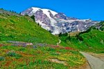
Picture4.jpg
The Alta Vista Trail was our last hike in the Paradise area. It can be accessed from two places, the parking lot were we were or from the Jackson Visitor Center. The trail is also connected to by several other trails but we headed to the trailhead nearby. Once we got our start, the trail initially traversed clusters of firs and patches of meadows. The flowers we saw included asters, bistorts, gentians, lupines, and paintbrushes. There were more I didn’t recognize but did see some low bush blueberry bushes, but they didn’t have fruit on them yet.

Continuing along the trail we passed several junctions with interconnecting trails that make lots of loop options if a hiker is so inclined, and then the Alta Vista Trail got a little steeper. Eventually we came to a junction that allowed for a loop that led us up and over the vista—and then beneath it. We did the loop clockwise for ultimate viewing of Rainier in our face on the way up—and St. Helens, Adams, and the Tatoosh Range on the way down.

So we headed forward and towards the left and made a short and steep push to the top of 5,940-foot Alta Vista. The little knob was forested on its western and northern sides and pretty open on its southern and eastern sides. There was a bench up there that Benny and I took another break on to. There was also a ledge that gave us a head-spinning views. The view south to the Paradise Lodge and Paradise Valley was really good. To the southeast was Mount Adams and to the southwest was a view of Mount St. Helens.

The view directly east is good too offering a different perspective of the Paradise Area, including the Edith Creek drainage. According to a sign-thingie at the visitor center it’s part of the intake system for Paradise’s water supply. The area is off limits to hiking, but we got a good view of it from Alta Vista.

Finally, we turned our attention northward to Panorama Point and Mount Rainier. All I can say is postcard perfect and downright awe-inspiring. There were a lot of trails beneath us and the hikers on them looked like happy ants. About that time a professional guide brought a group of international students to our space. I got up to leave but Benny wanted to hear what the guide was saying so we stayed.

Folks have been coming to this spot since before Mount Rainier was established as a national park in 1899. Just to the west of this spot, James Skinner established a tent camp in 1897. It later was purchased by John Reese of Ashford and became known as Reese’s Camp and the more inspiring Camp of the Clouds. It was a Tacoma-based climber, John B. Hartman who in 1889 bestowed the moniker Alta Vista on this point. The name is Spanish for “high view;” and that it is. Along with Reese’s Camp, these surrounding hills were once marred with developments, roads, and horse paths. A changing attitude in the park over time toward more preservation and less intensive recreational pursuits gradually led to many of these operations being removed. The area continues to recover from the impacts these developments had—and you can do your part by staying on the trails.

When we did get up to leave Benny was satisfied until he saw one of the kids drop a snack wrapper on the ground and not pick it up. Benny ran over to give it to him but the kid didn’t want to take it. He got a surprise when Benny said, “No tieres basura.” LOL or at least I was laughing to myself over the kid’s surprise that Benny was fluent when the kid curled his lip and intentionally threw the wrapper on the ground again. Ah, nope.

In two strides I was there. He may have been a “kid” but he was an older teen and closer to my age than to Benny’s. He was also closer to my size. “Recógelo. Ahora.”

“Hazme perra.”

The group leader stepped forward. “Is there a problem here?”

I understood being protective of the students in his charge, but I was too angry at that second. Luckily someone else had witnessed what went down even if they didn’t understand what had been said.

The guy said, “There’s a $20,000 US dollar fine for littering in a national park and possibly five years in prison. That kid littered. The little kid picked it up and tried to hand it to him and that’s when the big kid turned into a jerk. The little kid’s mom stepped in, and I think he called her something rude cause, if you notice, all the female students in your group are giving your guy there the evil eye.”

The Spanish teacher then took over with the students and found out what was said. I was still giving the kid a CPO Barrymore stare down and enjoying melting his machismo. When the teacher tried to pull the broken English crap with me I gave him a little bit of heck as well.

In Spanish I said, “Don’t. I’m fluent. I’ve also dealt with plenty of international student groups and know everyone gets at least ten hours of English training before the tour even starts. And chaperones are required to be English-fluent.” That goosed him. A little more directly I said, “The littering was bad enough. But the attitude this boy was throwing was at least as unacceptable. And he better be careful who he calls a bitch from here on out. There are enough females in your group to make sure he stays a boy for the remainder of his life. And if that doesn’t work, I’m sure you don’t want his behavior creating problems for your entire group, your guides, and your sponsor. If your students don’t understand that international travel is a privilege, I’m sure your government can find students who do and will appreciate what they get.”

Not everyone got the threat I was making but the chaperones and enough students understood exactly how big a stink I as willing to make that one man stepped forward and said, “I’ll stay with him in the bus so everyone else can complete the stay.”

In acknowledgement for the man’s willingness to sacrifice for the group I offered, “He just needs to pick up the litter and apologize to everyone for his behavior.”

The man must have been someone important because he turned and looked at the kid and that’s all it took after he finally figured out he wasn’t the big prissy deal he thought he was. The kid did it and it was done. I surprised everyone by shaking first the older man’s hand and then the kid’s. I’m sure some of them thought I was strange, but I was following my grandfather’s example in how he handled things, even sometimes when those things he handled were with me. Emphasize the positive, including when a situation is brought to a constructive conclusion.

I decided to let the student group go ahead of us for a while and let the area clear out of people that had witnessed the event. A few minutes later when there was another break in the number of people, while Benny and I were still sitting, he said quietly, “Sorry.”

“For?”

“Everyone got mad.”

“That part is not your fault. The kid was being a donkey’s behind, a bully. I wouldn’t have tolerated that even if it hadn’t been you on the receiving end, but because it was …” I stopped and cleared my throat, my anger still too close to the surface.

Benny leaned his head over on my arm and mumbled, “He was a stranger. I shouldn’t have talked to a stranger.”

Trying not to trash too many of our safety rules I said, “Yes. He was a stranger. But I was standing right there, and you were trying to be helpful. The kid is who turned it into something it didn’t have to be. Him … and me getting bent out of shape at him … is what made it nasty. But sometimes we must take a stand, stick to our principles in a way that makes other people take notice. When we don’t do what is right, we set a really bad example and will have to answer for it to the Creator.” Taking a deep breath I added, “And when a situation is concluded successfully, we need to learn to let it go and move on. I’m … just having a little difficulty doing that. The kid made me Barrymore angry.”

Benny understood the difference. Lawrence used to say it the same way. So did Grandfather Barry. Dad understood the difference, he just didn’t experience it very often though he did say that he made sure to get off the road and take regular breaks because road rage could be real. I’m not trying to make up a fairy tale. There’s a difference between regular angry and the kind of angry we Barrymore’s can get. I don’t mean we go all Hulk and stuff, I have enough trouble with the brain hamster doing that. I just mean there is a type of angry I can get that has more to do with my Barrymore personality than just regular anger due to reaction.

I forced myself to use the relaxation technique one of my counselors insisted I know and practice. It works most of the time and thankfully it worked that time as well without leaving me feeling washed out and shaky. I gave him a one-armed hug and said, “Well, will you look at that. I didn’t scare everyone off.”
maxresdefault.jpg

Benny looked where I pointed and suddenly grinned. There were two deer and a marmot looking at me like they were wondering if I was done being excessively human. The marmot in particular looked like they were just about ready to read me the riot act, like I was a naughty kit that needed a slap on the back of my head. That made me want to laugh and Benny and I got up, in charity with the Creator’s world once again, and finished the loop. We even managed to take a couple of photos and selfies along the way for our collection.
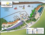
 

Kathy in FL

Administrator
_______________
Aug 8 - 13: Mount Rainier National Park, Washington (Part 7)
August 12th – Meadows and Peaks (Part 2)


Back at the van we took a snack and water break while I made sure we were finished with the trails in the area we were doing today. We were and, to the delight of someone looking for a parking spot, we headed to the next trail, this one located east of Reflection Lakes on Steven Canyons Road.

For a national park, getting parked at trailheads is reasonably straight forward for many of the hikes in Mt Rainier. However, there are exceptions and unfortunately, Bench and Snow Lakes turned out to be one of those. It was dang near impossible to get a trailhead parking spot. Parking was in a roadside semi circle pullout, shaped like a half moon. There were maybe 20 spaces total with potential for another five at the most if everyone squeezed together … which of course they didn’t. Despite this being a quieter and lesser-known trail, with only 20-25 spaces you are going to struggle to get parked here. I finally squeezed in at the very end and just barely kept the back of the van from hanging out onto the road. I couldn’t even exit on my side but crawled out with Benny through the sliding door.

Then crawled back in so we could use the head. There are no toilets available at the Bench and Snow Lakes trailhead. However, we discovered there was a vault toilet near Snow Lake at the end of the trail.

Hiking to these lakes was not your typical trail of gaining elevation on the way out and descending back to the beginning. This was one of those undulating up – down – up – down hikes, which meant we were climbing short steep sections at regular intervals throughout the trail. It didn’t really bother us, but I could tell it did some of our fellow hikers.

Straight out of the parking lot we started by gaining elevation on a gradual slope with improvised steps built in to prevent erosion. The path leveled out and then we through an area of gorgeous green meadows, wildflowers, shrubs, and small trees. Under our feet the trail was bouncy soft packed dirt easier on our feet than the paved trails had been.

After just 0.5 miles we reached a small rocky ledge which had views over the smaller northwest part of Bench Lake. It didn’t look like much from that vantage point, but it turned out to be larger than it appeared and it had an incredibly photogenic secret up its sleeve.

Bench Lake is so named because it sits on a bench like shelf of land right near a sharp drop off in the topography nearby. A further 0.25 miles along and now at a total of 0.75 miles hiked, we reached a fork in the path. Right continued to Snow Lake but first we took the left and carefully climbed down the narrow and steep path. That short trail led down to Bench Lake. It was steep and could be a little tricky to navigate, a fact we only learned in the doing. Shrubs and bushes protruded out into the path so we had to watch our eyes.
Picture5.jpg
We had a picnic lunch on the beach-like area once we reached Bench Lake. We weren’t the only ones with that idea so we had to go directly to the right so we were on the south side of the lake. The place wasn’t crowded at all, but we weren’t the only people there either. The day was clear and calm, Our reward for the effort was a pristine reflection shot of Mt Rainier in Bench Lake that rivaled the one we took at nearby Inspiration Lake.

Now for the major problem of the day and one that, having grown up on a river in Florida, I was fully prepared for contrary to most others that had take the trail No amount of bug spray was saving us on this hike. We avoided the worst of the problem with spray but it was our gloves and the nets on our hats that really kept things from being gawd awful. There were crazy people hiking around in shorts and hiking sandals. They were going to look like they had chicken pox before the night set. Even though no wind was good for photos, it wasn’t good for blowing the bugs away. I can’t tell you the number of times we heard, “I need one of those” (referring to our head nets) from other people on the trail.

We had to climb back up the steep bank to get back on the main trail since there is no other way out. Once back, we took a left toward Snow Lake. A further 0.25 miles hiking through more meadows and up more thigh burning steep dusty banks with steps and roots sticking out led us to a second fork. To the left was a toilet and Snow Lake camp which hosts two campers per night with permits. We used to vault toilet gratefully and then discussed how the camp fit into Leave No Trace principles. I was proud when Benny covered all of them.
Picture6.jpg
To the right led us to an overlook rock for Snow Lake and further beyond to a smaller body of water. No steep spur trails are required to stand at the Snow Lake overlook on its southwest side. I sprayed Benny down again because the bugs were really bad again at Snow Lake. There were a few hikers or campers swimming in Snow Lake when we reached the water’s edge. I gave it some thought but the bugs were not making it an attractive idea so we beat feet to reach the end of the trail to escape being eaten alive.

In my opinion, Bench Lake was more attractive than Snow Lake, particularly if you can get the pristine reflection shot. But it is a short trail and worth it just to be out in nature. By the time we reached Snow Lake we had only hiked one mile. We walked a further 0.25 miles from Snow Lake until we reached one final small body of shallow water at the base of a towering cliff. There was a sign there stating ‘end of maintained trail’ at 1.25 miles. The instructions said follow the ridge along until you see a ‘horn’ made of rocks and you have found Unicorn Peak topping out at 6,972 ft elevation. Benny spotted it before I did. It looks like a “horn” but where the “unicorn” part came from I couldn’t tell you.

Further exploring is allowed but you’d need to be careful if you did it. The rocky talus slope isn’t real stable and you had to be considerate of vulnerable vegetation. There is a climber’s route up the talus slope leading to peaks on the Tatoosh Range for the more prepared adventurer.

The best part of hiking Bench and Snow Lake were the dozens of amazing Mt Rainier views the entire way back to the parking lot. They certainly made up for the constant leg muscle burn of climbing up and down the steep trail sections. The other pros were it was surprisingly quiet compared to some of the other trails, the wildflowers were very abundant, and you could swim in the lakes if you wanted to. The only cons I can think of is the bugs being the worst I’d experienced in the park, and that hike down to Bench Lake was a tricky mess I probably wouldn’t do again with Benny in tow. Oh yeah, and the parking, let’s not forget about that. Someone had parked even closer to me when we were trying to get out and I nearly had to climb in through the rear doors. And because it was a camper truck backing out was a little dangerous until I could see traffic.

“Feeling grumpy? Want to be alone? Then don’t hike to Pinnacle Peak because if you are in a funk the hikers you’ll meet on this trail will raise your spirits whether you want them raised or not,” wrote a guidebook author. They weren’t kidding. There were hikers of all ages, sizes and abilities on the trail. There were off-duty rangers getting in a quick trail run; climbers with heavy packs using the peak as a training ground; and groups of hikers on fitness challenges and geocaching hunts.

Even if not aiming for the summits hikers could still enjoy the well-formed trails that led lead across wildflower-covered slopes to outcrops and tarns. Pinnacle Peak is the shortest of three trails in Rainier which access the Tatoosh. The trail began across the street from the Reflection Lakes Trailhead. It rose steadily in a subalpine forest before pitching steeply across rock slides at .65, .75 and .85 miles. There were great views of Rainier and meadows along Tatoosh Creek on this climb. A ramp-like path wound up a talus field on the NW flank of Pinnacle Peak to the End of Maintained Trail sign on the saddle (1.3 miles : 5,897'). There the established paths split for Pinnacle (left) and Plummer (right). We spotted mountain goats on the ridges above us and even saw a bear in the distance … very distance thank goodness. Beyond the maintained trail sign Pinnacle Peak is a Class III scramble and Plummer only slightly more accommodating. Nope. That wasn’t in the plan book, so it was back to the van.

By the time we got back to our campsite it was nearly time for me to start dinner so Benny could got to the ranger program. My suspicions were correct about why I’d been catching him looking around closely, he hadn’t wanted to run into the student group again. And that’s why I was determined we would go to the ranger program even though I wasn’t exactly eager for it. I’m not going to let Benny start hiding from people just because they make him uncomfortable. I’m not going to force people on him but at the same time I don’t want him handicapped either. And most of all I don’t want to be the one handicapping him.

I could have handled things differently. I didn’t. I own that. I don’t think I should have ignored it but I could have gone to the student’s chaperone. If another situation like that comes up I need to think it through further. The last thing I want to do is teach Benny everything needs to turn into a fight of some kind. Because he is so empathetic he needs coping skills. And I’m the one that needs to teach them to him.

He was a little clingy at first but just as I’d hoped, the ranger talk was so interesting that he started paying more attention to it than he did his personal discomfort. Back in camp we went over the Leave No Trace principles one more time and then Benny got a surprise … a patch. He almost flipped out.

“Did you think I was kidding?”

“No! You always tell me the truth. But … but this is the one in the gift shop. The one I liked.”

“Yep. I may not always be able to get you a patch or pin or whatever immediately after a lesson, but this time I could. We might save them up for a week or something. You did good Little Bear.”

“Thanks Aunt Gus!” he said with a grin and then a hug.

Man that feels good. I wonder if he will still do it when he grows up?”
 

seraphima

Veteran Member
I love the way Gus controls her passionate anger, or her fright. We need much more of this kind of behavior these days! Sometimes I think the supposed anonymity of the internet has allowed people to say or even act out whatever idea or feeling pops into their head - 'justified' or 'not' - instead of controlling themselves consciously.
 

Kathy in FL

Administrator
_______________
Aug 8 - 13: Mount Rainier National Park, Washington (Part 8)
August 13th – Skyline Trail

Today’s survival skill we covered was S.T.O.P. I had planned on something else, like cooking, but a kid got separated from his parents so this is what came up. We heard about it as we were hitting the restrooms first thing this morning. The found him at first light, not far from camp, but he was exhausted, had fallen asleep, and hadn’t heard his parents calling for him.

He’d gotten up in the middle of the night, climbed out of the “kid tent” without waking anyone to buddy up with, and had gone into the trees to use the bathroom. Unfortunately he got turned around coming back in the dark, especially after dropping his flashlight, and gotten lost. He hadn’t gone far but it was far enough away that had he gone any further, he could have gone over a ledge in the dark.

So after a breakfast of gluten-free pancakes on our way to our day hike we discussed S.T.O.P. First, you stop as soon as you realize you are lost or separated from your adult. Second, you think about the situation, don’t panic. Third, you observe your surroundings. Forth, you plan what to do.

“Is that why you say you try to have a plan before you need one?” Benny asked.

“Yeppers,” I confirm. “Not just about getting lost but to make sure such things don’t happen, but if they do, I already know pretty much what I’m going to do.”

“Is that what you were telling the rangers when they asked how you moved so fast to help me and when we fell over the side of the mountain?”

Ugh. Didn’t even want to go over the memories, but he had a good point. “That’s one example. But that’s also because I have a lot of training in Search and Rescue. All the training helps me know what I need to do and how to do it fast and safely.”

Anyway, we are going to work on having such a plan for Benny … and me. If I’m able to have confidence that he knows what to do, I won’t be tempted to panic either. We are going to have a plan in place when we go into an area where separation is possible. Any crowded venues. Or not crowded venues but unfamiliar ones, like when we go to stores to get groceries. Later on, we’ll talk about more serious times such as for natural disasters or other not-so-fun to think about situations. At that moment it was enough that he was thinking and not just worrying.

Today was our last day in Mount Rainier and I had scheduled the Skyline Trail, an approximately six-mile hike that was paved the first half-mile until Myrtle Falls. It was a loop trail that had us leaving and returning to the Jackson visitor center, similar to the trails yesterday morning. Along the way we got views of Rainier, glaciers, and the Tatoosh Range. Because the weather was so nice we even got glimpses of Mount Adams and Mount St. Helens.
Picture7.jpg
I don’t know why I left this hike for last when it is billed at the quintessential hike in Mt. Ranier but after yesterday, I’m glad that I did because it erased all the remaining “trauma” I was feeling. Benny, contrary to my concern, was absolutely fine. Like what happened in Sunrise, and then with the international student, was simply another adventure and today was going to be a new one.

We arrived before 7.30am so we were almost guaranteed a parking spot. LOL There were still plenty all right but there were people there ahead of us. As I saw yesterday, once the lot is full, you’re going to be waiting for super-early sunrise hikers to return back to their cars. And around 10am through noon, you will see a lot more spaces open up as the hikers who set off between 6am – 7am arrive back to Paradise, you just have to keep circling the lot until a space presents itself.
Picture8.jpg
I’d been told that since the trail was a loop, it could be done in either direction. But after delving a little deeper, I found that hiking the trail clockwise meant lots better views of Mt. Ranier. It meant the trail was very steep at first, but after that it was moderate for the remainder of the loop. That’s what I decided to do, trying to avoid some of the crowds on the popular trail for those who wanted the easier elevation change.
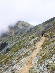
Last but not least, it was impressed upon trail users in several ways to stay on the trail. One sign that Benny particularly enjoyed was about the marmots in the area.
Picture9.jpg
The trailhead was behind the Jackson Visitor Center. I made sure to pick up a new trail map – mine was a mess – and check for trail conditions. Once I deemed us good to go I proceeded north, following signage for the Skyline Trail. Continuing on, we will quickly encountered a split for a few ancillary trails including the Waterfall Trail and the Dead-horse Creek Trail, the later we’d done yesterday. The west leg of the Waterfall Trail was a nice detour in wildflower season as it leads you through lupine filled switchbacks. We were very lucky that our time in the park has coincided with peak wildflower season. The flowers hang around until the end of August, but not much later than that, and they peak a couple of weeks prior to completely disappearing.
Picture10.jpg
After pictures of the wildflowers we headed back and continued on the Skyline Trail. The initial grade from the parking lot is steep, but it eventually eases into a more forgiving climb after about 0.4 miles. As the intensity of the trail grade lessened, we came to the split for the Dead-horse Creek Trail and Glacier Vista.

“Hey! I remember this!” Benny said.

“Hey is for horses Squirt. But yes, we were through here a couple of times yesterday.” I was trying very hard not to think of some other things that happened in this area and traveled on by keeping right. We navigated a few sets of stone-carved staircases where we were treated to some dazzling views of the 14,410-foot peak known as Tahoma or “great white mountain” to native tribes.

Continuing on we eventually passed Glacier Vista on our left. There were a bunch of people there taking pictures and some of the lenses looked like they could get clear shots of the freckles where a frog bumps its butt on Mars. At 6,300 feet, Glacier Vista also serves as an unofficial turnaround for many visitors who are not enthused by the prospects of taking on some of the more serious climbing that lay ahead. As a result, the foot traffic thinned out a bit after that point. But seriously, be on the lookout for a new crowd, marmots.
Picture11.jpg
I swear it was like those rodents, cute or not, were laying claim to the path. You’d be walking along and suddenly there was one all splayed out right in the middle of where you wanted to walk. And the rules are you aren’t supposed to interact with them or bother them. You also were supposed to walk off trail. It caused a few traffic jams. One guy looks at another guy and said, “Seriously. It reminds me of my mother-in-law. When she comes to the house she takes over the place and there is no moving her until she wants to move.”

For myself I asked one particular example, “Do you mind your majesty? I have a timetable.”

It just yawned, got back on its feet for a couple of yards, and then plopped right back down giving me an eye roll. Even Benny thought it was funny. I suppose they should be allowed to do as they please, it is their territory after all, but Benny and I both agree that if we had to hibernate for eight months, when the sun was up we’d be getting our wiggles out.

Over the next half mile we hiked along the Nisqually Glacier, another trail we’d completed, as the trail looped around in a hairpin turn and moved southeast toward Panorama Point. After that half mile, we reached a junction for Pebble Creek and Camp Muir. That was the point where summit-bound climbers diverge, heading towards the seemingly endless trek up the Muir snowfield to reach Camp Muir for the night. We however continued straight to the southeast and arrived at Panorama Point after a short quarter mile of travel. Just a shade under an elevation of 7,000 feet, Panorama Point provided memorable views of the Paradise valley, Mount St. Helens, Mount Adams and Mount Hood.
Picture13.jpgPanorama Point also had a pit toilet to the northwest, the highest elevation facilities available to hikers outside of Camp Muir. And yes, there was a line, so it was a good thing we didn’t need a pit stop. There was a sign by the door that reminded users, when finished, to latch the door from the outside so wildlife did not mistakenly wander in and become trapped when the door blew shut. And I suppose that means it has happened. Benny and I had a snicker at how we would feel if we got caught in one of those things and couldn’t get out.

From Panorama Point the trail markers directed us along a path carved into a steep ridge to the east. Although the signage labels this as part of the Skyline Trail, some consider this section of the ‘low skyline’ to be a shortcut and prefer the more stable footing of the high skyline trail to the north. We decided to go for better footing as we watched people struggle up the short cut and continued north up the high Skyline Trail. After half a mile of travel the path looped around and rejoined the main trail. Once there I found a girl about my age nursing a scraped up knee. I looked at Benny a little apologetically then stopped to give her and her companions a hand. That wasn’t the only time I did that during the day and by the end I felt a little bit like the AAA courtesy truck must feel, constantly stopping to help with flat tires, over heating engines, and other mishaps on the road. That’s fine, but I will need to refill my first aid supplies if this keeps up.
Picture12.jpg
Following this merger, we descended another half mile until we reached the junction for the Golden Gate Trail. I vaguely recalled seeing a sign for it from the Sunrise Rim Trail, but I was too involved with packing Benny back to the van in Sunrise at the time. The Golden Gate Trail is a more direct route back to the Paradise parking lot that shaves a mile off your overall journey, but deprives you of the seeing Sluiskin Falls, the Van Trump Monument and the accomplishment of completing the full Skyline loop. Benny and I were in fine fettle and it was our only hike of the day so we proceeded southwest and continued on the Skyline Trail. We arrived at the Sluiskin Falls and Paradise Glacier Trail junction after 0.6 miles.

The Paradise Glacier Trail to our left was a dead end spur trail that once hosted views of large ice caves at the edge of the glacier, or so a sign-thingie said. Unfortunately, the caves have since thawed and as a result the Glacier Trail is no longer as popular as it once was. We continued south and almost immediately found the Stevens Van Trump Historic Monument, which commemorates the first documented ascent of Mount Rainier by P.B. Van Trump and General Hazard Stevens in 1870.

“They really climbed all the way to the top?” Benny asked, looking at the mountain and then me.

“Yeppers. Amazing what humans can get up to when they are motivated to meet a goal,” I told him with a grin. “About like when you fly through your chores when there is popcorn at the end of it.”

“Aw …” he grimaced. Well I thought it was funny.

We hiked another 0.4 miles past the monument and to arrive at the Lake Trails turnoff, a 4-mile trail that detours toward Reflection Lakes and Louise Lake and eventually loops back to Paradise. We’d already hiked the area so we proceeded west. After about a mile of travel the Golden Gate Trail rejoined the Skyline Trail and not long after we arrived at Myrtle Falls. We crossed the bridge over the Edith Creek Basin and quickly took a left off the path for the Myrtle Falls viewpoint and one of the trail’s best sights. We took plenty of pictures and selfies and then rejoined the trail. We continued on and before we knew it - a half mile later - we were back at the Paradise parking lot, having completed Skyline Loop.

We had a picnic lunch beside the visitor center, disposed of our trash appropriately, then hung around the visitor center to use the wifi and to get my notes on the next couple of stops in order. But first I took Benny into the gift shop to look around one last time. I found hiking medallions for a couple of the hikes we did, some stickers as well, some post cards (need to watch the accumulation) and then a Junior Ranger medallion for his walking stick as a surprise for Benny.
Picture14.png
“I knew I saved a spot! I knew it!” he told me all excited.

“I thought you were saving that to put a leather thong through.”

Momentarily stymied he asked, “Can we go around the hiker sticker? Please?”

I grinned and said, “I’ll figure something out. Let’s get our passport stamped before I forget.”

A man at the gift shop gave me the URL for a website that has all of the national park medallions and they might make good surprise gifts for Benny, but not until we get someplace I can actually receive mail at. I also took a look at the patches they had in stock and picked up a couple, without Benny noticing, for some of the survival skill lessons.

I got a surprise myself that day, an invitation from an old friend that I’m going to accept. For now I’m going to get both Benny and I in bed. Tomorrow is an early day. We are leaving Rainier and heading to Olympic National Park with a grocery stop along the way. That’s a three hour plus drive without the stops. I’m trying to get through south of Seattle before the crazies wake up for the day. My information is that the riots are burning hot and mean for the last week.

Someone told me about an independent satellite station called “Road Warriors.” They have a website also and people send in current conditions such as weather, road blocks, social unrest, where the cheapest fuel can be found, and shortages in any given area. The radio is for “breaking news” but you can search by area, highway, etc. on the website. I’m going to give it a try and see how useful it is. Assuming it doesn’t get knocked off the air, or their signal blocked. That happens a lot as well.

Resources:
Paradise Things To Do (nps.gov)
https://visitrainier.com/media/pdfs/Mt-Rainier_Birding_List.pdf
 

Kathy in FL

Administrator
_______________
Aug 14 – 17: Olympic National Park, Washington (Part 1)


Weather: 64F/57F
Driving Route:
Picture1.png
August 14th

Four hours with two stops (food and fuel), but at least I managed to skirt Seattle. The news coming out of there is nasty. And would you believe it? They’ve got a schedule. For the riots I mean. That’s the agreement between the city and the organizations sponsoring the rioters, excuse me, the protestors. So long as they keep it to certain days so that businesses and residents can prepare, they won’t send in the National Guard to round “protestors” up and put them in holding camps. If the “protestors” insist on doing the stupid and getting “too violent” and “too destructive” then the National Guard will put them in the camps without bail until they come to trial and at trial the book will be thrown at them. All righty then. Let’s see how long that lasts. Even at my age I know that people will use all the rope you give them to hang themselves with.

I didn’t go looking for that information. When I stopped to get fuel and some fresh stuff to piece out what we still have, I was bombarded with it multiple times in the form of a public service announcement. Insanity. I remember Dad talking about the old days when the whole protest movement started. I’m not talking ancient history during the hippie era of the 1960s and 70s but the stuff that happened in the 2010s and 2020s when he was a kid. Looks like those days are coming back around, not that they ever really stopped. I just noticed they’ve gotten bad again, or bad enough I have watching out for crazy people like that to avoid putting Benny in danger. I don’t know how people live in those cities with kids. I’m just driving through some of those areas and it gives me the heebies.
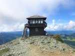
But enough of that. If I dwell on it too much the brain hamster gets a little obnoxious and today has actually been pretty cool and I don’t want to ruin it.
Picture2.png
First off, we are staying at an RV camp in the Sol Duc Valley area that is 40 minutes west of Port Angeles where the main visitor center is located. Yep, that is a bit further than I had intended but at the same time it is what it is in this particular national Park.

Second, by staying in the RV park Benny and I have access to the hot springs swimming area. You heard that right, hot … springs. Yippee skippy. But before the hot springs there were a few things we needed to do.

We started out at the main visitor center which is the Port Angeles Visitor Center. First surprise of the day went to Benny. There are three different programs he can participate in … the Junior Ranger program, the Ocean Stewards Junior Ranger program, and World Heritage Junior Ranger program. I thought he was going to flip out. I hope we have time for him to complete them all. The Junior Ranger program is like the others he has completed; very park centric and based on activities you do inside the park. The Ocean Stewards is a hands-on program that you complete in the park and if you complete it you earn a patch. We did something similar in Florida when we first started back in Florida but this one is specifically for Olympic and West Coast waters. The World Heritage program is once again somewhat unique to this location. Olympic National Park is one of 24 designated UNESCO World Heritage Sites in the United States. These sites possess "outstanding universal value" to humanity for their exceptional cultural and natural significance. He already worked on all three tonight before crashing and burning. Little Bear has had a full day.
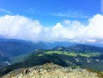
Picture3.jpg
In addition to the Junior Ranger booklets, the visitor center has exhibits about Olympic's natural and cultural history, a hands-on "Discovery Room" for kids, Passport stamping station which we took advantage of now so we wouldn’t forget later, and an award-winning orientation film called "Mosaic of Diversity" (25 minutes). Of course there was the gift shop/bookstore, and some nature trails.

For those looking to spend anywhere from a few hours to an entire day in the Sol Duc, there are a number of shorter hikes that may be suitable.

We did the two nature trails since we had plenty of time. Peabody Creek trail was only 0.5 miles long, and the Living Forest trail was slightly shorter at 0.4 miles. They were nice but we were off for meatier trails near where we would be camping.

First I checked in, but couldn’t have the spot yet so we parked in the parking lot and did a 6-mile loop called Lover’s Land. Benny was not thrilled about the name but I told him not to worry about what it was called, just enjoy what it was … a way to calm the wiggles. That made him laugh and after I grabbed my pack we were off.

It was like hitting all the highlights of Sol Duc in one shot. There were falls, hot springs, the campground and resort, and the river. We were told the Falls were breathtaking, and I have to agree. They’re one of the most visited sites in the park. Native American legend says that the falls were formed by a dragon because of the hot springs.

The trail starts at the trailhead in the parking area, crossing the river and walking upstream. The first mile is easy and tree-lined, passing by the campsites not far from the resort. After the first mile, the trail gets steeper as it curves away from the river and enters a forest of hemlock, fir, and Sitka spruce. We followed the hot springs road to the end, continuing beyond the Sol Duc Falls Nature Trail.

At the midway point of the loop after a bit of a steep climb, the falls are visible from a bridge in an “impressively lush” canyon, as described by the trail brochure we picked up. Depending on the flow, Sol Duc Falls splits into as many as four different falls as it tumbles 48ft. All four were flowing despite the drought they are experiencing further east. There are multiple viewpoints for the falls so none of them get too crowded, or at least that was our experience. Olympic is nearly as busy as some of the other parks we’ve visited lately.
Picture4.jpg
We crossed the bridge and hiked on the other side of the river which helped us to descend to more level ground, hugging the river as we went. The route led us back to the trailhead where we started. The trail was cool-ish so I’m glad I had Benny and I where our light jackets.

The west end of Lovers Lane is a good place to observe salmon. Chinook and coho return in late summer and spawn in late fall, while cutthroat and steelhead run in the fall and winter and spawn into the spring. The Sol Duc River is one of only a few places in Olympic where anadromous fish run in every season. And yeah, I had to look the word up because I didn’t know what it meant when I read it to Benny from a sign-thingie. Essentially it means fish that rely on adult migration for spawning to continue the species. So there. I can use a dictionary with the best of them.
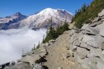
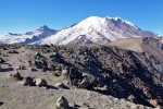
Learning about woodlands is more interesting than I thought considering how much I love the water. The forest near Sol Duc Hot Springs Resort is considered a second-generation forest, evidenced by its smaller size and the presence of alder. Red alder may grow 3' a year for its first 20 years, which make it ideal for re-establishing cut or burned woodlands. Cedar has been called the cornerstone of native northwest coast culture because of its versatile application. Wood was used for everything from structural posts to canoes, while roots and limbs were used for baskets and rope. The inner bark burns slowly, enabling fire to be carried from camp to camp. Red Cedar's ability to absorb and release moisture without shrinking or warping is well suited for durable applications in humid climates. The wood's large pores trap air, which helps regulate temperature. Antimicrobial properties combat mold and fungus. Western Hemlock bark is high in tannins, which native people used for dyes and cleansing solutions. Hemlock pitch was made into a liniment oil that was applied to chests for colds.

I love the smell of cedar and was remembering the sachets that Grandma Barry put in her linen closet when we started our next hike, a climb to Mink Lake. Mink Lake is located 2.4 miles from Sol Duc Hot Springs Resort. It is described as a small lake but looked more like a large pond.
Picture5.jpg
The Mink Lake Trail passes through several “arboreal communities” to the lake and continues over the broad meadows of Bogachiel Park to Little Divide and the Bogachiel River Trail.

The trail heads south from Sol Duc Hot Springs and rises steadily into a second generation forest. Old growth fir and hemlock takeover beyond the first mile, giving way to subalpine fir, yellow cedar and mountain hemlock as you gain elevation. Edible varieties of huckleberry line the trail, which peak in early fall. See? I do like the forest.

The trail follows Mink Creek leading up to the spur for Mink Lake, which drops to an open marsh on the northwest shore. There are several nice campsites and a shelter on the lake but there were also a crapton of bite-y bugs so I’m glad we weren’t camping there. They probably dine on all the animals in the area. I saw trails made by waterfowl through the marsh, saw some trout flopping around and frogs bumping their butts. We saw a couple of deer and I think, given the size though it was far off, we saw an elk. Someone at the resort confirmed that this is a migration route for the big ol’ things but I’ll just make sure and stay out of their way.

The Mink Lake Trail continued 1.8 miles and 1295' up to Little Divide, where the Bogachiel River Trail branches west, and a connector runs east to Deer Lake and on to High Divide. I would have continued a little further, but I had a surprise for Benny.

Our site was finally ready and I pulled into one of only seventeen RV spots in the resort. A booking agent had helped get me in, I would have just gone to the regular campground. That means that we have water, electric, and access to a dump station for a small charge. I did that right off. The sites don’t have a lot of privacy but the electric and potable water spigot make up for it. There’s something else that makes up for it to.

“Your mouth is hanging open,” I said with a grin.

“You … you said there’s a pool. A real pool. And it is part of the hot springs and everything.”

“I didn’t say everything. And you mouth is still hanging open.”

“And … and … and … I can go?!”

“Assuming you want to go.”

“Oh yeah! Oh yeah! Oh yeah!”

I have got to do something about that Snoopy Dance. Then again it will make great blackmail material when he is older.

The surprise is that with our reservation we have access to Mineral Hot Springs & Pool at the resort for a discounted rate. My plan is to try and take advantage of it every day. We’ll see how that goes. Benny sure did enjoy them today, and frankly so did I. There are three Mineral Hot Spring soaking pools and one Freshwater Pool. The spring water comes from rain and melting snow, which seeps through cracks in the sedimentary rocks where it mingles with gasses coming from cooling volcanic rocks. The mineralized spring waters then rise to the surface along a larger crack or fissure. The pools are open from 8 am to 7:30 pm
Picture6.jpg
The first pool is the Small Mineral Wading Pool. It gets to 99F but is only 6-8” deep so is suitable for all ages. The second pool is the Medium Mineral Pool. It gets to 104F, is 3’ deep, and you must be at least four years of age to be in it. The third pool is the Large mineral fountain pool. It averages a comfortable 101 F, is 3’ deep, and this pool is also restricted to those over four years of age. The last pool is the Freshwater pool. This pool does not feel warm, especially after you have been in one of the hot pools, and only gets to 50F – 85F. It is deeper as well at 3’ – 10’, but is suitable for all ages.

We were nice and melty when we left to go back to the van. After getting so heated up I decided we would just stay in the van for the evening as it was going to get down into the 50s for the night time low. Instead we worked on another survival skill; how to use a knife safely. I worked with Benny on this as soon as he could grab stuff. Penny was awful about leaving sharp objects out where Benny could get at them. Childproof didn’t seem to register with her. Lawrence gave me the okay once he understood my concern and agreed. He and Dad basically had to do the same thing with me but not because they didn’t put stuff away but because I got into everything. One of my mother’s sisters was a nurse and more than once Dad had to run me over to her or it would have been a trip to the ER. She didn’t like my Dad but she never blamed him for me getting hurt, my tendencies were well known by the time I turned two.

I never wanted Benny to have to learn to put his own stitches in which is what my Tia Adelia make me learned after the third time in as many months. More, I didn’t want Benny to be as self-destructive as I was. But I didn’t want to teach him the way some people “taught” me.

I see so many people instill fear in a child when it comes to sharp objects. Particularly knives. At least Dad, Lawrence, and Grandfather Barry didn’t scare me to teach me, especially when it came to knives. They finally got it through my hard head that knives are tools that, when used properly, can be helpful. Knife safety is important because while you don’t want a kid grabbing a knife by the blade.
Picture7.jpg
The skill lesson was pretty much just a review, but I added a little more to it by showing him how to clean and sharpen a blade. It was a little nerve wracking for me at first, but he proved himself by following the instructions. I also let him practice his whittling skills by “carving” a fish out of a bar of soap. He did better than I did the first time I tried it. He is about half way through and he’ll probably finish it tomorrow night. Then I’ll run a string through it and hang it in our “shower” in the head and he can wash with it … and yes it is unscented soap.

I found out something else from the camp host. We can have a fire in the grate in our camp. . We can collect dead and down wood so long as it is smaller than 6” in diameter and so long as it is within 100 feet of the campgrounds and below 3,500 feet in elevation. The other option is to buy wood from the camp host.

No fire tonight and it is time to hit the hay. We have a few hikes for tomorrow and possibly even some beach paths. If we get that accomplished I told Benny we’d go back to the pools again.
 
Top